Glenorchy

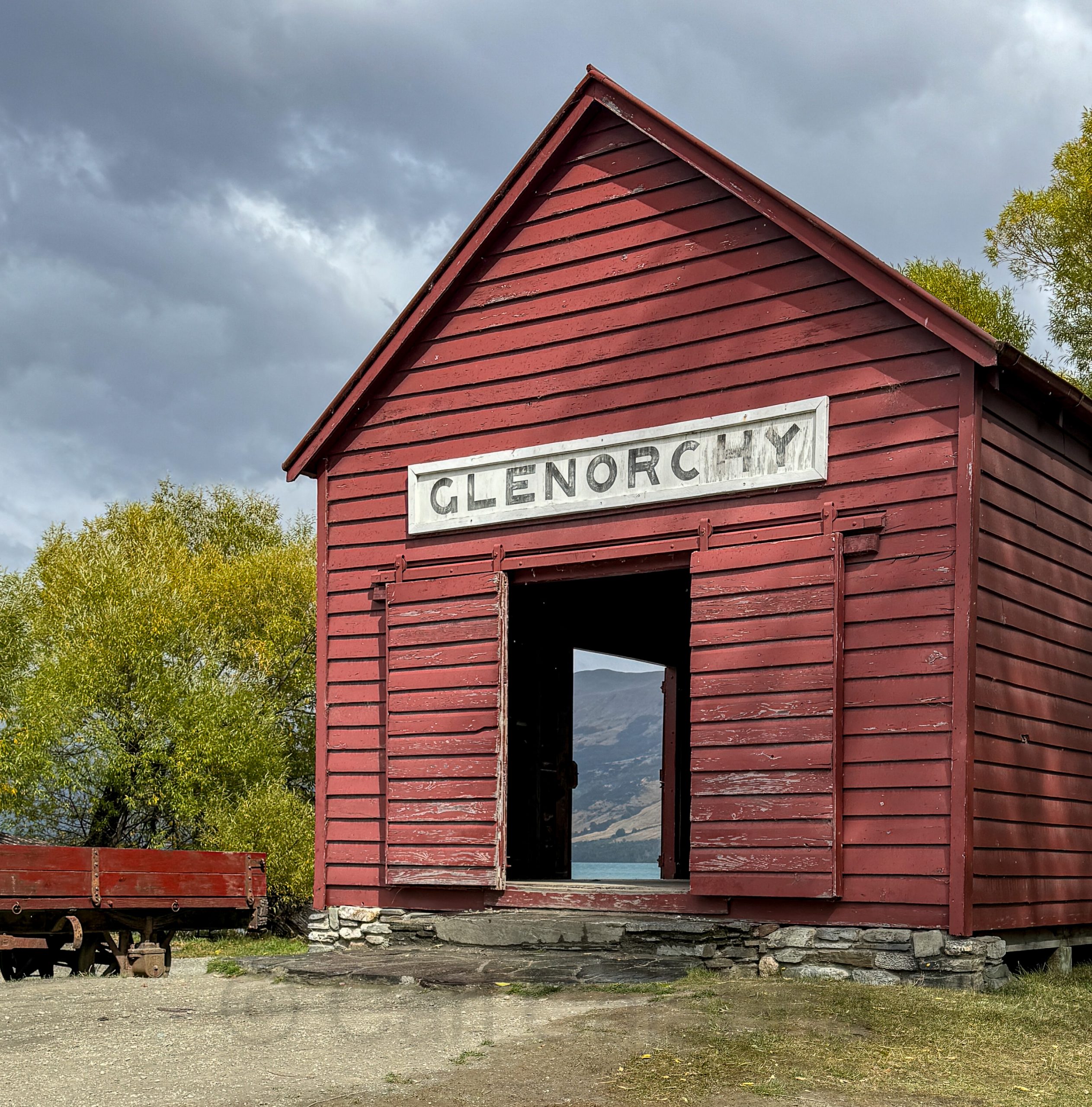
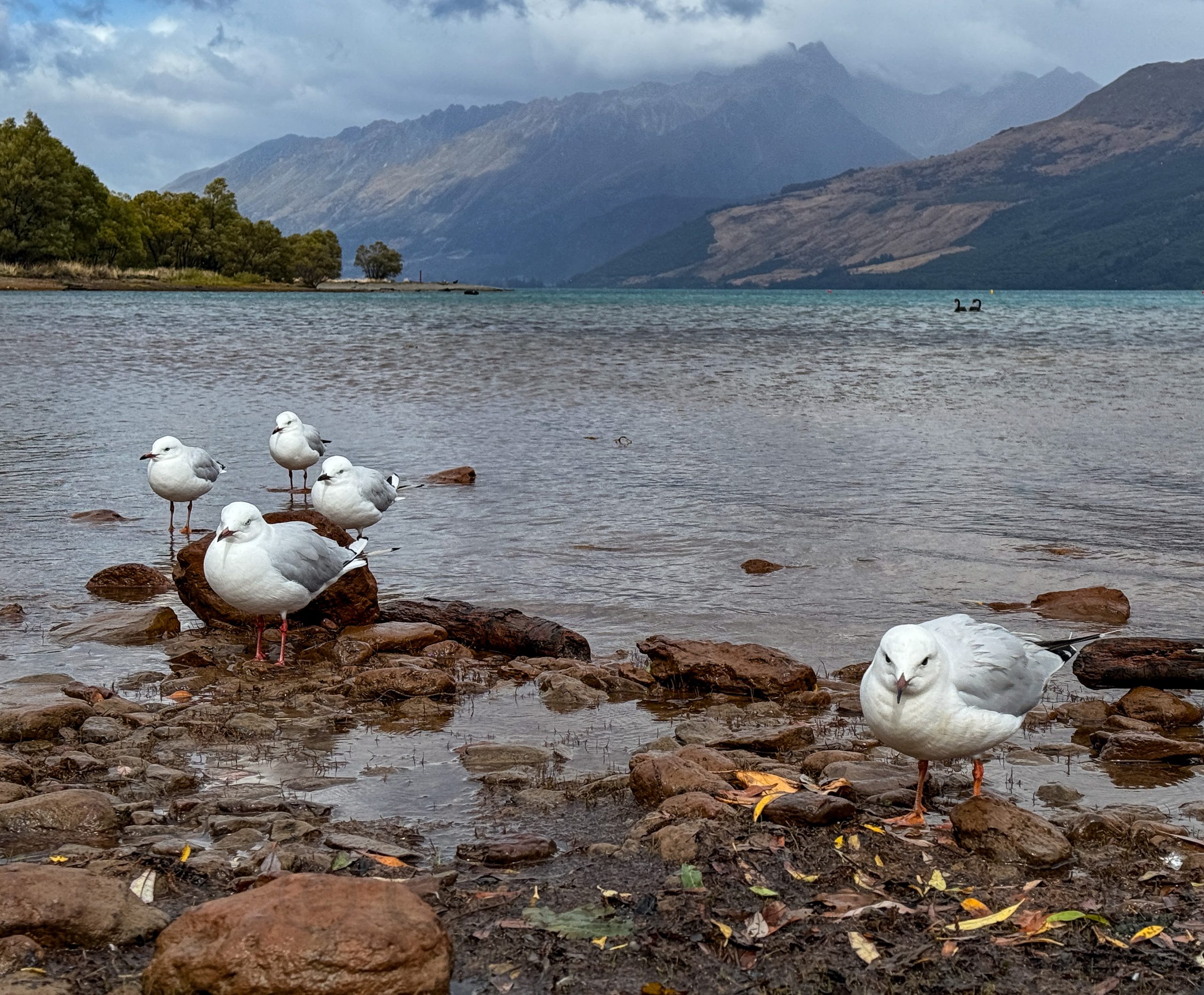
Glenorchy is a picturesque settlement at the northern end of Lake Wakatipu in New Zealand’s Otago region, known for its stunning natural beauty and outdoor activities. The area has been featured in several films, including The Lord of the Rings and The Chronicles of Narnia. We arrived shortly before noon with intermittent rain and high winds to hike the Glenorchy Scenic Lagoon Track. Low clouds diminished the views of Mont Bonpland but did not detract form the plentiful birdlife in the area.

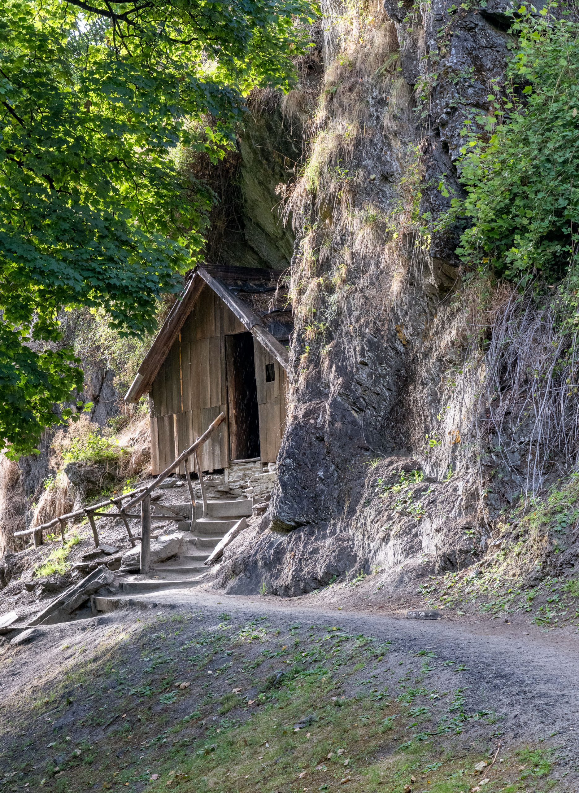
The Arrowtown Chinese Settlement, established during the Otago Gold Rush of the 1860s, was a small community of Chinese miners and merchants living on the fringes of Arrowtown. By 1885, it had grown to include about 10 huts, a large social hall, at least two stores, and extensive gardens, serving as a hub for Chinese immigrants who faced discrimination and lived separately from the European settlers. We stopped here to tour the settlement during the morning. You could argue that the tiny huts built into the sides of a mountain were the inspiration for Hobbit Holes.

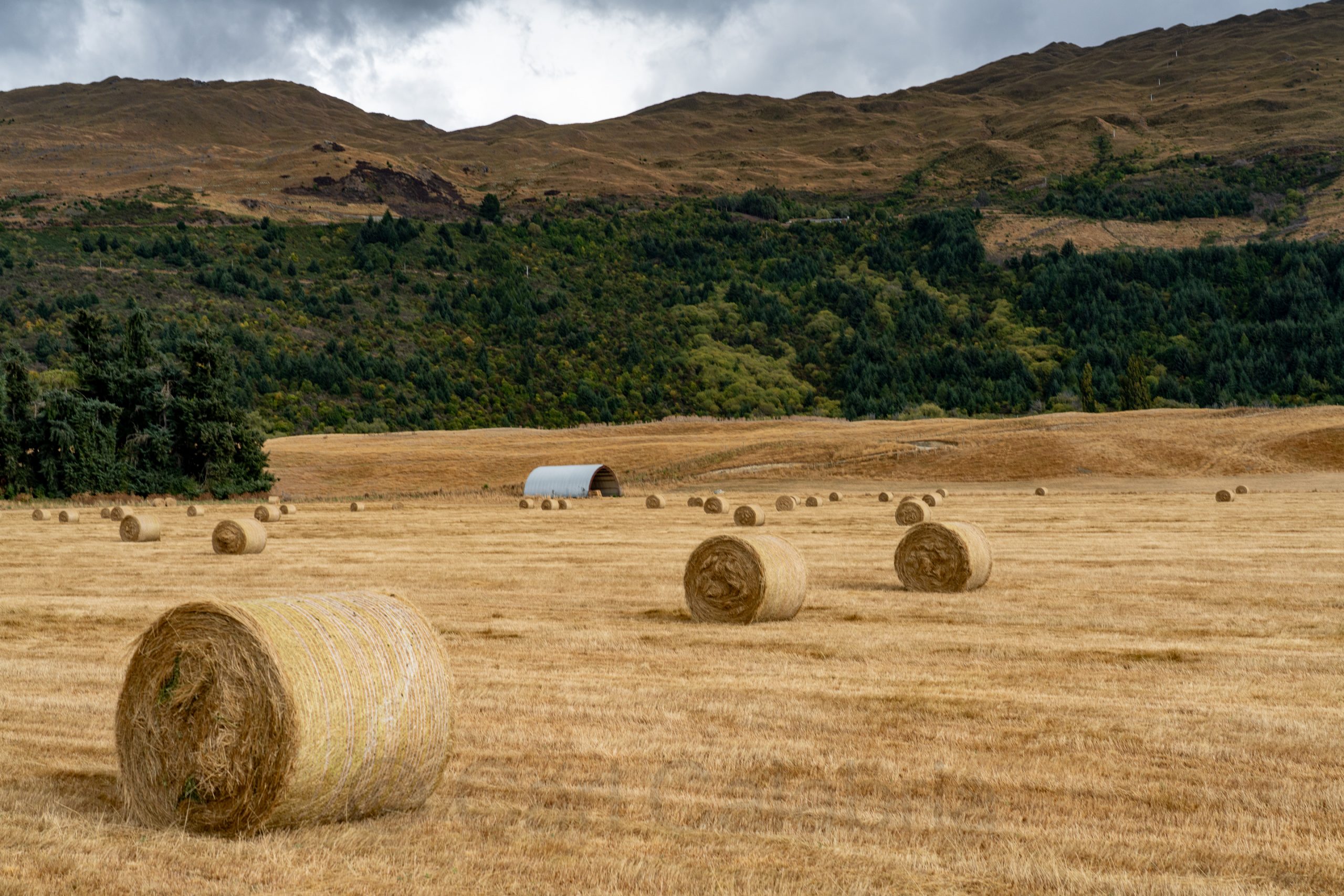
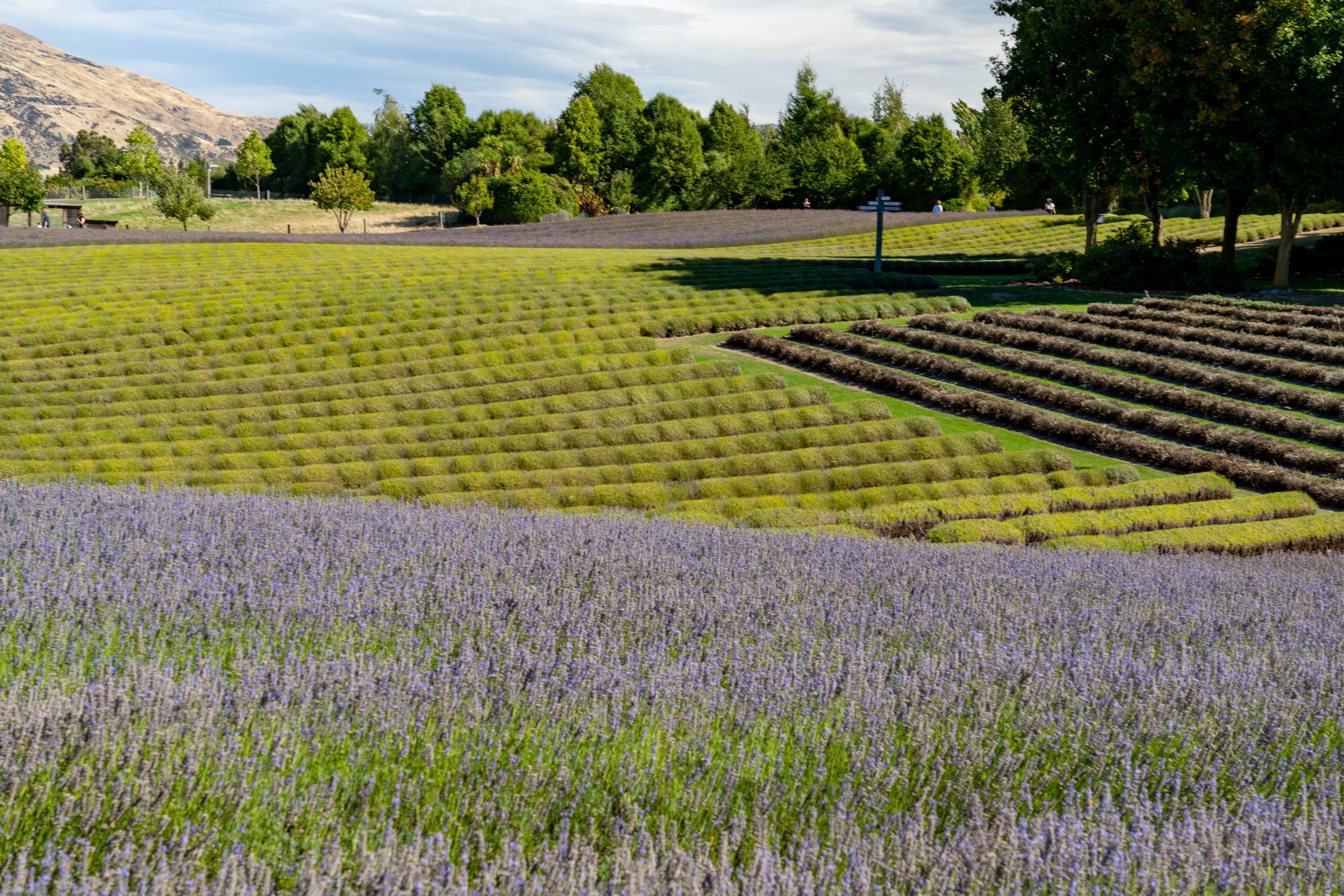
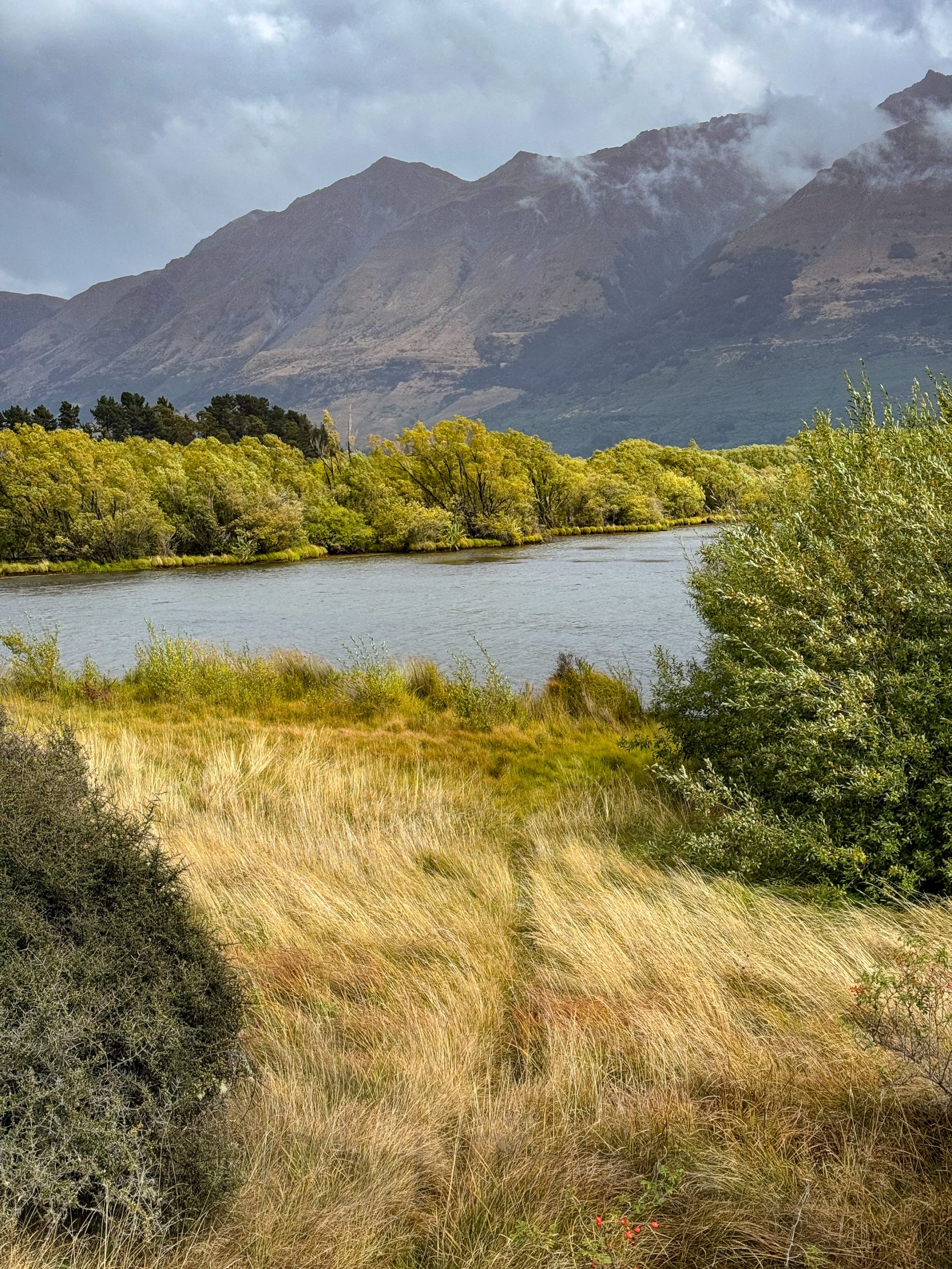
The photo below was taken from the roadside on our drive to Glenorchy. Even with the sunlight muted by clouds, I loved the color and composition and am happy I stopped for it (not always easy when traffic is moving along at 100km per hour.)

Wanaka

We arrived in Wanaka last night, where, for the first time, we are staying in a tiny house. Of our accommodations thus far, it is our favorite. It is nestled on a hillside overlooking Lake Wanaka with a small pond below the porch. I got up before sunrise to capture the famous Wanaka Tree. The tree started its life over 80 years ago as a willow branch used as a fence post in Lake Wanaka to keep livestock from wandering. Over time, it took root and grew into the solitary tree seen today. In 2014, a photograph of the tree by Dennis Radermacher won the New Zealand Geographic photo of the year award. The image, taken on a misty day, captured the tree’s unique appearance and set it on the path to fame as #ThatWanakaTree spread rapidly on social media.

Mou Waho is an “island in a lake, on an island in a lake, on an island in the ocean.” It contains Arethusa Pool, a small lake near its peak that itself has a tiny island, creating a rare recursive landform. It was our destination this morning via speedboat (the 25 minute ride each way was an experience in and of itself). The island is predator-free and serves as a sanctuary for native wildlife, including the endangered Buff Weka, pictured below.

In the afternoon, we visited a Lavender Farm, which was as picturesque as it was fragrant. The working farm was also home to a couple of alpaca who were kind enough to pose for me.

In news from the US, Nico was featured in a segment on WBZ News (CBS affiliate). The story can be found at https://www.cbsnews.com/boston/news/nico-calabria-us-new-england-amputee-soccer-team/

Haast Pass

Gates of Haast

Today, we drove from Franz Josef to Wanaka via the Haast Pass, exploring almost every trailhead we encountered. The day started with drizzle and overcast skies and ended with bright sunshine. Our original plan was to hike to Matheson Lake for views of the Fox Glacier, but low clouds put us off that agenda, and we are thankful it did.

Haast Beach

On the path to Roaring Billy Falls.

Thunder Creek Falls

Rock cairns across from Fantail Falls (must click for higher resolution to fully appreciate)

Lake Hāwea

Franz Josef Glacier

Jeanine and I opted for different activities today. She was interested in a little downtime, and I was looking forward to some up time. I signed on to a heli-hike tour of the Franz Josef Glacier, the fourth largest of over 2000 in New Zealand. A helicopter transported us to the glacier where a guide led us on a 2-hour hike through crevasses, tunnels and over the surface of the glacier. The weather started out perfect but gradually clouds began to develop and we had to finish the last quarter of our hike rather quickly so as to avoid spending the night on the glacier. The helicopters use visual navigation and cannot land if the single landing spot becomes obscured by clouds. When this happens, the group spends the night on the glacier in provided tents and sleeping bags until the weather has cleared. Suffice it to say, I was please that our group made it out ahead of the clouds.

Hokitika Gorge

We continued our journey southward, stopping at the Hokitika Gorge for a relatively short hike. The glacial fed river is a brilliant turquoise, fringed by stark white limestone cliffs and lush green rainforest. My photographs do not do justice to the glorious color palette. As is typical in New Zealand, the trails are beautifully maintained and often include swinging bridges that are as fun to traverse as they are to photograph.

With so much candy for the eye in front of you, it is easy to miss what is underfoot even though it is just as exciting. Entoloma hochstetteri, also known as the blue pinkgill, is a species of mushroom that is endemic to New Zealand. It is the only mushroom to ever be featured on a bank note and it has yet to be determined if it is poisonous or not.

Punakaiki

Today was ostensibly a travel day during which we stopped several times en route to Punakaiki. Our first stop was at Split Apple Rock whose name says it all. We continued to the Nelson Lakes National Park where we paused for a 1-hour hike at Lake Rotoiti and lunch. Lunch did not include the 4-foot-long freshwater eels which abound here.

Finally, we made our way to the west coast and the Pancake Rocks at Punakaiki. Click on the image below to fully understand where the name comes from.

This evening we are staying in a cabin by the ocean. It will not be remembered as one of our better accommodations, but the view from the beach at sunset was pretty hard to beat.

Tonga Island Marine Reserve

Jeanine and I spent the day on a kayak tour of the Tonga Island Marine Reserve. The highlight of the day was our encounter with several seal pups playing around in a grouping of rocks, protecting them from potential predators. They were adorable and reminded me of how our kids would play rough and tumble on the couch in our living room.

Jeanine displays a recovered sea urchin.

Here we are at the Tonga Arches. Unfortunately, our guide who took the picture was some distance away and did not know how to zoom the lens.

Dr. Suess Trees, as described by our guide.

Between yesterday’s hike and today’s paddling, I am ready for a less physically exhausting day. Tomorrow we will begin heading south and most of the day will be spent driving.

Abel Tasman Coast Trail

Today, Jeanine and I hiked an 8-mile section of the Abel Tasman Coastal Track, one of New Zealand’s great tracks. We boarded a water taxi that deposited us at Bark Bay, and then we made the 4-hour hike to Anchorage Bay, where we returned to our home base at Kaiteriteri again by water taxi. Most of the trek is in tropical vegetation leaving you unaware of the shear cliff on the ocean side of the path. Occasional, there is a gap in the trees affording views of the ridiculously beautiful beaches.

Bridges are encountered frequently as you traverse the many streams that feed the bays. The suspension bridges were my favorite, reminding me of the hiking I did in the Himalaya.

Bark Bay

Sandfly Bay

Jeanine soothed her feet in Anchorage Bay while we waited for our water taxi.

Ferry to South Island

We bid the North Island farewell this morning as we departed for the South Island by ferry. I spent the entire 3-hour voyage on deck and was rewarded for enduring the chilly wind when a pod of about 100 dolphins seemingly came out to investigate the ferry. During their brief visit, I got several great images.

The ferry route to Picton concludes with a narrow corridor formed between a massive peninsula and the island of Onauku pictured below.

After docking, we drove 2 hours to Kaiteriteri, where we are staying for three nights, steps from the lovely beach.

Wellington

Our rental car spent most of the day in a downtown Wellington parking garage, a welcome respite from driving for me. We visited the Wellington Museum in the morning. There, I learned about the Wahine ferry disaster. Wellington is the windiest city in the world, and on April 10, 1968, 125 mph gusts in a severe storm blew the Wahine onto the Barrrett Reef causing it to eventually capsize and sink. 53 souls lost their lives in the worst maritime disaster in the countries modern history. Wellington is also well know for early developments in steam power (see model below).

After lunch, we took a 3-hour small bus tour of the entire bay area with a very knowledgeable and funny guide.

A side thruster propeller from the ill-fated Wahine located at a memorial to those who lost their lives.

The final stop was at the base of the famous Wellington Cable Car. We rode up, passing through the colorfully lit tunnels and arriving at the top for a brief tour of the Cable Car Museum and the Carter Observatory.

After the tour, Jeanine visited the Museum of New Zealand Te Papa Tongarewa while I opted to photograph a Pride Day parade happening in the city.

Castlepoint

Castlepoint was our destination for this morning. Jeanine hiked up to the lighthouse and took the photo below. I climbed up the central spine of Castlepoint Reef and put my drone to good use. On my way down, I almost tripped over a dozing seal. I am not sure who was more surprised, but I know who ran in the opposite direction as fast as he could. The seal was quite territorial and I was not able to descend past him without risk of being attacked. It took quite a bit of effort but I managed to scale my way down in a different area.

Next, we set out for Wellington, stopping only for the aerial photo below of a typical New Zealand farm and lunch.

Zealandia Te Māra a Tāne is a one-square-mile urban ecosanctuary set around a picturesque reservoir. It is home to some of New Zealand’s most rare and extraordinary wildlife. A perimeter fence keeps all the ground animals inside the park while birds stay for the food they find among the native trees. We toured the sanctuary for several hours before checking in at our AirBnb.

Tongariro National Park

This morning, we drove for 2 hours to the Tongariro National Park, where we spent an equal amount of time hiking to the Taranaki Falls. The weather was perfect, and the 65-foot falls were full with yesterday’s rain. Tongariro is New Zealand’s oldest national park, a dual World Heritage area, and home to three active volcanic mountains, two of which are pictured below. After visiting the park, we drove 4 hours to Masterton. Despite my earlier claims about the lack of straight and flat roads in New Zealand, a good portion of our journey today had such stretches and a speed limit of 62mph which made the trip much less arduous.

Egmont National Park

Our primary destination this morning was Mount Taranaki in the Egmont National Park. Unfortunately, our good weather luck ran out and we faced high winds and driven rain. We had planned to hike to the Wilkies Pools and Dawson Falls but decided to forgo the former in the interest of safety. The falls were spectacular and more than justified the drive. I had hoped to photograph the three volcanoes in the park but they were covered in clouds while we were there. With a few extra hours on our hands, we decided to stop at Waihi Beach and were greatly rewarded for the detour. The beach is strewn with huge pieces of driftwood and rocks shaped by the waves and wind. During our visit, the wind speed rarely dipped below 20 mph.

Our final destination for the day was the city of Whanganui, where we visited the Durie Hill Memorial Tower before checking into our quaint AirBnb. Once settled we ventured into the downtown arts district where Jeanine purchased a pair of earrings and we enjoyed a Japanese dinner for a change of pace.

Ruakuri Cave

The Waitomo area features several limestone caves that are inhabited by glow worms. Only the Ruakuri Cave permits photography inside. It also contains stalactites, stalagmites, curtains, popcorn, and limestone formations of all manner. Access to the cave is by a spiral staircase that is beautiful in its own right. It also makes this the only wheelchair accessible cave in the southern hemisphere. Our guide allowed me to use my tripod for the glow worm photo which would have been impossible otherwise. Even so, the photo is not that great. You really have to see these in person to appreciate them.

After our visit to the cave, we had hoped to hike to the Three Sisters and Elephant Rock. Unfortunately, it started to rain so heavily that we opted to drive directly to our bed and and breakfast in New Plymouth.