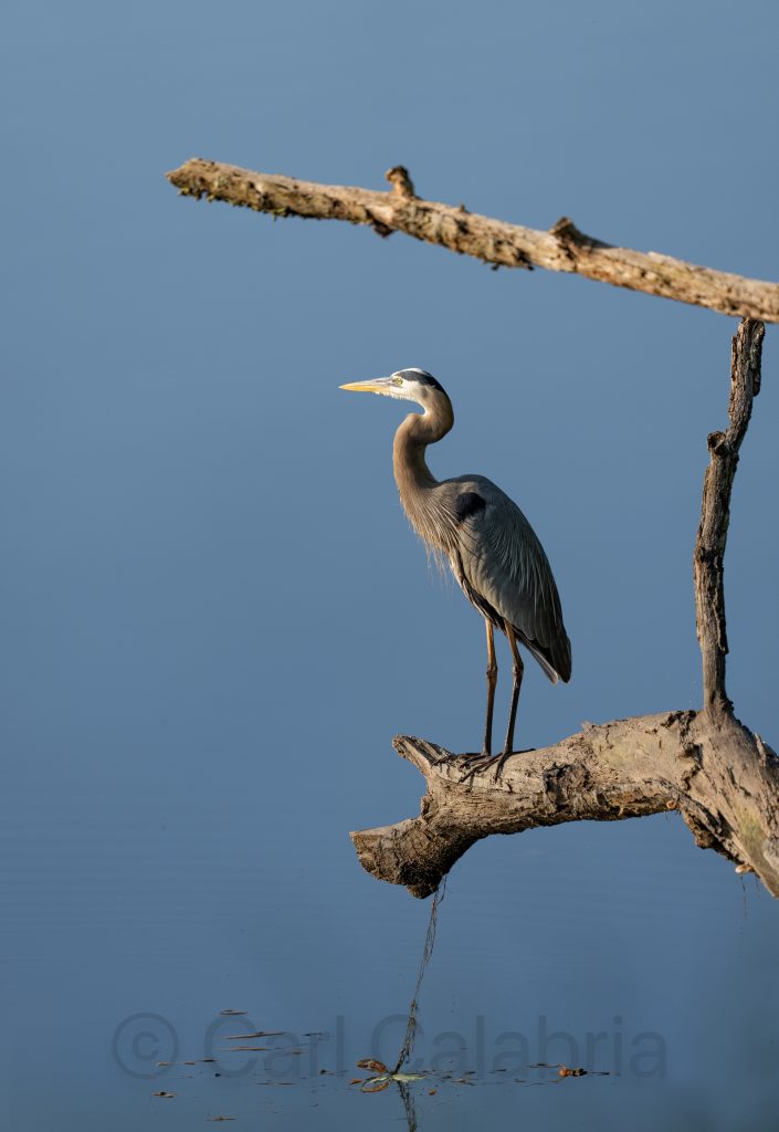
This morning, I woke up to find a blue heron perched on a branch over the river. The light was wonderful, and I managed to get this shot without scaring my subject away. Later, I removed and sectioned a large branch that had fallen into the river during a winter storm. It proved to be a more strenuous task than I had anticipated, made no easier by the extreme temperatures we are having today.
Jeanine threw her back out while getting into her car after yoga class this afternoon. We had to cancel plans to attend the neighborhood picnic and a dinner party we were looking forward to. I am not a very good nursemaid maid but I tried to make her as comfortable as possible.
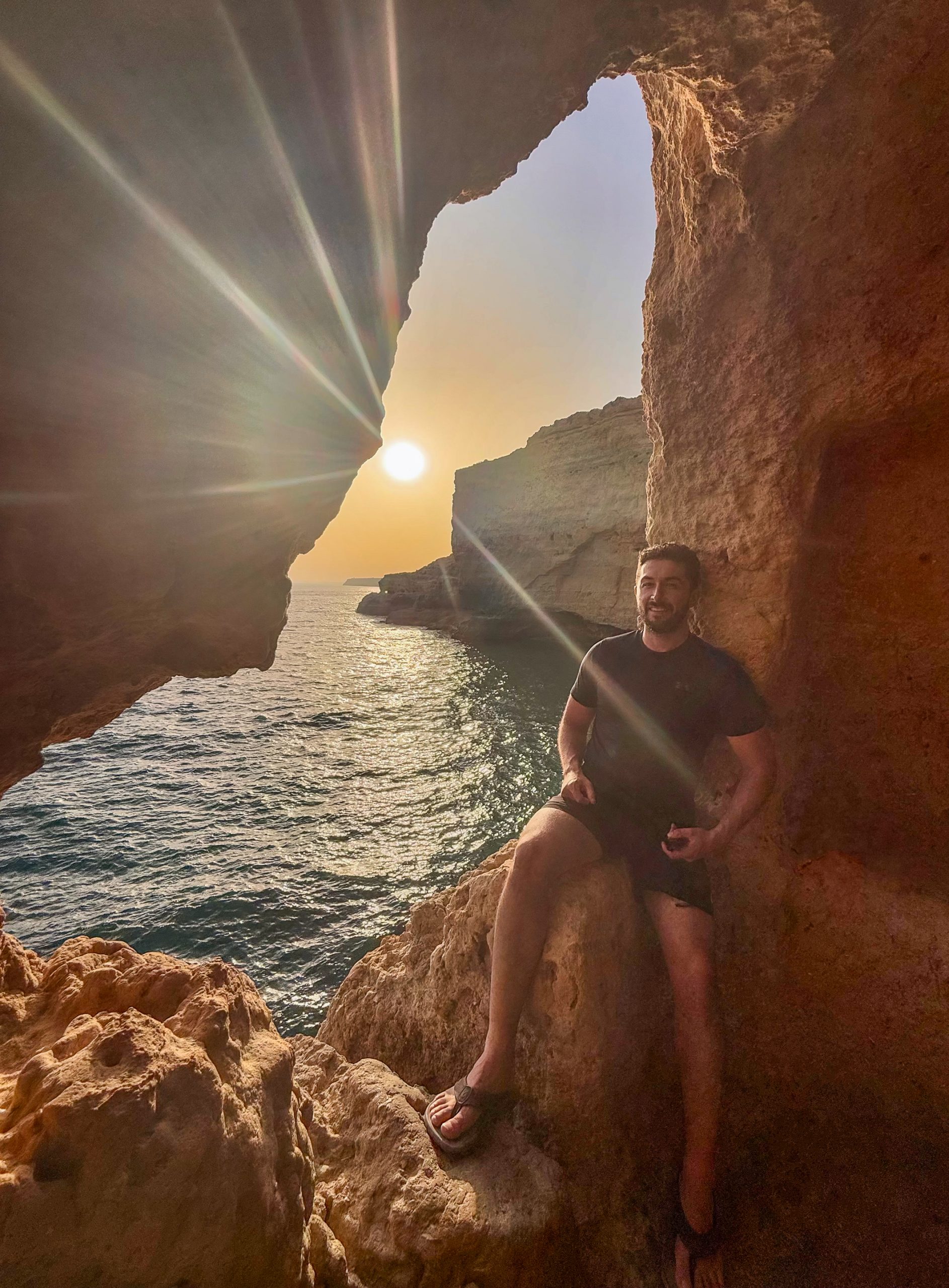
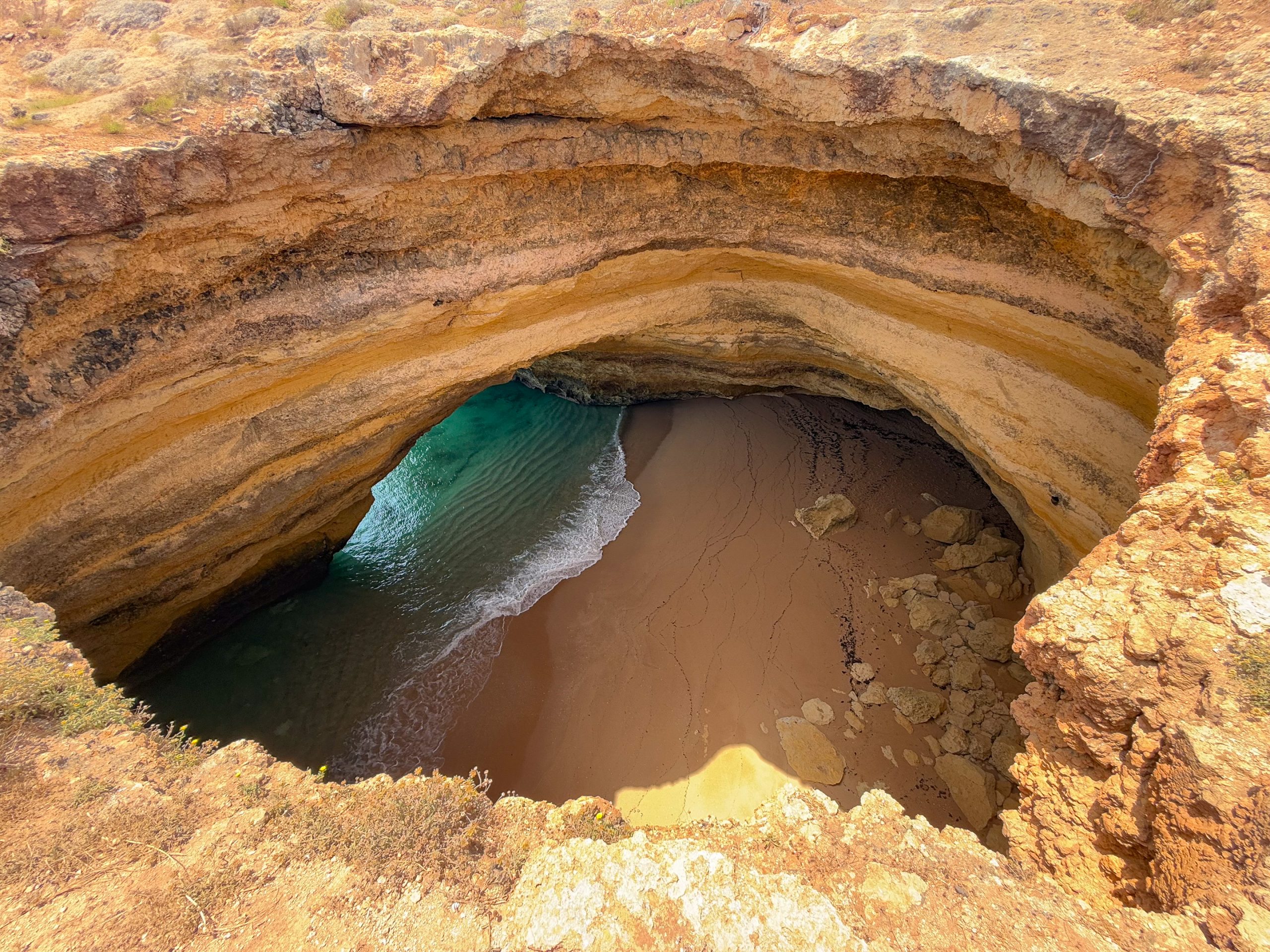
Kyle shared several photos from his trip to Portugal. The Benagil Cave has been on my bucket list for some time, and I was thrilled to see that he had visited this natural wonder.
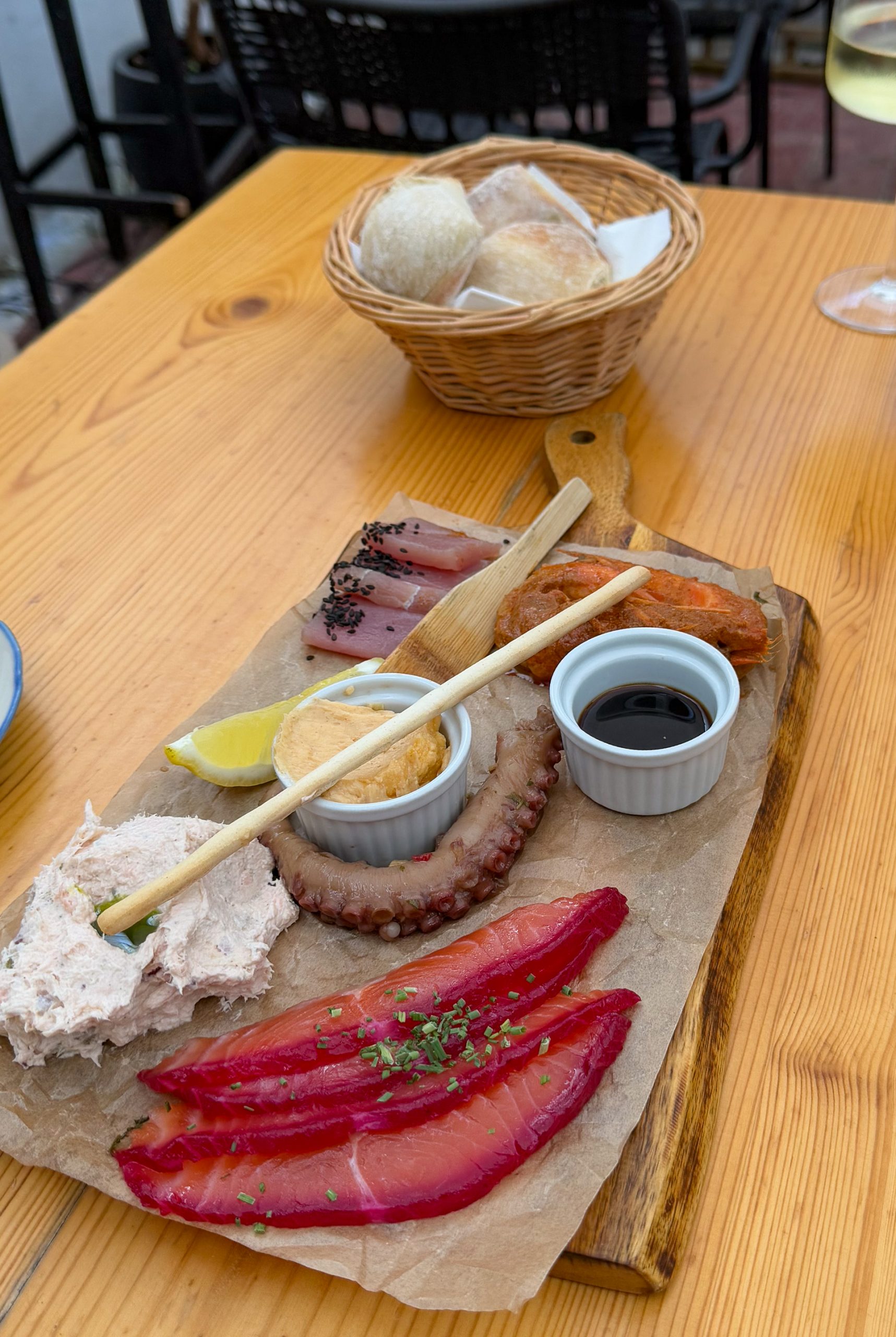
Kyle may have inherited his passion for adventure travel from me, but there is no doubt he acquired his appreciation for exotic fine food from his mother. Presented with the meal below, I would be content to have the bread and the lemon, and possibly the sweet potato if I were feeling particularly venturesome.
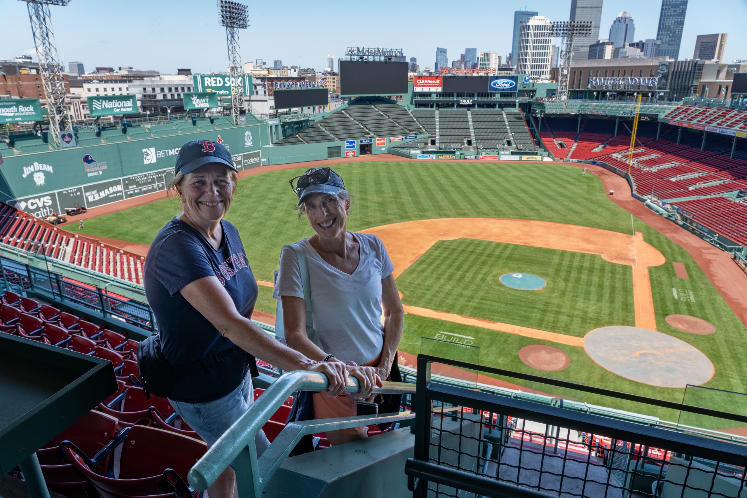
Kris is a big baseball fan, or to be more specific, a Phillies fan. Even so, we thought she would enjoy a tour of Fenway Park while in town. Fenway is the oldest active Major League Baseball stadium, having opened in 1912 as the home of the Boston Red Sox. The park is famous for its distinctive features, especially the 37-foot-high left field wall known as the “Green Monster,” as well as quirky elements like “The Triangle” and “Pesky’s Pole”. With a seating capacity of about 37,755 for night games, it is one of the smallest MLB ballparks. Fenway has hosted the World Series eleven times, with the Red Sox winning six championships there. Besides baseball, it has been a venue for football, concerts, hockey, and other major events. In 2012, Fenway Park was added to the National Register of Historic Places, cementing its status as a Boston and baseball landmark.
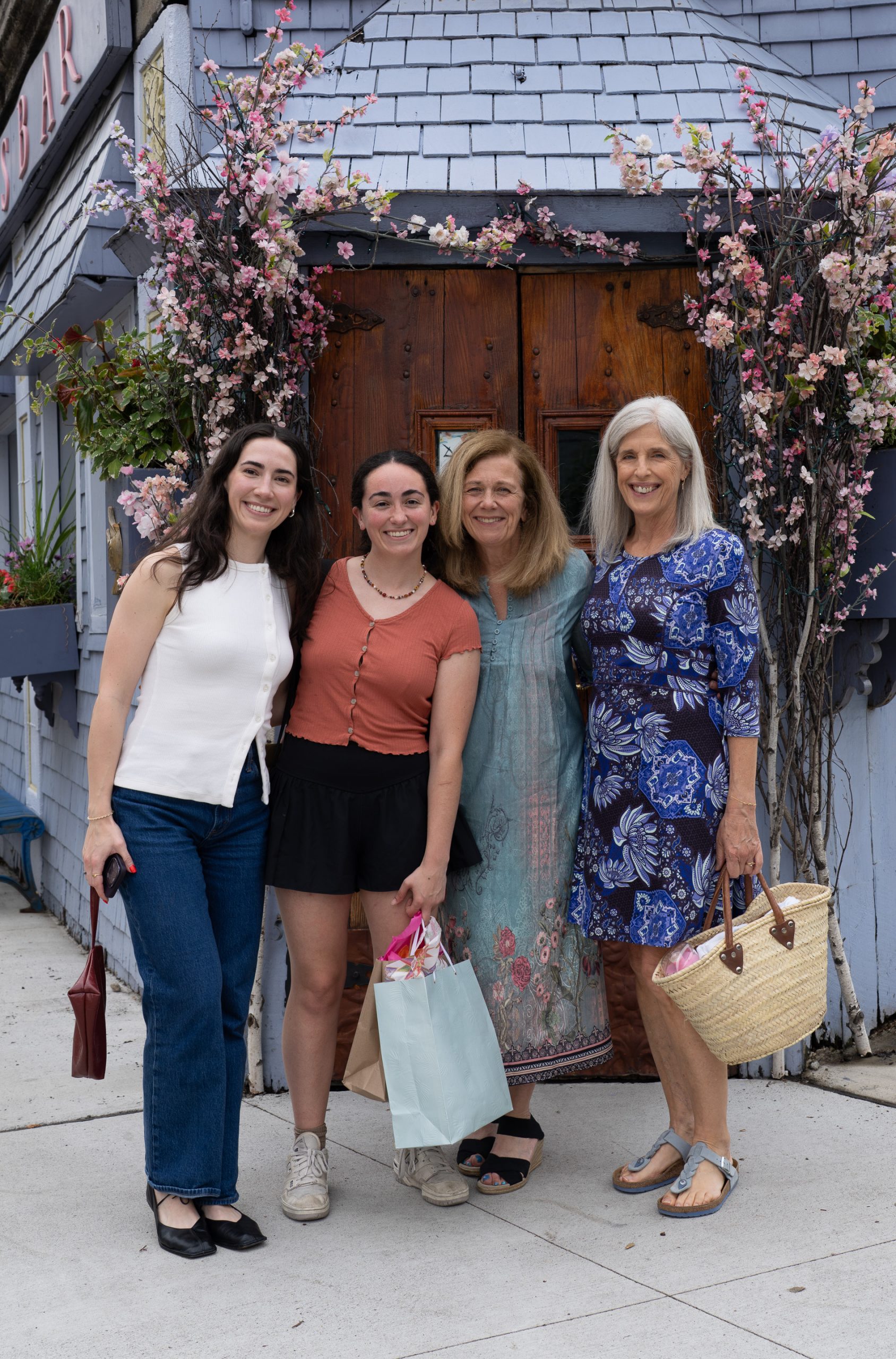
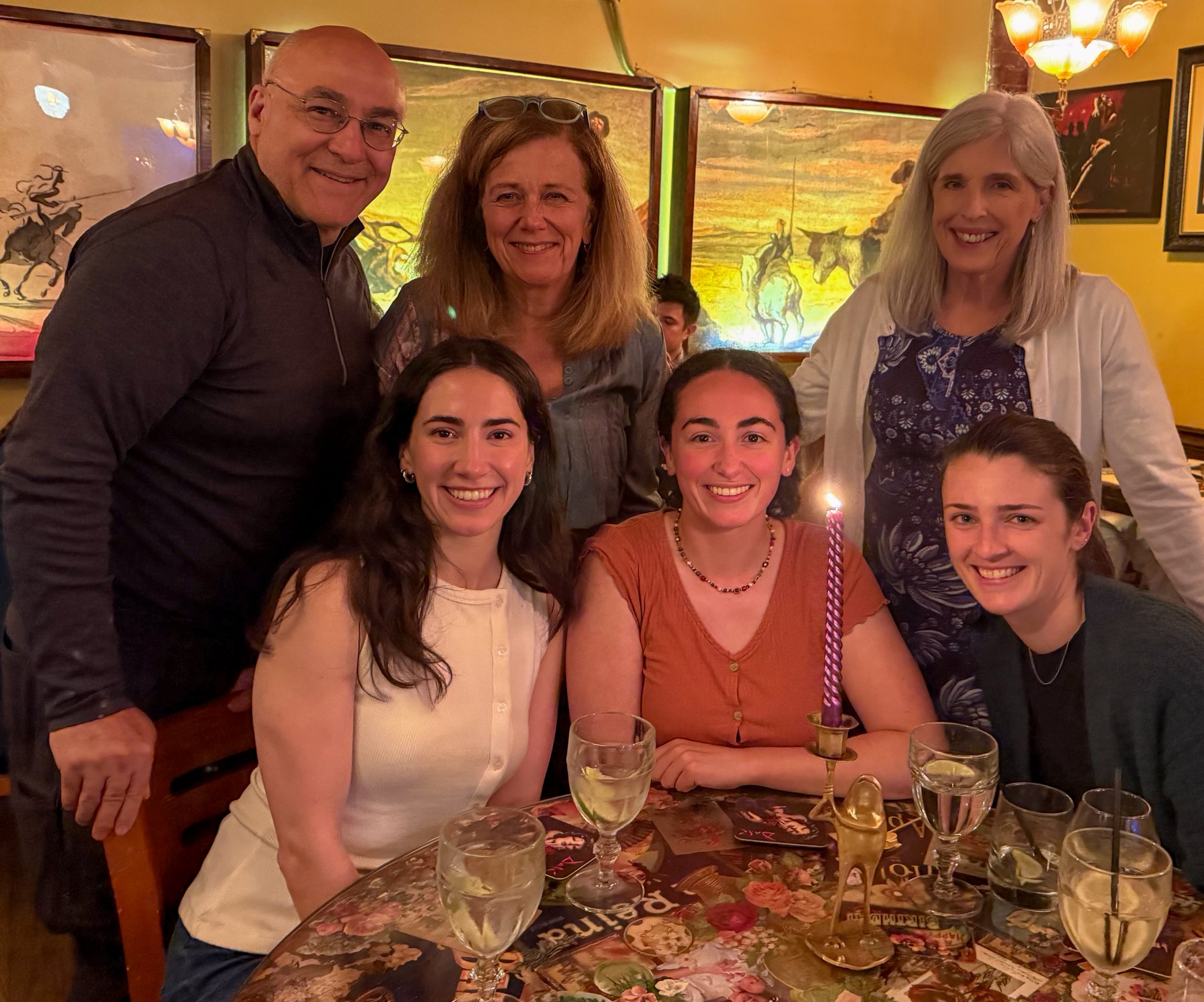
This evening, we were joined by Kris and Maya’s friends Sarinnagh and Claire to celebrate her 26th birthday, a day in advance. Unfortunately, her brothers were unable to attend. Kyle is in Portugal touring the wine country, and Nico is in Arizona dodging rattlesnakes (literally). Maya requested that we dine at the Dali restaurant, a Spanish tapas bar she has always wanted to try. The food and ambiance were exceptional but no match for the friendships around the table. Maya has been best friends with Sarinnagh since kindergarten, and with Claire since middle school. Jeanine and Kris have been BFF for nearly 50 years. The warmth of the celebration reflected the profound relationships among these women.
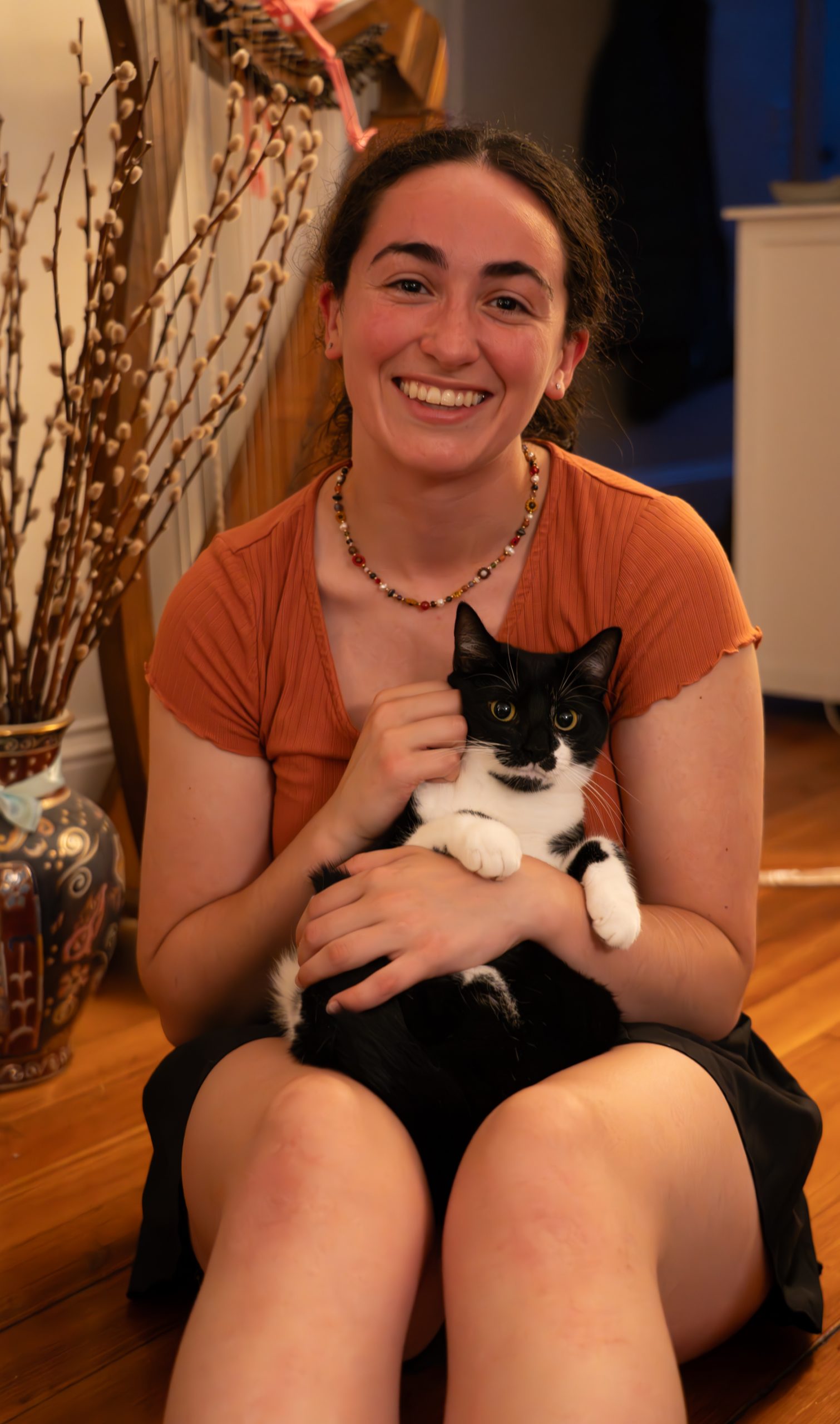
After dinner, we reconvened at Maya’s apartment, where she introduced us to Wally and Kurt, the sibling cats she lives with.
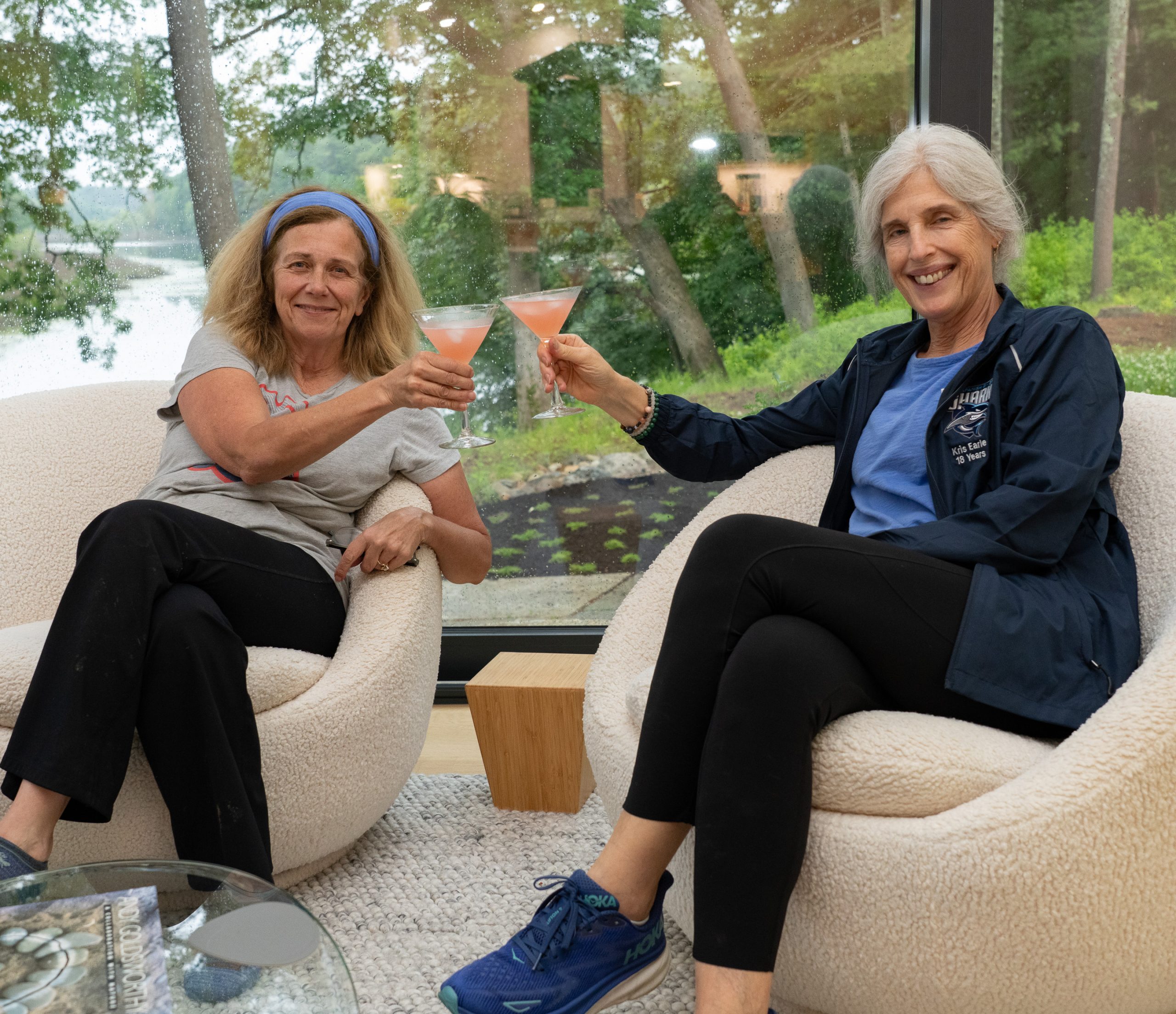
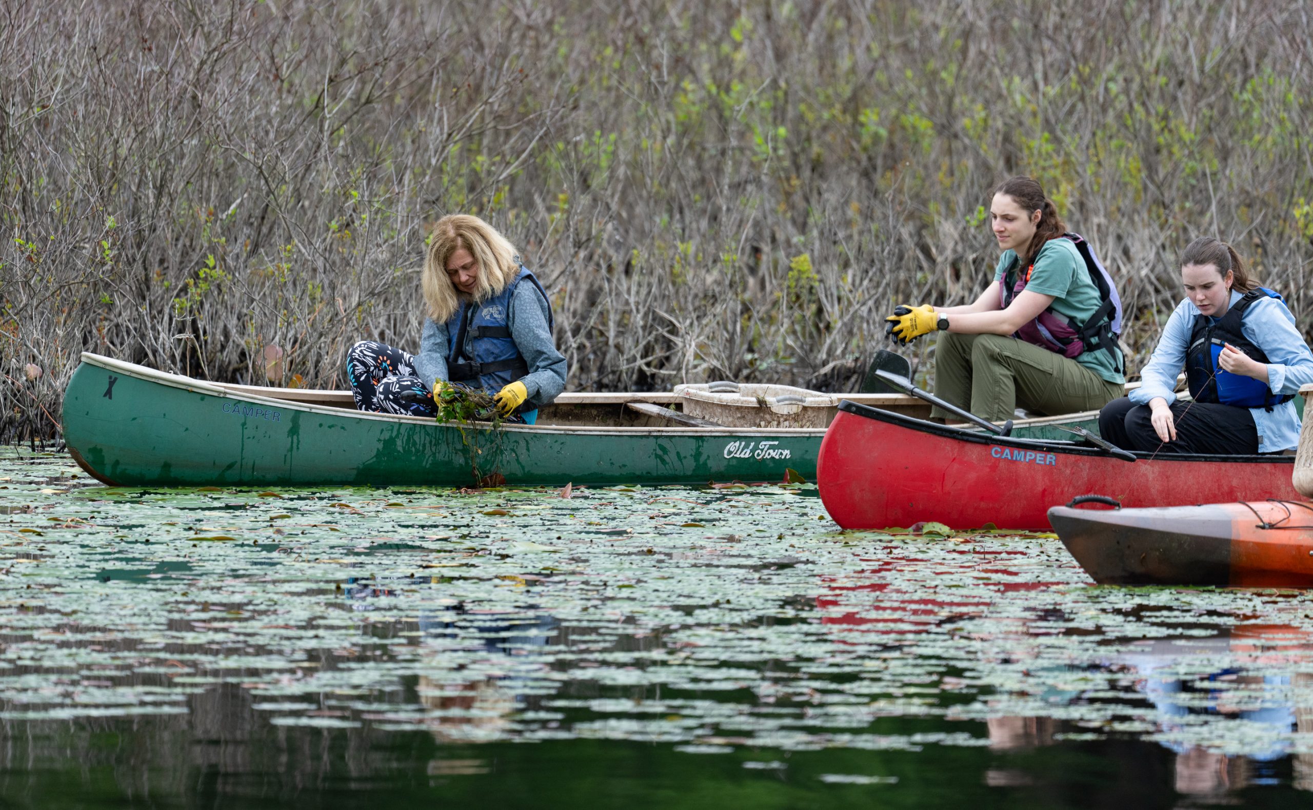
Jeanine and Kris enjoyed a cocktail after a long day of work. In the morning, they were on the river in a canoe extracting water chestnuts. In the afternoon, they were at Kyle’s place getting it ready for new tenants. Kyle would be wise to thank them profusely for the effort they put in. I mulched our newly planted creeping thyme bed, which was more than enough exercise while I recover from my weekend collision with the ground.
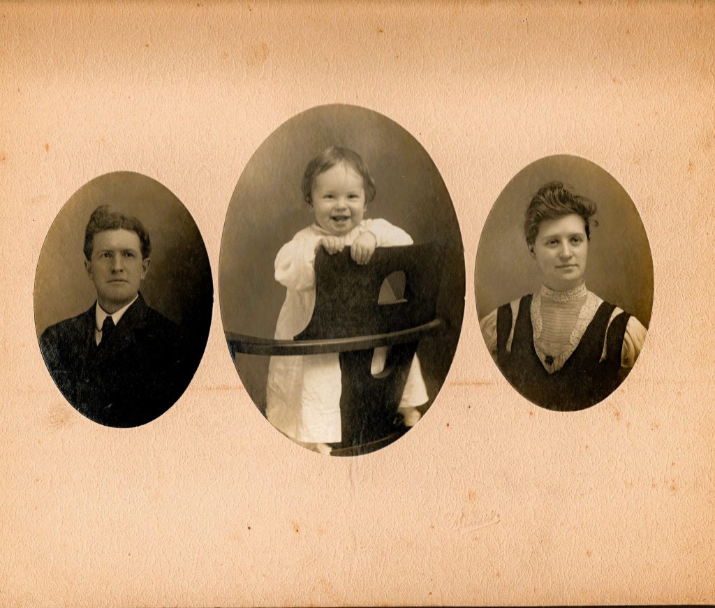
Pictured in the middle is Jeanine’s grandmother, Lila Nalder, on her father’s side, framed by her parents. Lauren, Jeanine’s sister, shared this photo with us after receiving it from some sort of ancestry group. It is no doubt the oldest picture we have of Jeanine’s side of the family and a real treasure.
With 7 minutes to go in my soccer match this morning, I suffered a slight concussion when an opponent took my feet out from under me while I was up for a head ball. I landed flat on my back and head. It was an unintentional foul, and I think the other guy felt worse than I did. I took a moment to gather myself and returned to the pitch. A few minutes later, I felt a little disoriented and decided to finish the game on the bench. It was our last game of the season before playoffs, and we ended in style with a 4-0 win.
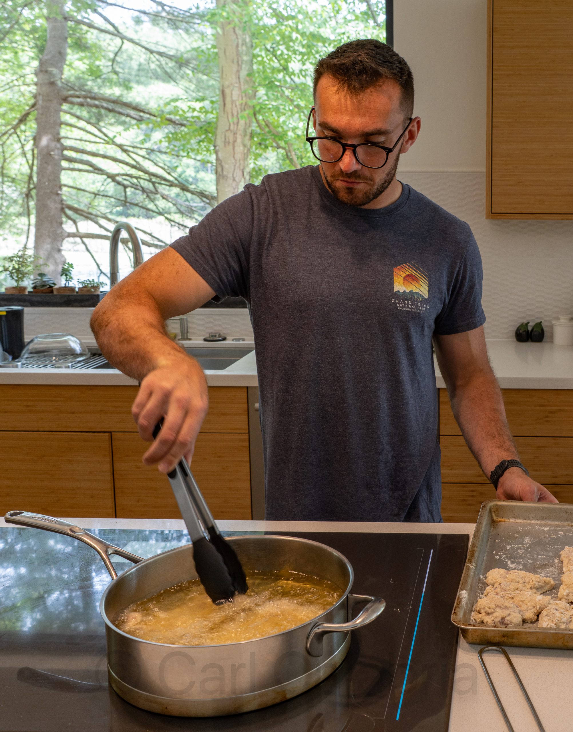
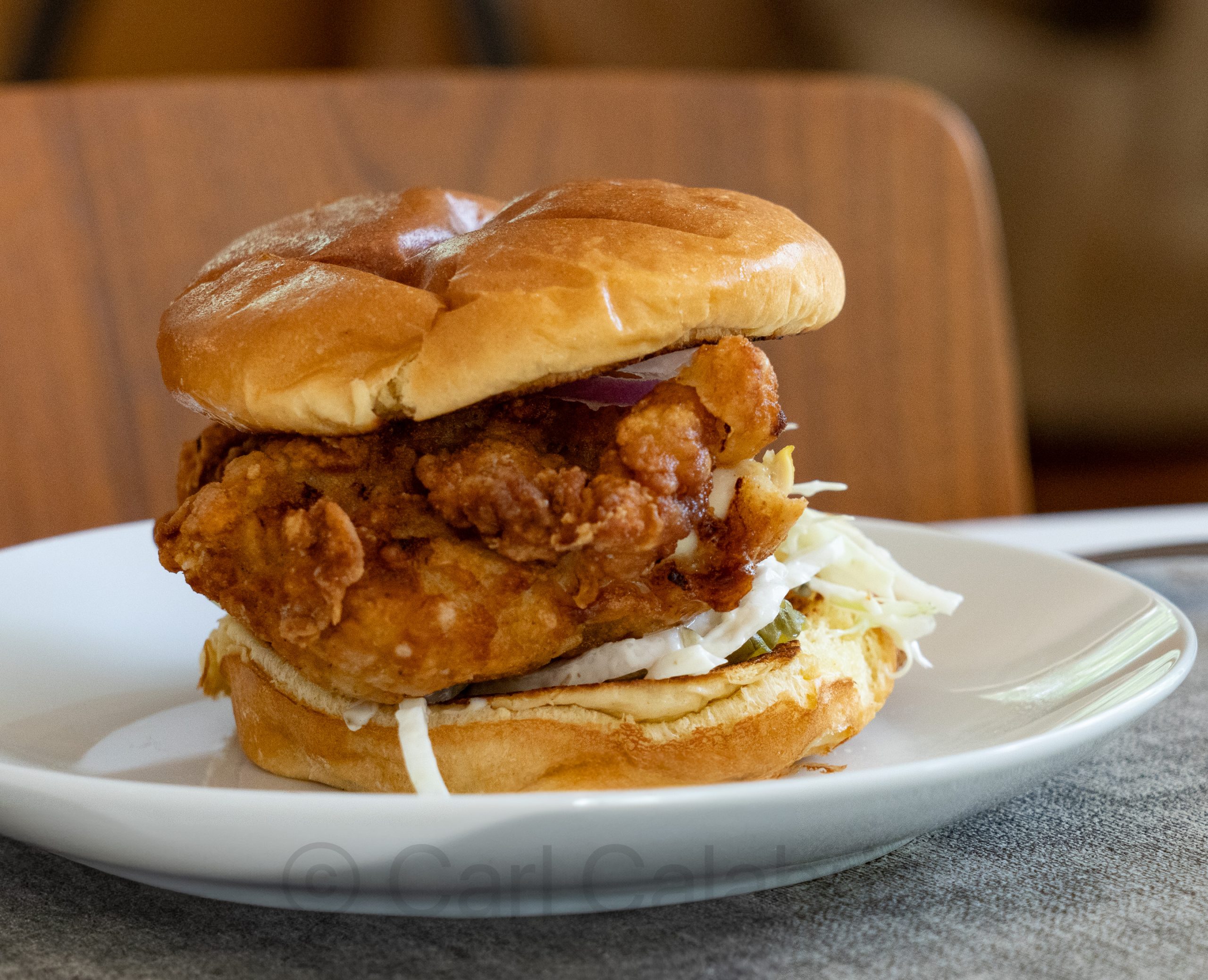
When I returned home, Nico and Maya were hard at work preparing a special Father’s Day lunch, which was amazing. We had the best fried chicken sandwiches I have ever tasted. They were truly amazing and followed by corn fritters, one of my all-time favorite foods.
Kyle called in from Portugal to join the celebration, and although we missed his presence, I am thrilled to see him living his best life.
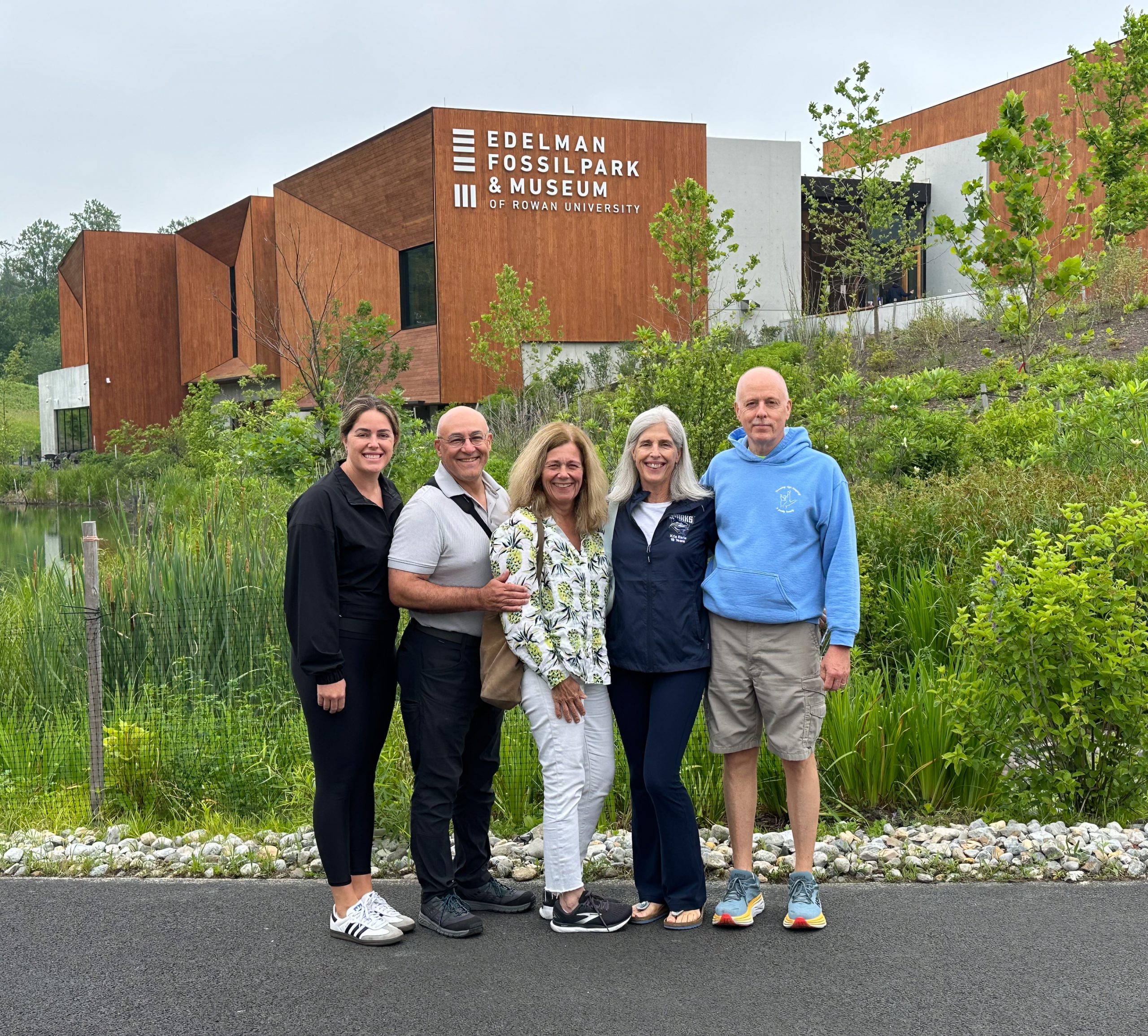
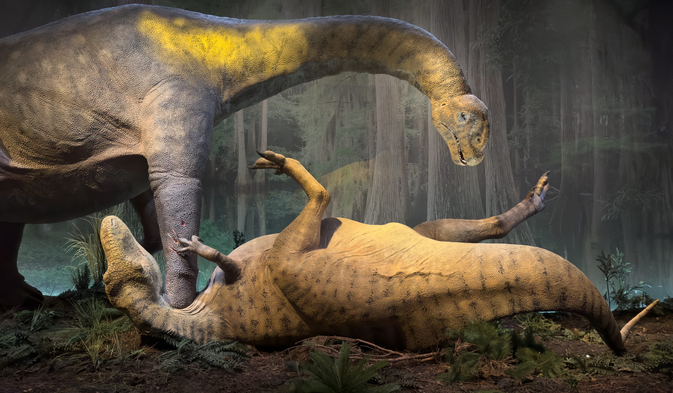
What happened in the days, even hours, after an asteroid set off the extinction of the dinosaurs? I learned the answer to this question while listening to a TED Talk by renowned paleontologist Dr. Ken Lacovara, the founding executive director of the Edelman Fossil Park & Museum, which opened just over 2 months ago in southern New Jersey. Built on the site of a marl quarry, it contains the most complete fossil record of the event that ended the age of the dinosaurs. Over 100,000 specimens representing more than 100 species were excavated from an area the size of a tennis court over a period of 14 years.
When I learned that Jeanine and I would be traveling to Ocean City to visit with the Earles, I knew we would have to add this museum to our itinerary. This morning we made the one-hour drive to visit the park and museum, and it more than lived up to my expectations. Afterwards, Jeanine and I made the drive back to Concord, during which I listened to another TED Talk and learned the answer to why small mammals who survived the impact managed to thrive when, by all accounts, the surviving reptiles should have annihilated them. The answer, BTW: fungi.
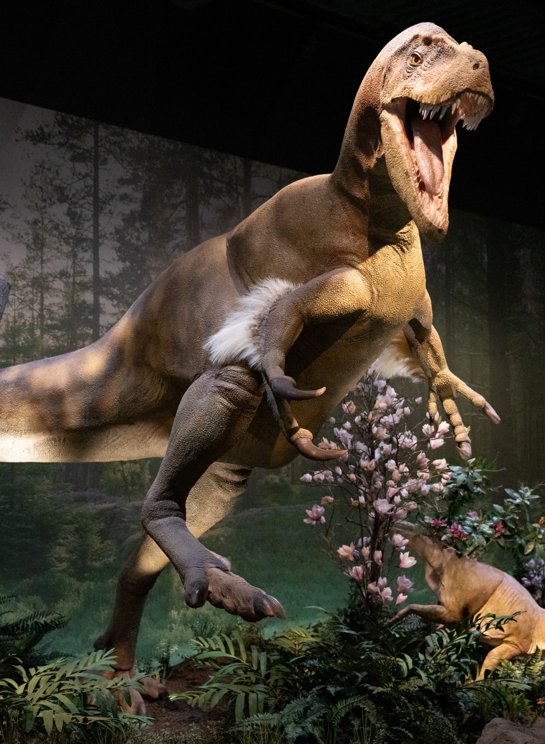
Although all of the land-based dinosaurs were wiped out, many reptiles and aquatic dinosaurs survived the initial asteroid impact. The nuclear winter that followed (dust blocking the sun for years) took care of almost all the survivors.
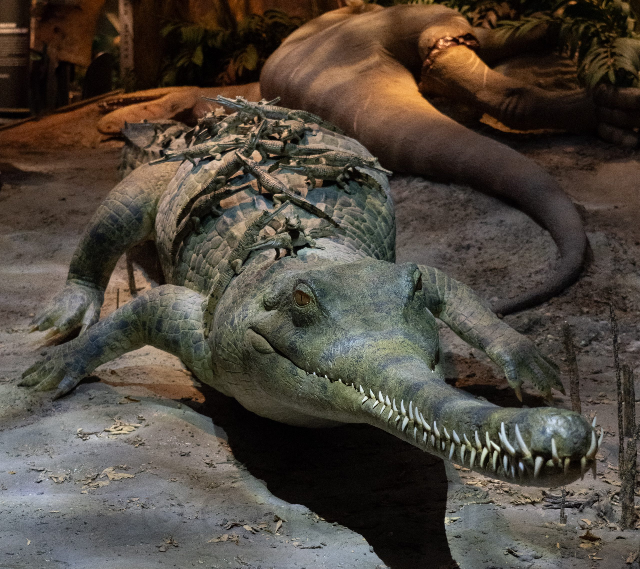
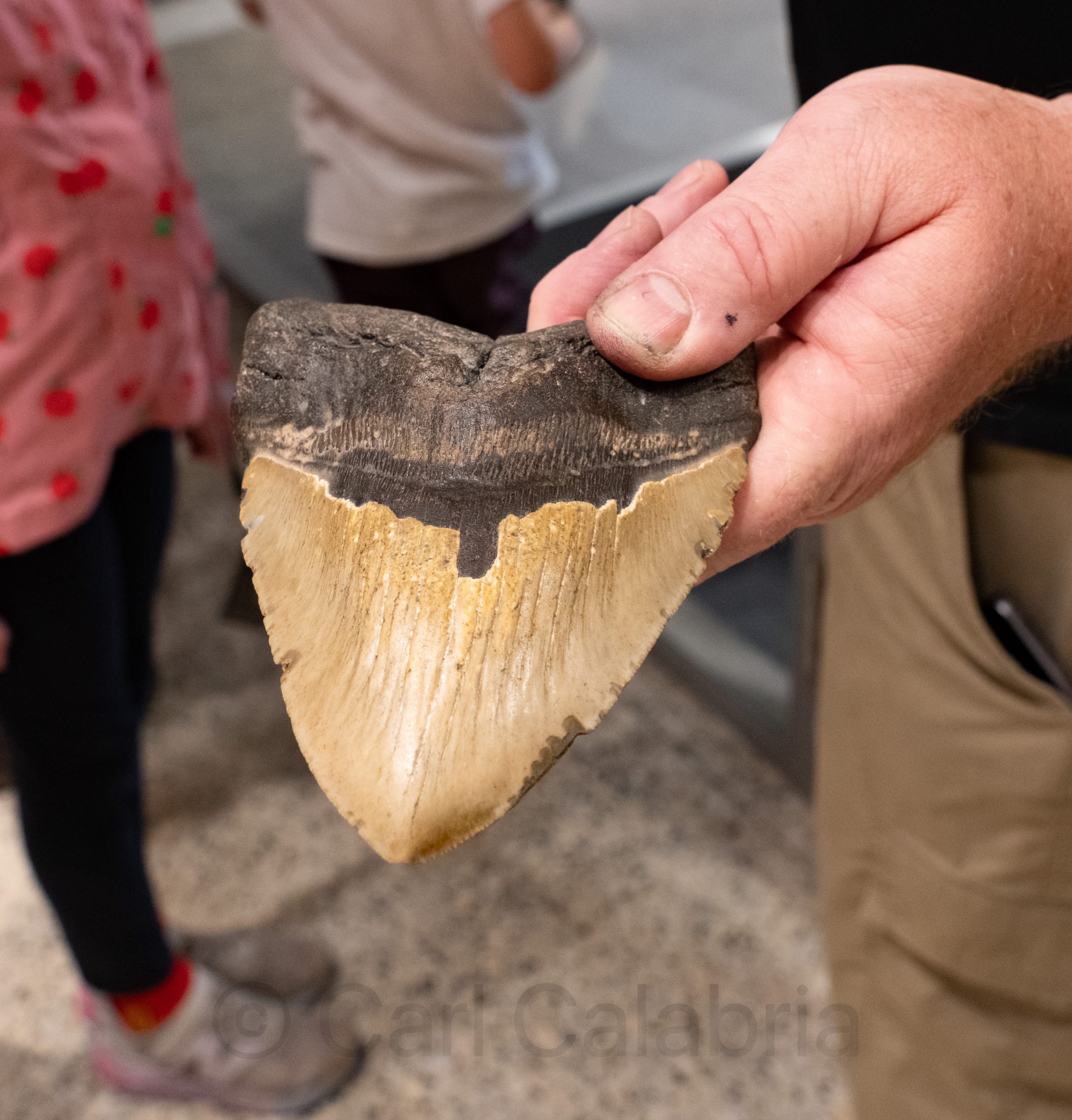
Pictured below is a shark tooth. Striations found in the femur of a large dinosaur made by sharks support the theory that animals killed moments after the impact were taken to sea by the ensuing tsunami, where they would have been floating buffets.
The fossil record also shows that many carnivorous dinosaurs were no match for the much larger plant-eaters, which could use their weight to crush them. Think lion versus bull elephant.
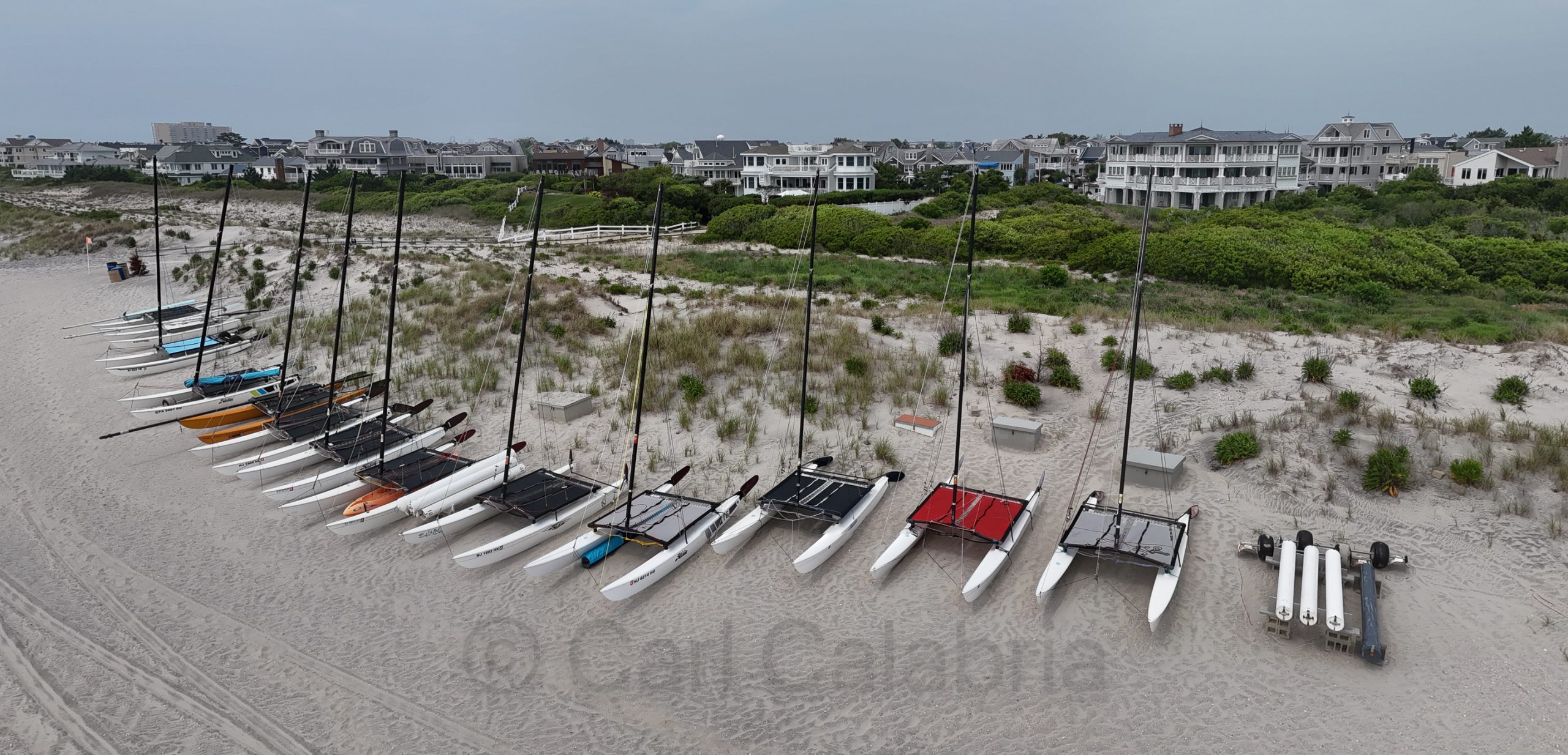
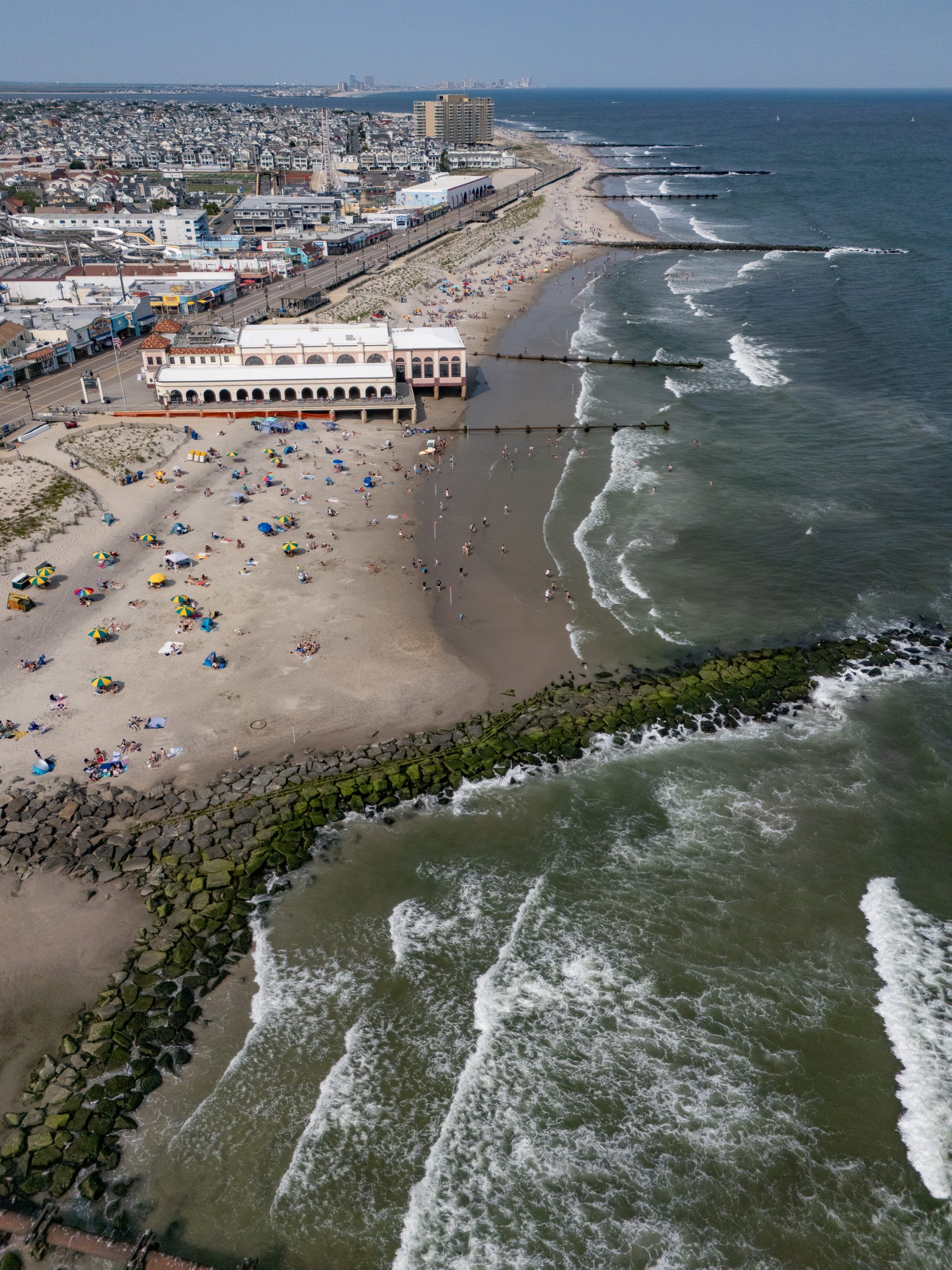
Kris’ daughter, Bethany, took us on a golf cart tour of Ocean City, starting with the Surf Road Beach on the northern end of the island.
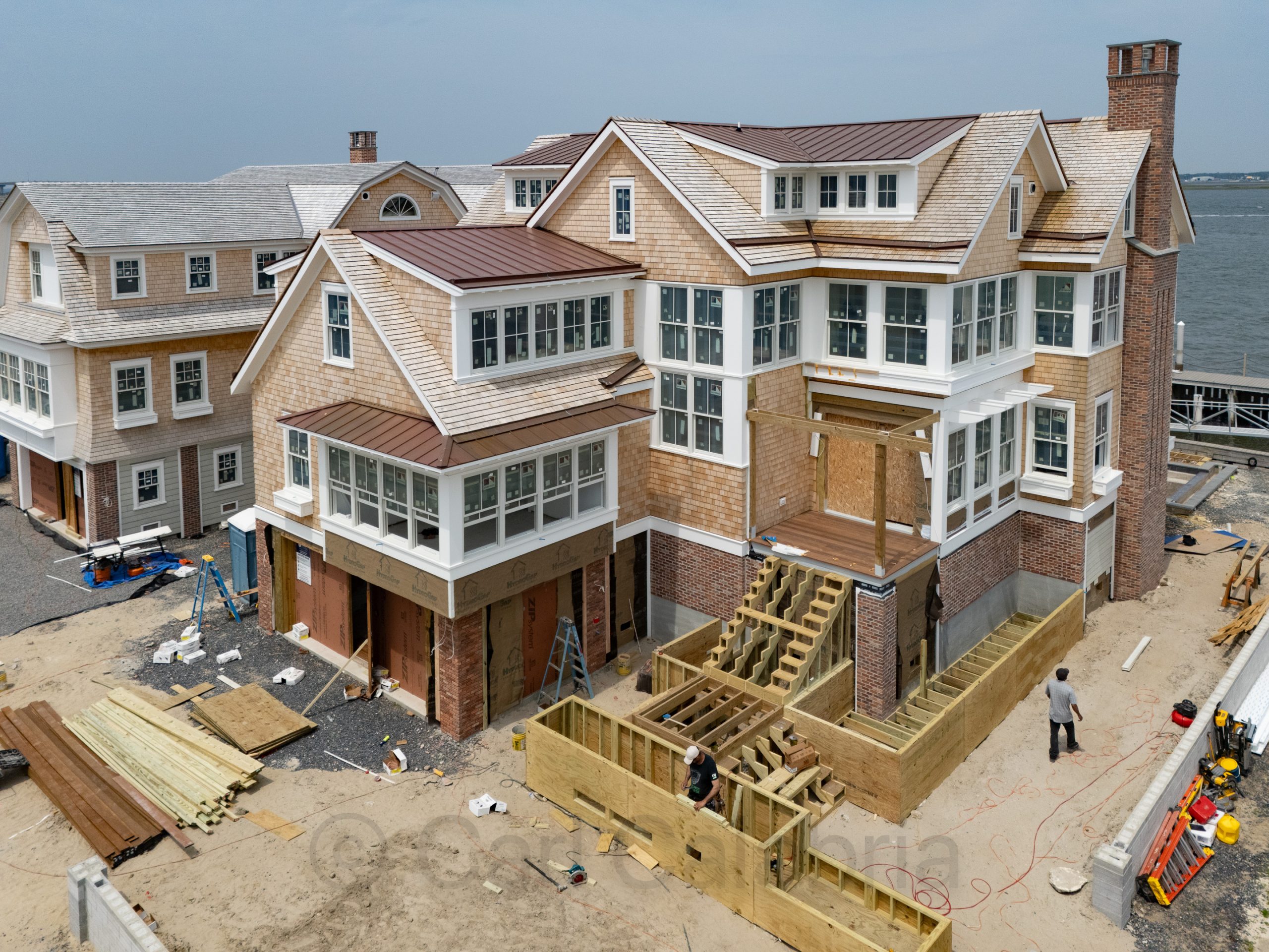
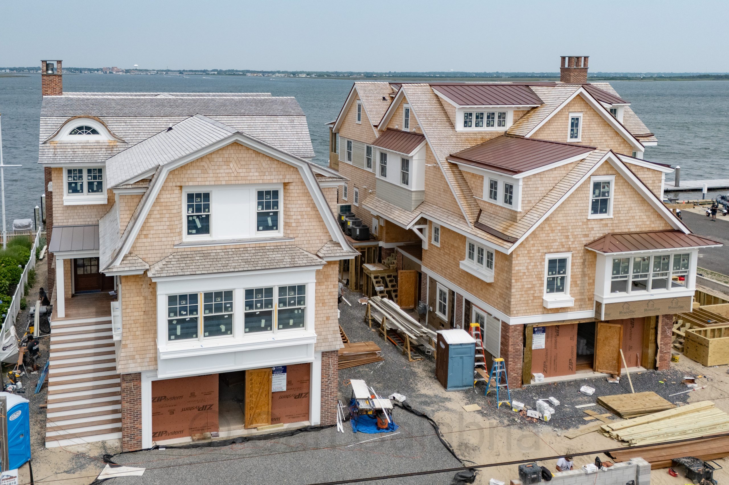
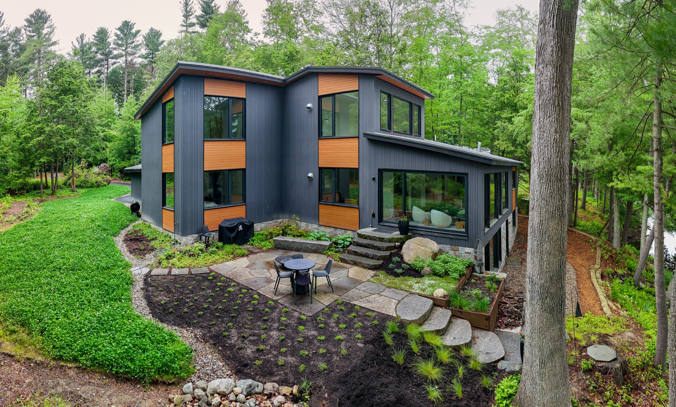
We then visited two of the adjacent properties that she and her husband are developing on the bay side of the island. The one in the foreground is listed for $14.9M, and the one behind it for $11.5M, with construction expected to be completed by the end of summer.
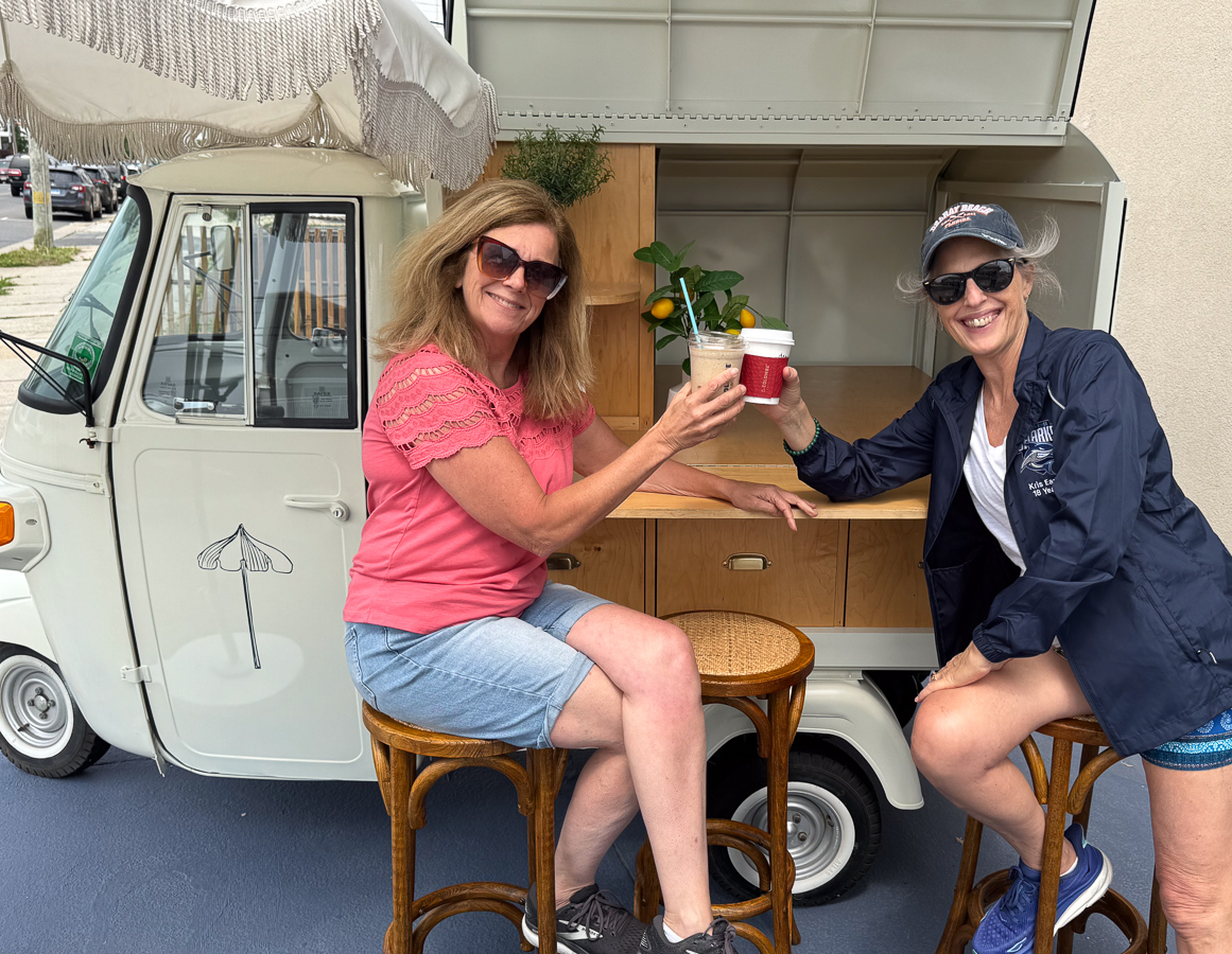
Caffeination was the next order of business.
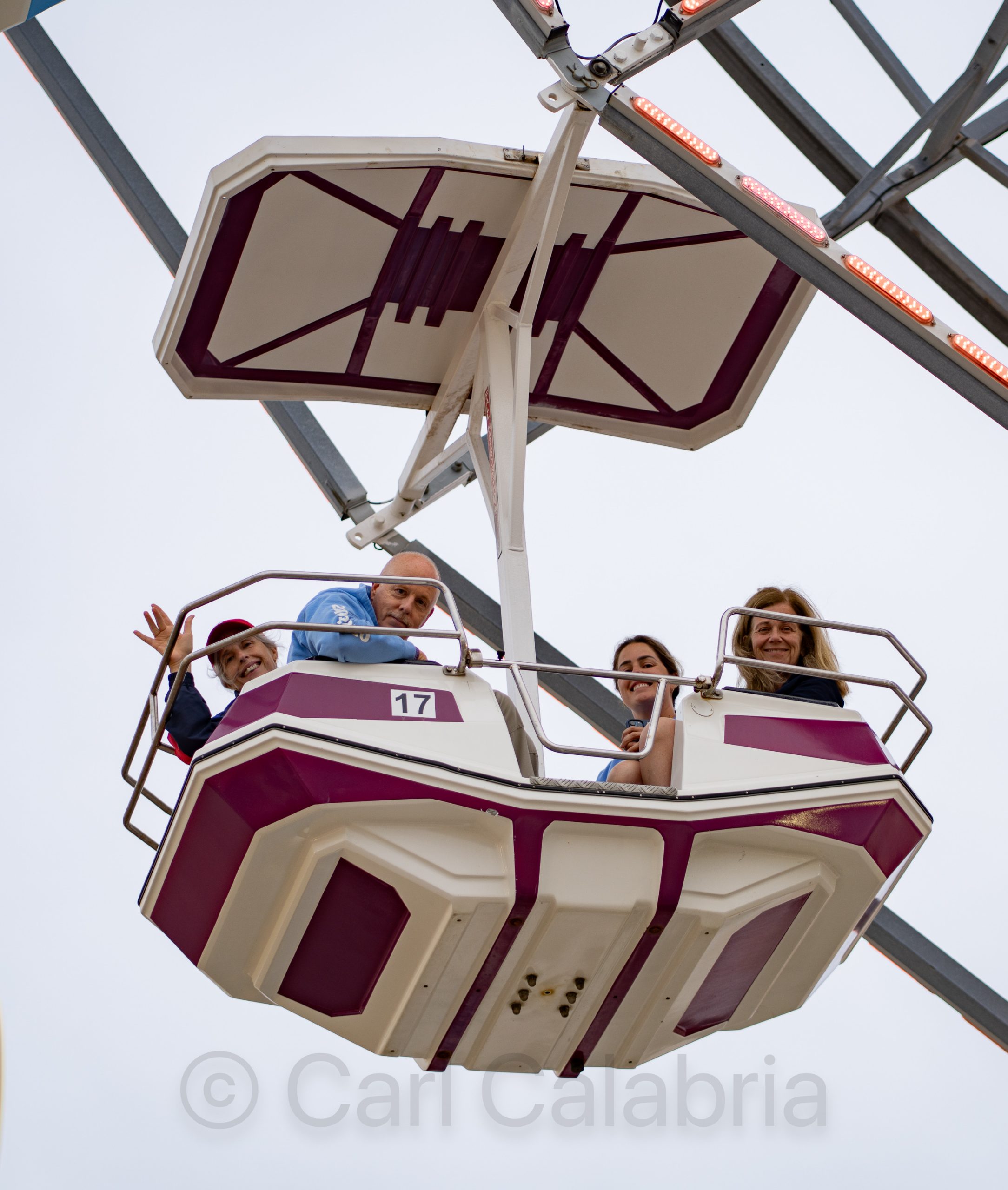
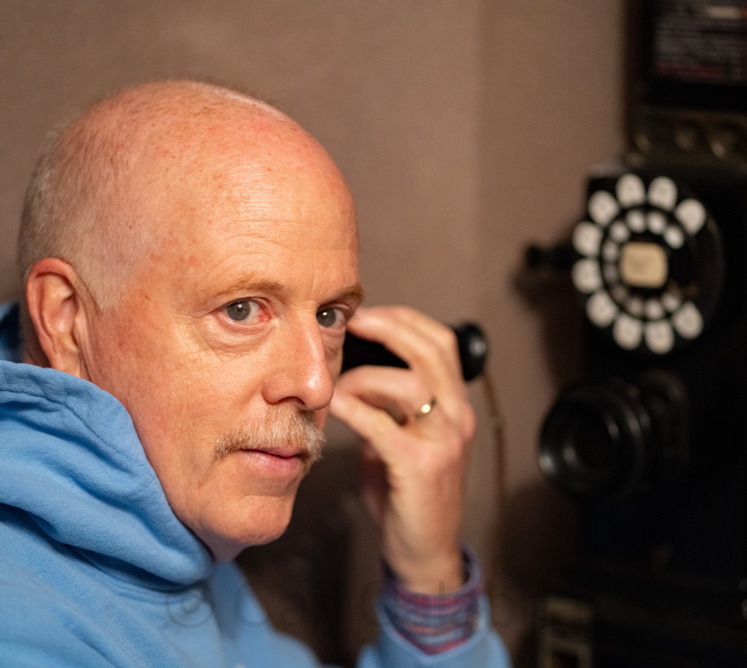
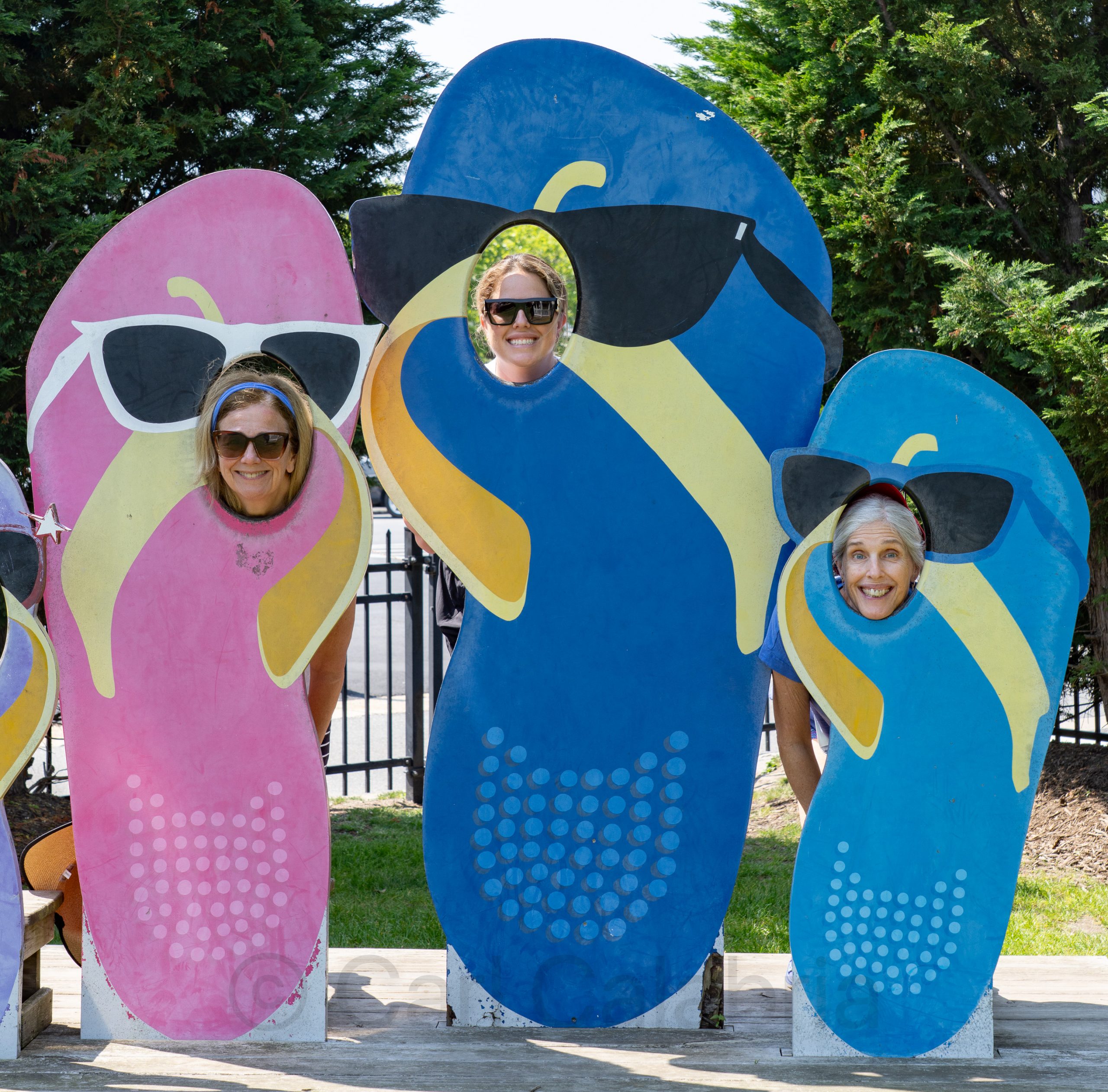
In the evening, we were joined by Rob, Kris’s husband, who flew up from Florida. After another amazing dinner, we hit the boardwalk for a final time and took advantage of the latest communication technology available in the home state of Bell Laboratories.
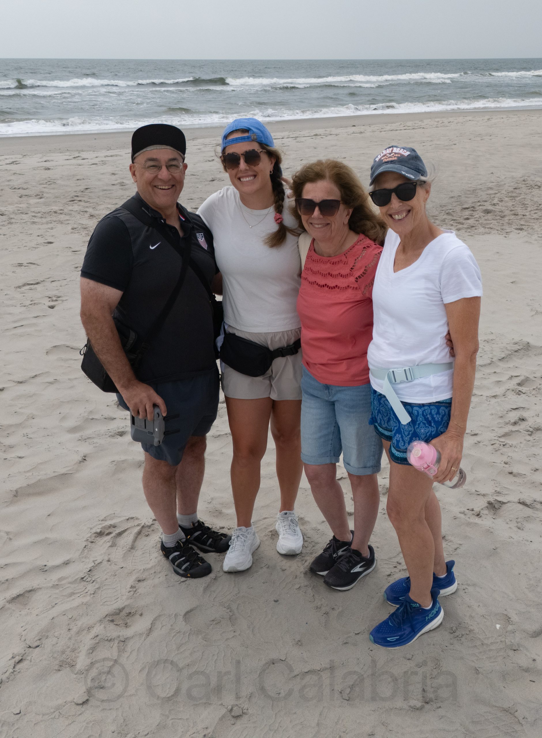
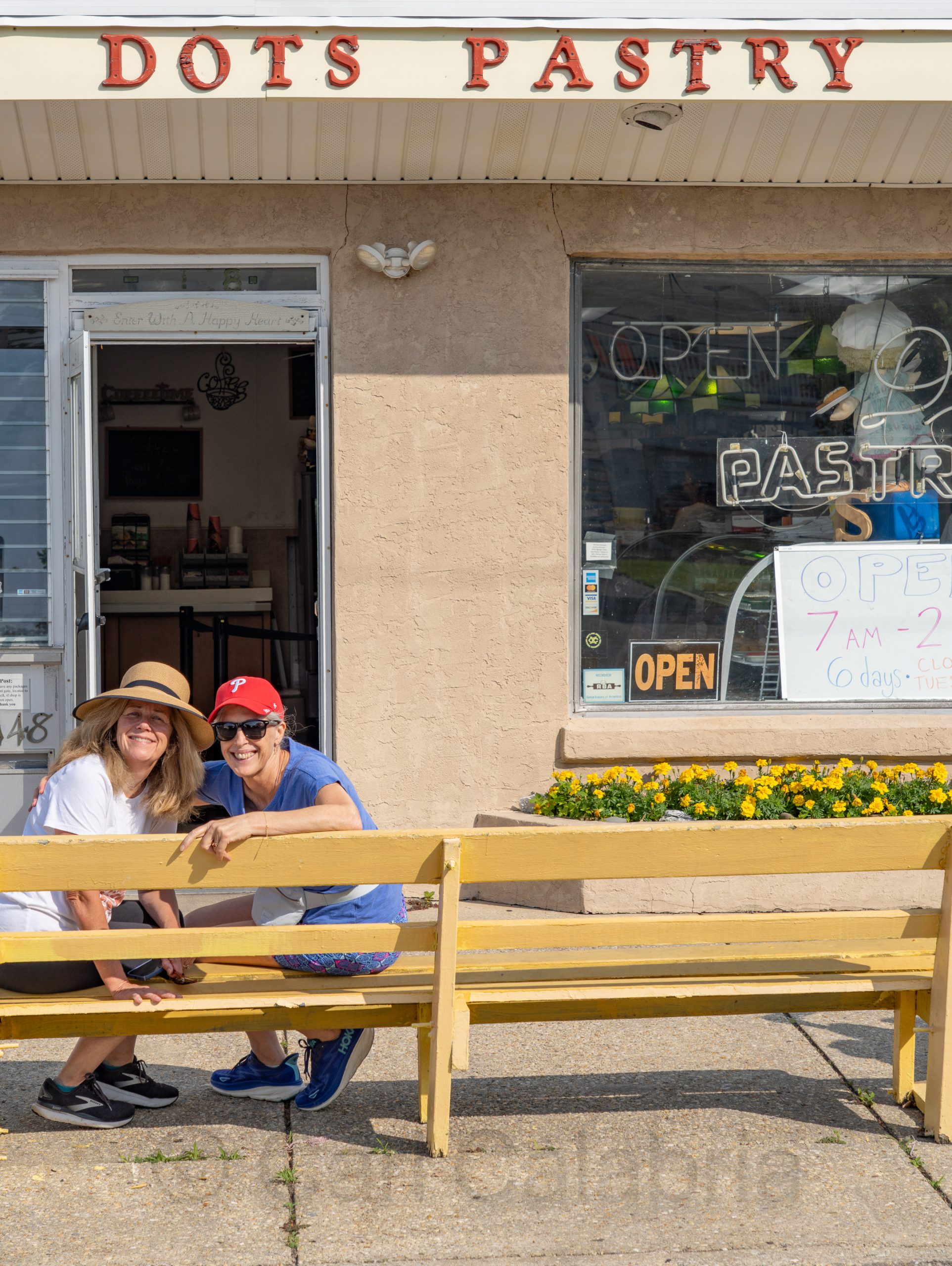
This morning, Jeanine, Kris, her daughter Beth, and Aunt Martha made a short excursion to Dots Pastry shop, where we acquired several thousand calories to augment our otherwise healthy breakfast. Later we went for a walk through Ocean City’s town center, stopping to purchase a new summer outfit for Jeanine. I then settled in for a leisurely nap while the women took to the beach and ocean.
Jeanine and I drove to Ocean City, NJ, today, where we will be staying with her best friend, Kris, and her family. We timed our travel to avoid rush hour traffic in the greater NYC area and made the journey in 6 hours including two brief stops for recharging the car. After several days of rain in Concord, we enjoyed the clear skies, warm sun, and ocean breezes that greeted us.
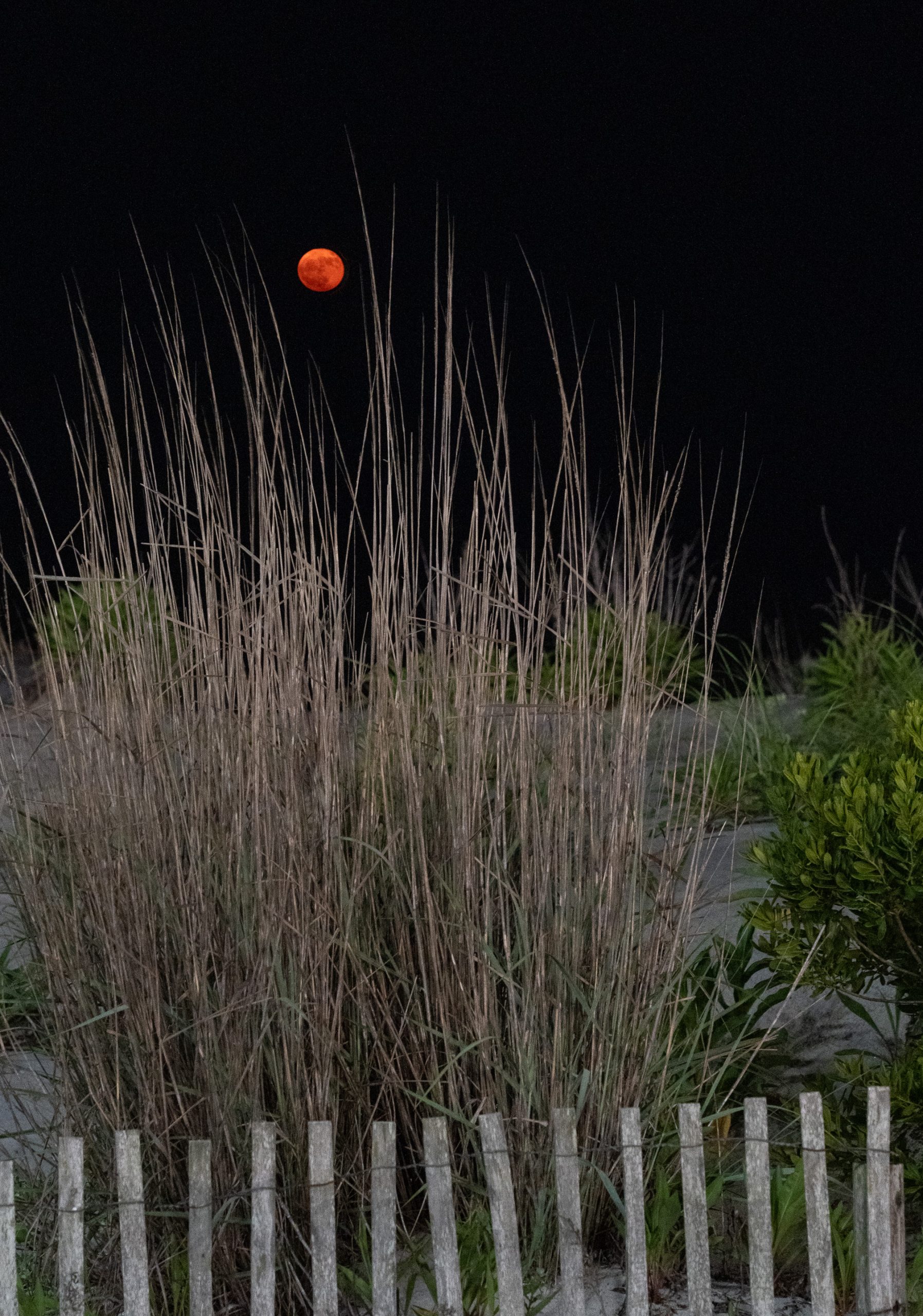
After dinner, we strolled down to the boardwalk to enjoy the Strawberry Moon. Initially, I feared that clouds on the horizon would ruin the opportunity, but eagle-eyed Jeanine spotted it as it emerged from cover. This Strawberry Moon was especially significant because it coincided with a major lunar standstill or “lunistice,” a rare event that occurs roughly every 18.6 years. This made the full moon appear unusually low on the horizon, the lowest it has been since 2006 and won’t be again until 2043. When the moon is low, it often appears more reddish or orange due to atmospheric scattering and this year smoke from the Canadian wildfires only added to the color.
Water chestnut (Trapa natans), often called “American water chestnut” in the U.S., is a highly invasive aquatic plant, not to be confused with the edible water chestnut used in Asian cuisine. Native to Eurasia, it was introduced to North America in the 19th century and has since become a major ecological threat in the northeastern United States. Jeanine joined other members of the community this morning to pull plants from the river in the ongoing battle to keep the spread at bay.
Yesterday, Jeanine and I planted 95 creeping thyme plants in the area between our patio and the clover lawn over a few hours. If they grow to their expected dimensions, we will have a lush, natural carpet covering the entire area that is robust enough to withstand foot traffic and will nearly double the usable size of our patio. Compared to similar work we did in the front yard, this project went three times faster, taking advantage of lessons learned. This time, we marked the hole locations for the entire area before excavating and then excavated all the holes before planting. Now for the hard part: wait 1 or 2 years for the creeping thyme to spread.
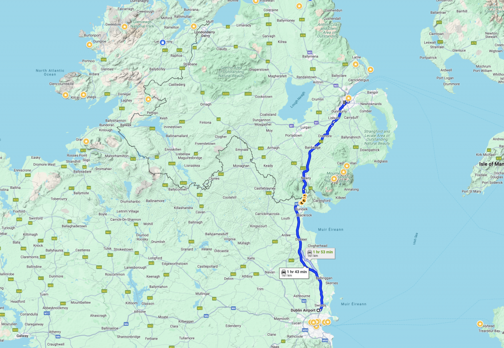
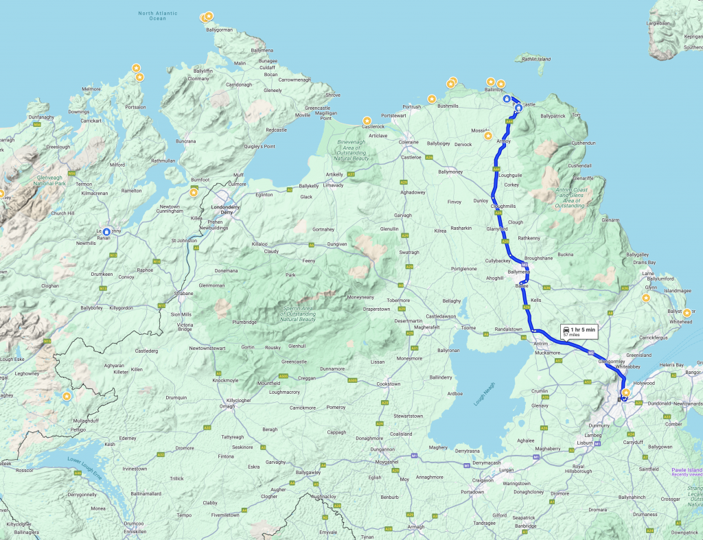
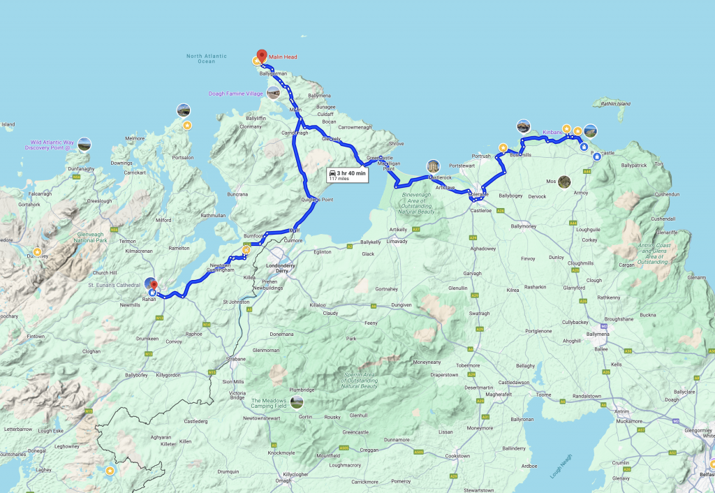
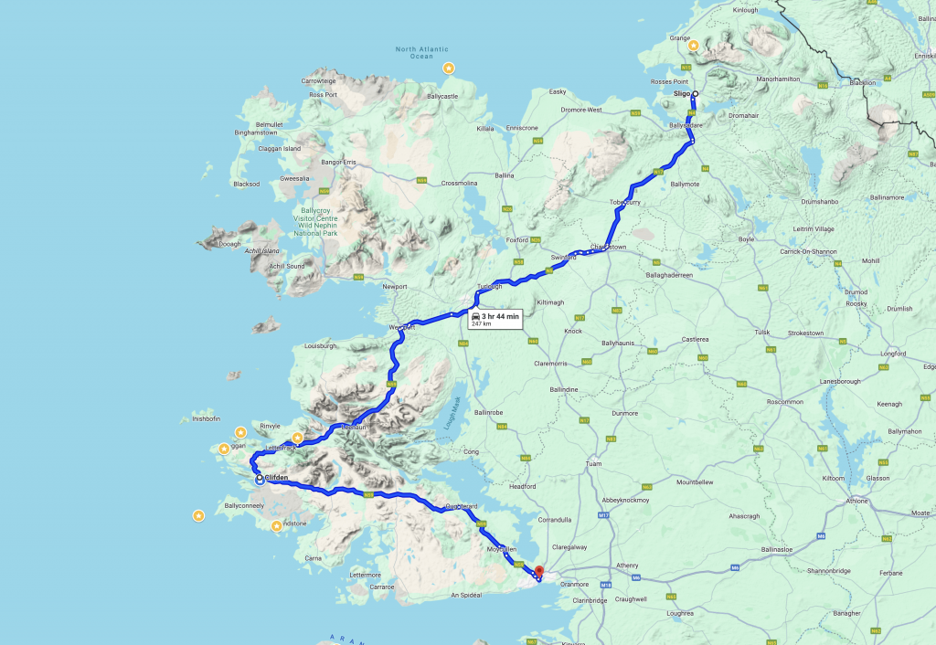
Next month, Jeanine and I will be traveling to Galway, Ireland, to celebrate the marriage of my nephew, Mario. We will fly into Dublin a week before, where we will rent a car and meet up with my brother (Mark) and sister-in-law (Marie) to do a little touring through Northern Ireland. Before such trips, I like to identify places to visit and map out a driving route. Today, I spent some time documenting a tentative plan to share with Mark and Marie for their review.
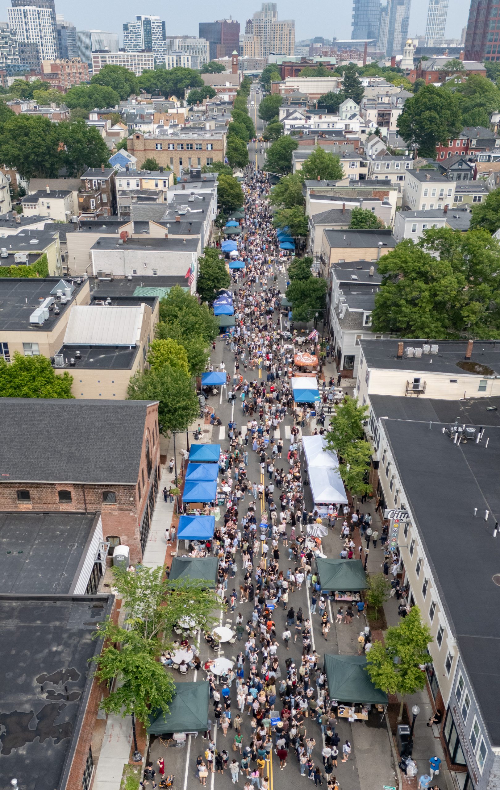
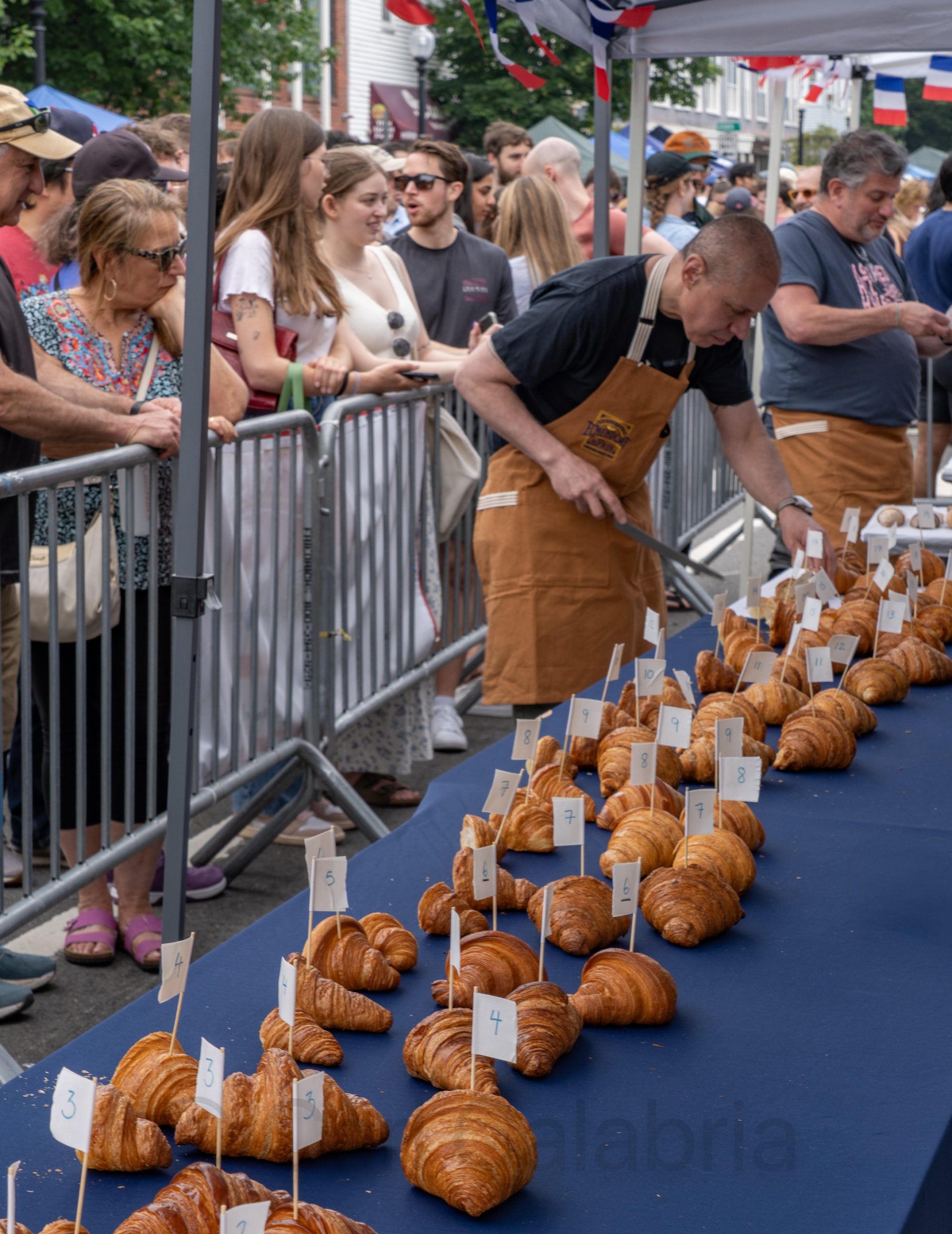
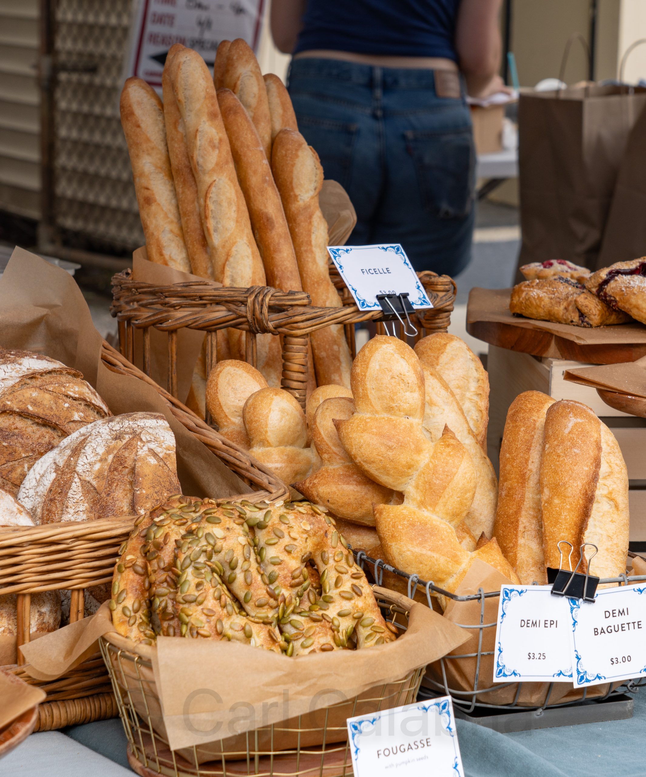
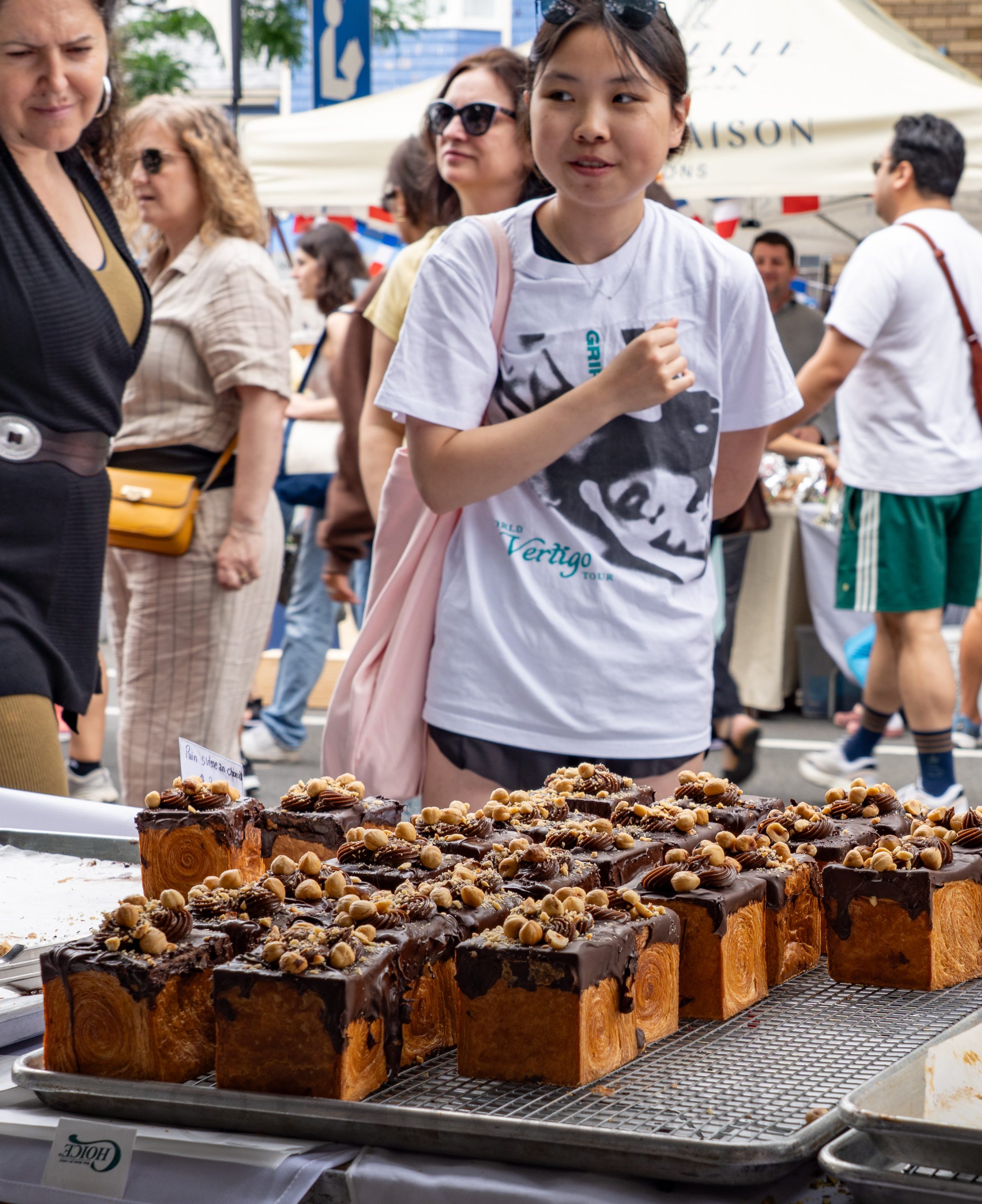
Le Grand Prix Elmendorf du Pain is an annual Parisian-inspired street festival and bread competition held in East Cambridge, celebrating French baking traditions and local community spirit. The event features an eclectic mix of French-inspired food vendors, local artists, live music, and a festive atmosphere as Cambridge and Eighth streets are closed to cars for the occasion. The bread competition is divided into amateur and professional categories, with this year’s challenge focusing on demi-baguettes for home bakers and croissants for professionals, judged blind by a panel of experts. Inspired by Paris’s Grand Prix de la Baguette, the event aims to highlight both the artistry of bread-making and the vibrancy of the East Cambridge community. Jeanine and I enjoyed our visit during which we obtained two loaves of bread, a cheese and cracker plate, a cherry and almond cookie, and two rather large smiles.
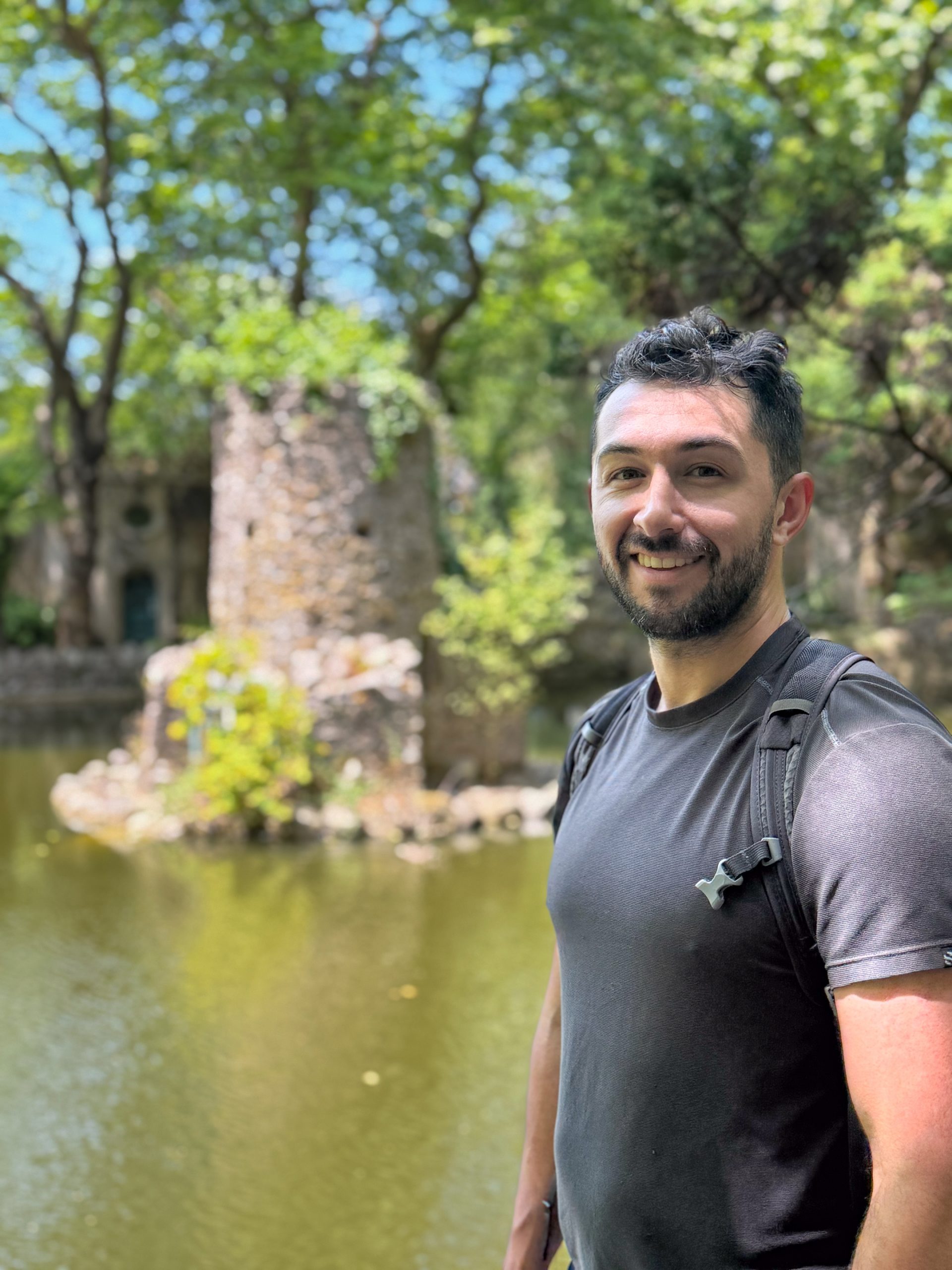
We then drove to Medford for a brief visit with Kyle, who is leaving for Portugal tomorrow on a month-long stint working remotely.
Earlier in the day, I watched from the sidelines as my soccer team fought hard for a 2-1 win, which secured our first-place finish for the spring season and home-field advantage for the league championship playoffs. I decided it was better to forego playing today than risk re-injuring my hamstring and missing the playoff matches. I fully expect to be back on the pitch next weekend.
This website is dedicated to sharing, with family and friends, the day-to-day adventures of the Calabria family.