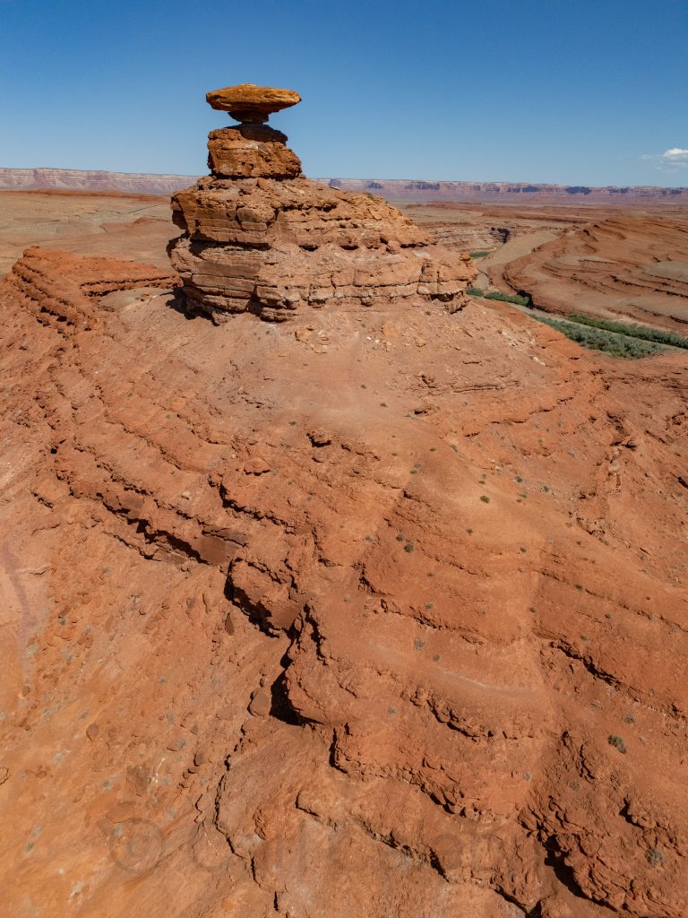
Mexican Hat is a small town in southern Utah named after a distinctive rock formation that resembles an upside-down sombrero perched high above the adjacent San Juan River. With a population of ~100 it is not exactly a marquee destination. It does, however, make an ideal home base for visiting Monument Valley, Gooseneck State Park, and Valley of the Gods, all on the itinerary for today.
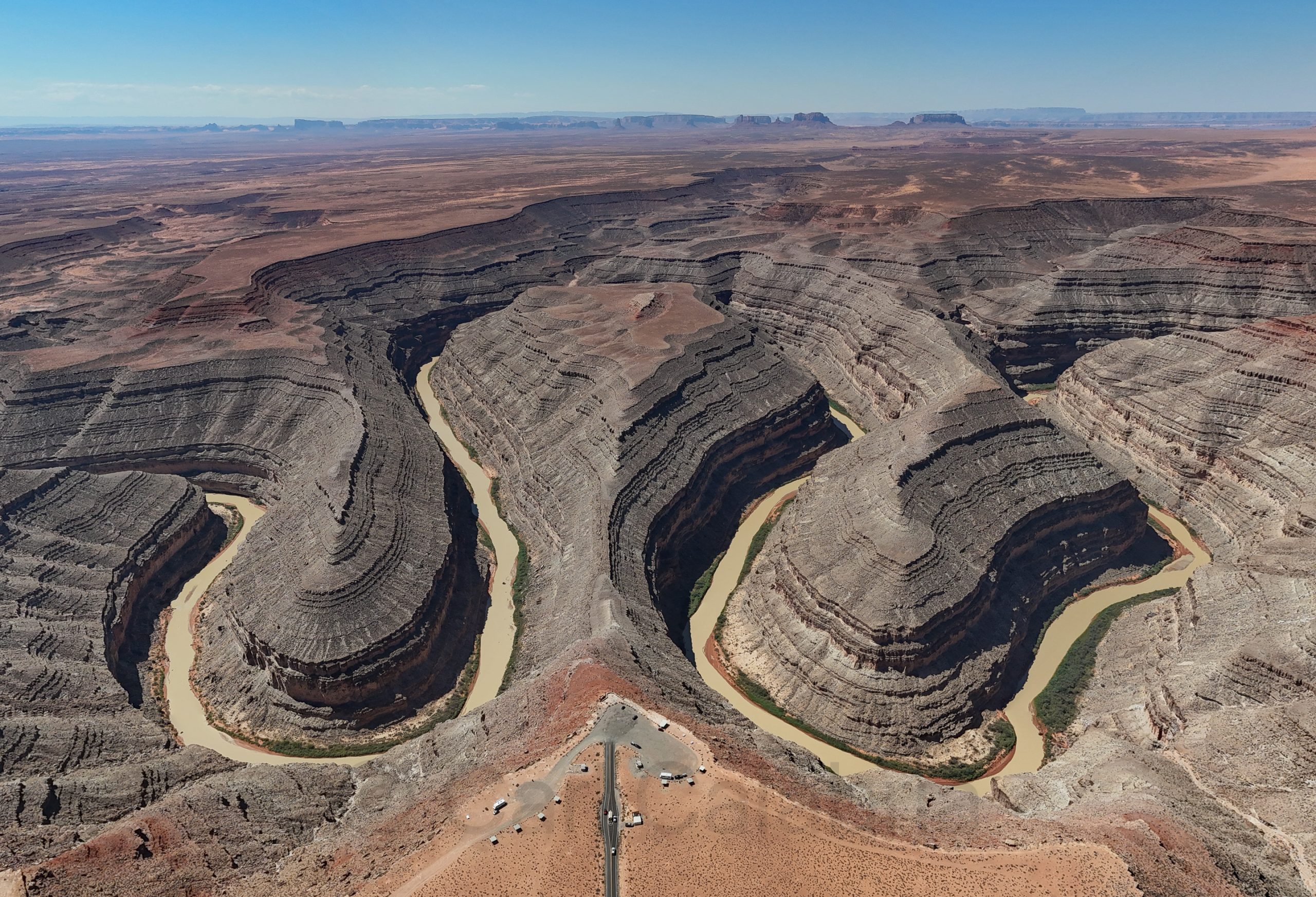
Pictured below is a location that I scouted using Google Maps satellite view. I suspect that the San Juan River once circled/created this butte before it found a shortcut.
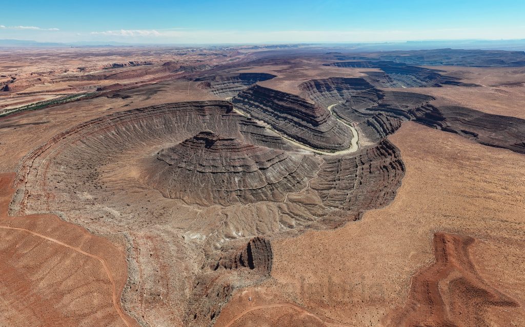
Gooseneck State Park
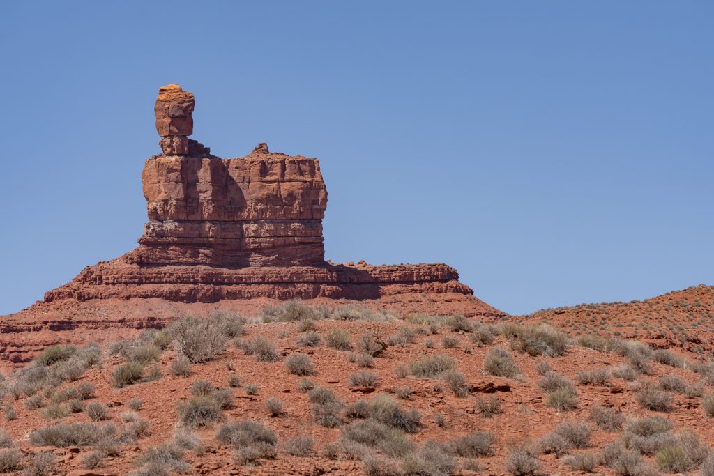
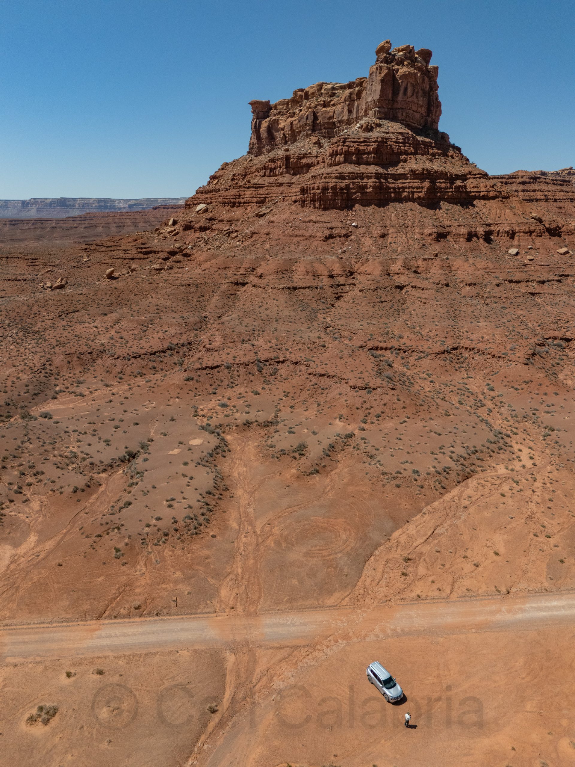
Valley of the Gods is a scenic backcountry area featuring dramatic sandstone buttes, pinnacles, and mesas reminiscent of Monument Valley. It can be traversed via a stunning 17-mile unpaved drive through vast open terrain with unique rock formations. The aptly named “Lady in the Bath Tub” is one of the more whimsical. The rugged road is likely the reason few people visit here. This is my second time and I only encountered a dozen other people on each occasion.
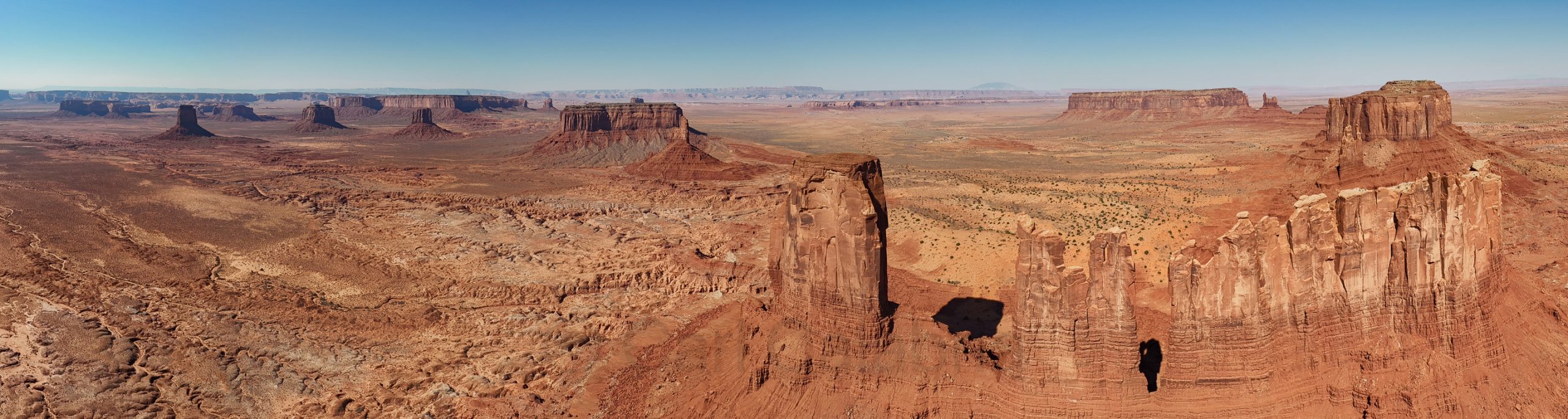
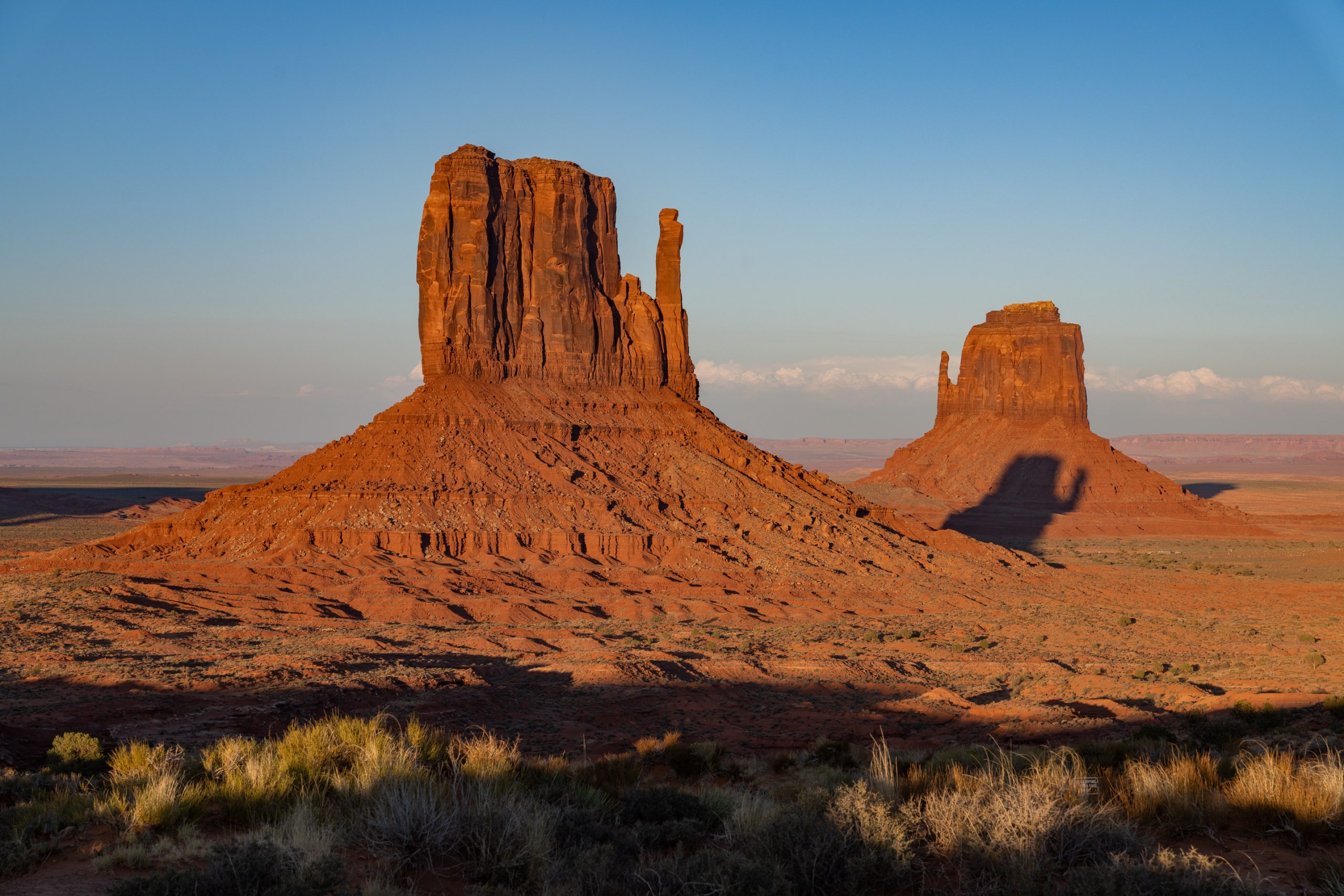
The last time I was in Monument Valley, I lost my drone when attempting the photo below. Since then, I have gained much experience as a pilot, and I have a newer model with better obstacle avoidance and greater radio range. I was extremely nervous on this flight, but equally euphoric as I knew I had timed the light perfectly.
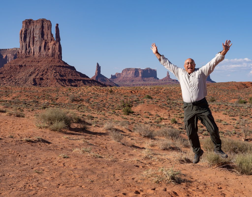
Midday light, on the other hand, is pretty mundane, so I tried to add a different kind of interest to my photos. It took about 20 attempts to perfectly time my jump to the ten-second shutter delay.
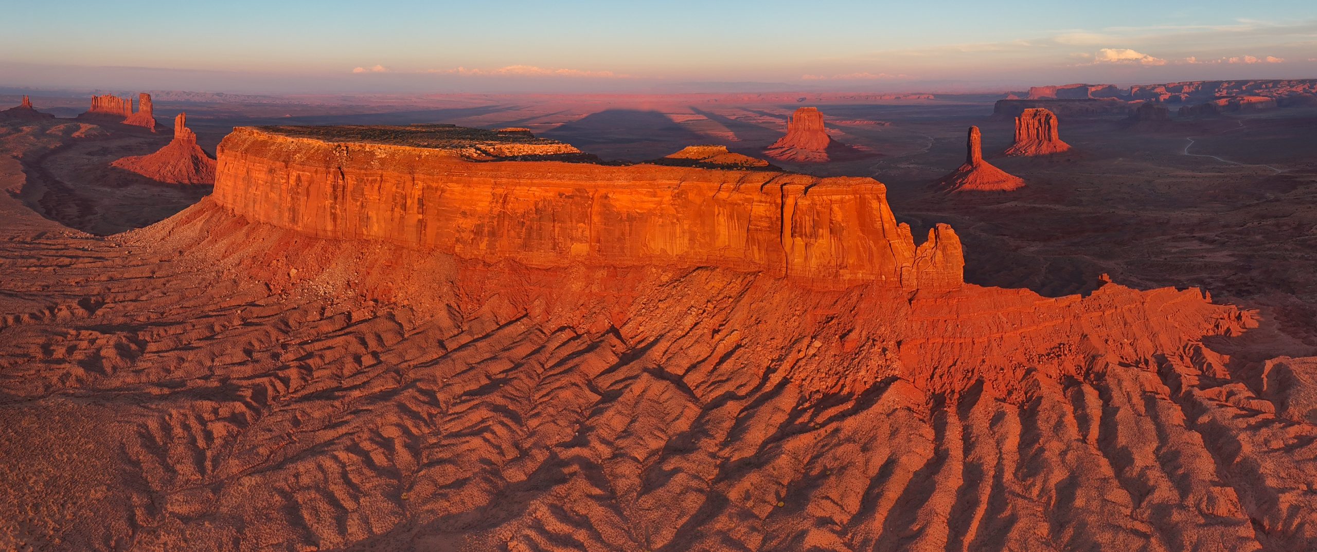
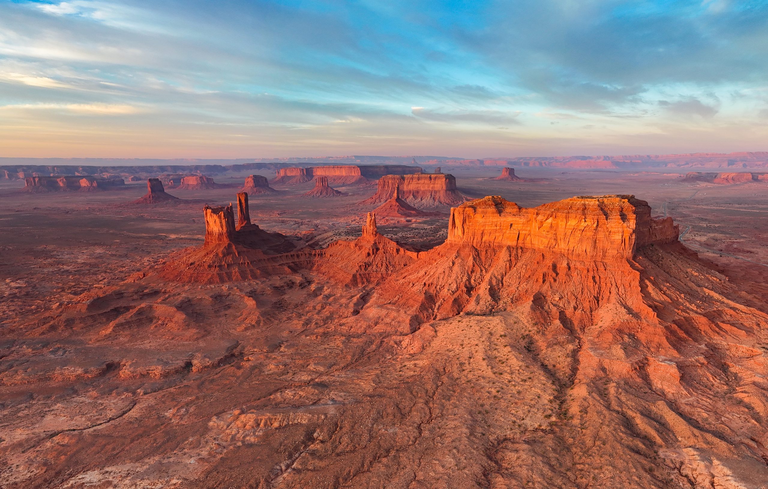
When the sun started setting, I was in business again. I took the photo below about 20 minutes before golden light to give myself time to drive outside the park and far enough away to get a comprehensive view.