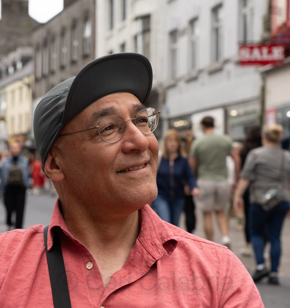
Jeanine and I spent a good portion of the afternoon at the Cambridge Jazz Festival, where we did a little Salsa and Merengue dancing and enjoyed the Caribbean jazz sounds of Ron Reid’s Special Metal Project. There is a good chance, weather permitting, we will attend for a second day tomorrow.
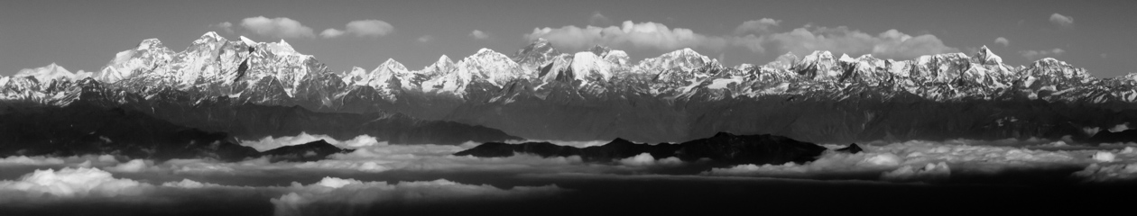
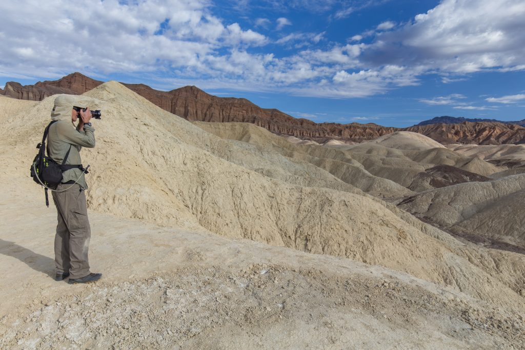
In the early days of Truevision, the company I co-founded in my twenties, I hired an engineer from Switzerland named Frank Löffel for the role of an ASIC (chip) Designer. He wrote a well-researched letter describing his skills and capabilities, as well as how they would benefit the company. We granted him an interview, were impressed, and proceeded to offer him the job. He later told me we were the only company to respond to 30 similar letters he had sent out to other potential employers. When he moved to the US to start work, he had no place to live, so I invited him to stay in my spare bedroom. Eventually, he got his own place and went on to work for the company for several years. Frank and I both shared an interest in landscape photography. He was most drawn to deserts and his work was at a level I can only aspire to reach. We reconnected after ~20 years while we were both attending the National Association of Broadcasters (NAB) trade show in Las Vegas. After the show ended we spent a day together shooting photography in Death Valley. I have wonderful memories of that day but damn few photos of Frank to share beyond the one above. Frank was a loner and would work intermittently to fund his passion for desert photography. He had a Toyota Land Cruiser fitted with huge tires and a pop-top camper. It had several spares on the roof along with extra gas cans, car jacks, and traction ramps. It was fitted with solar panels and storage areas for all his photo gear. He had recently spent several months in the Bolivian high dessert and had driven up from South America.
I recently learned that Frank died 6 months ago. At the time, he was being held in an Iranian prison where he reportedly committed suicide. The Iranian’s claimed he was a spy taking photos of a military base near where he was arrested, and it is suspected that he was tortured. My guess is he was there shooting landscape photography of the deserts he loved so much, finding himself in the wrong place, at the wrong time, with a truck full of high-end photography gear and drones.
This was unbelievably sad news to receive, but even worse is that I can find no record of his online photography portfolio. He devoted much of his life to making beautiful images of some of the most remote and desolate places on Earth, and now it appears his photographic legacy may be lost forever as well.
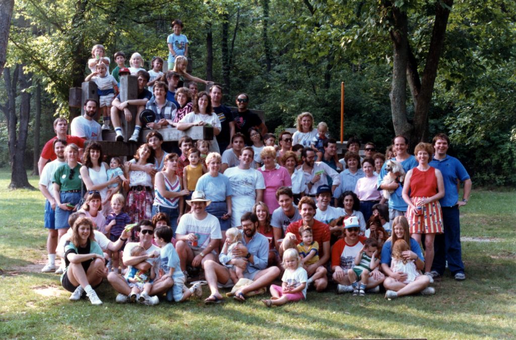
Frank is pictured below in an early Truevision company picnic photo with his girlfriend. He is directly below the Frisbee.
I offer my condolences to his sister, wife, and son, and pledge I will do all in my power to recover his photographs.
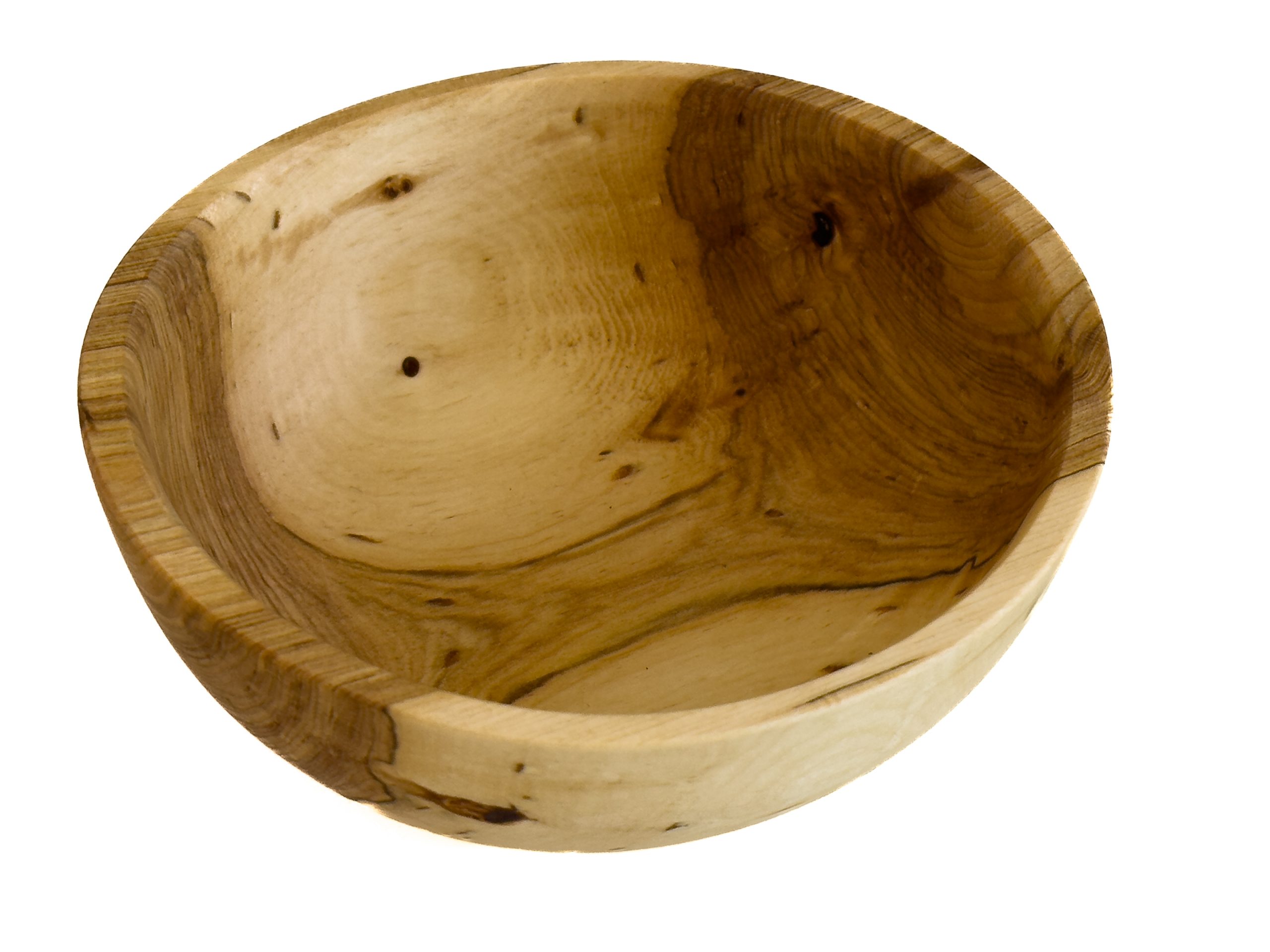
When my brother last visited us in Concord, he left with a small section of a Linden Tree trunk from our yard. While in Ireland, he returned it in a slightly different form. Mark has become a skilled woodturner, and we have been the beneficiaries of several of his creations.
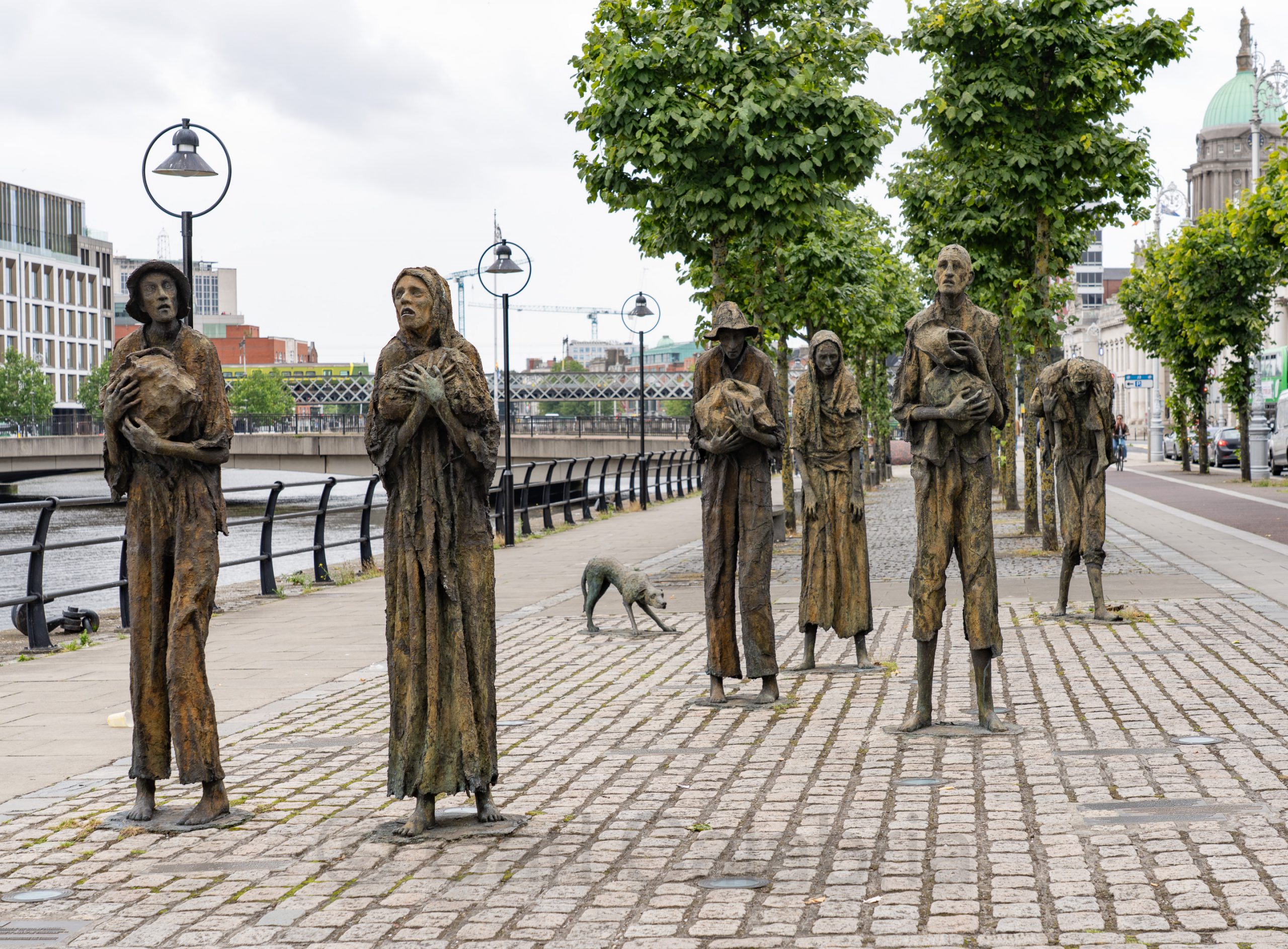
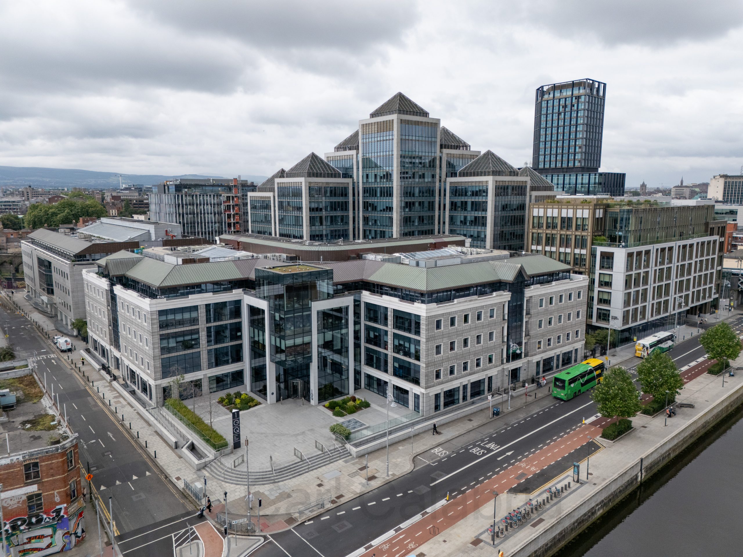
Our return flight to the US was not until late afternoon, allowing Jeanine and me another half day to explore Dublin. She opted to visit the Irish Emigration Museum, while I chose to wander around outside. Pictured above is the Famine Memorial, which vividly portrays starving people in rags, some carrying children and meager belongings, symbolizing the suffering faced by the Irish population during the famine when about one million people died and another million emigrated from Ireland. Below, a part of Dublin’s modern skyline is George Quay Plaza.
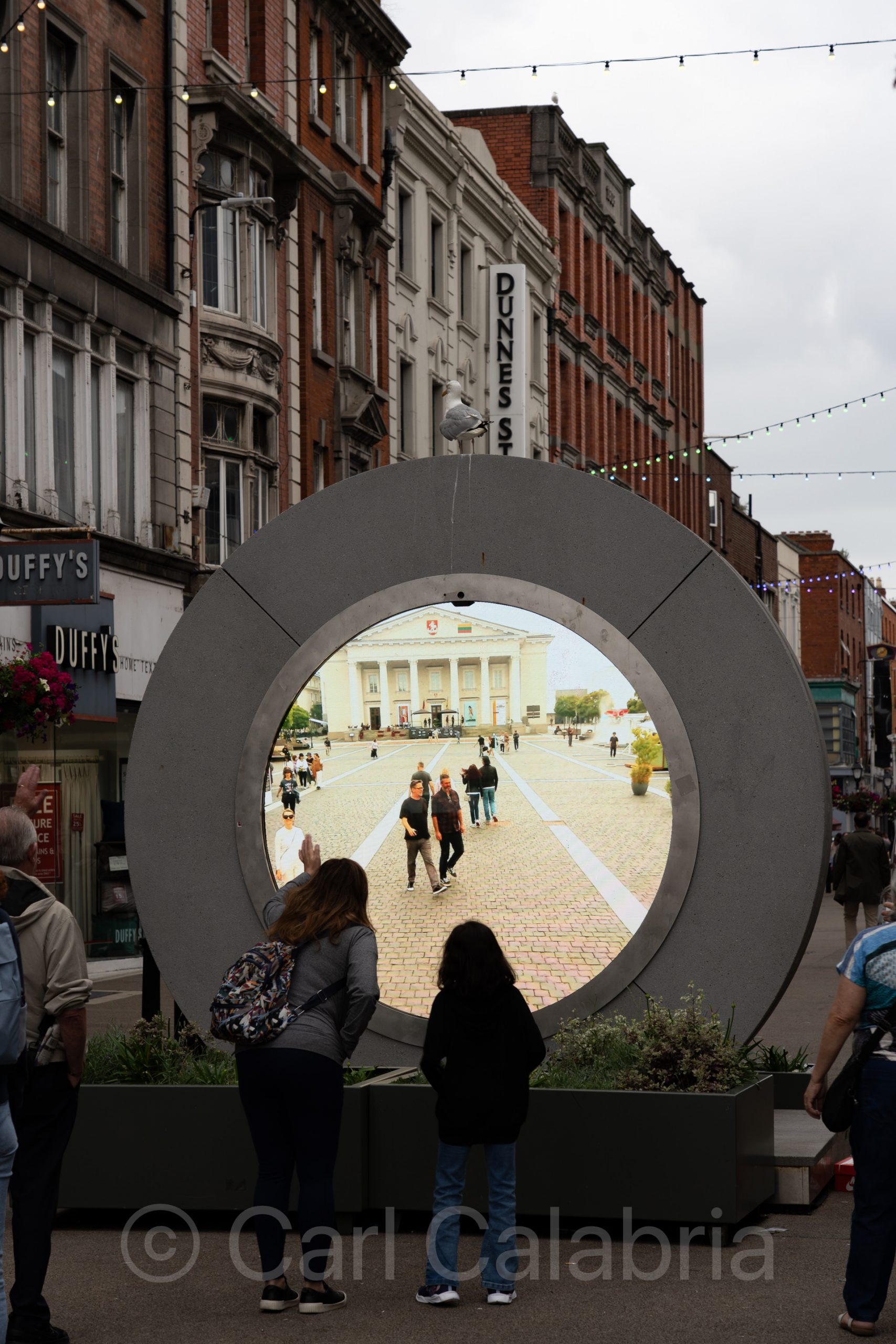
“The Portal” is an innovative public art installation that creates a real-time visual connection between Dublin and other cities worldwide. Initially, the portal was coupled to another portal in New York City and has since expanded to include Vilnius (Lithuania), Poland, and Brazil. It consists of a large circular sculpture with a rounded screen in the middle that streams a continuous, unfiltered live video feed of the other city. This allows people in Dublin to see and interact visually with those in the different cities as if they were sharing the same space.
It is without a doubt the most engaging piece of urban art I have ever encountered.
The Samuel Beckett Bridge is a cable-stayed swing bridge that spans the River Liffey. Designed by renowned Spanish architect Santiago Calatrava, the bridge is noted for its elegant shape that evokes an Irish harp lying on its edge, symbolizing Irish culture. The bridge is 120 meters long and 48 meters high, featuring a single curved pylon that rises 46 meters above sea level.
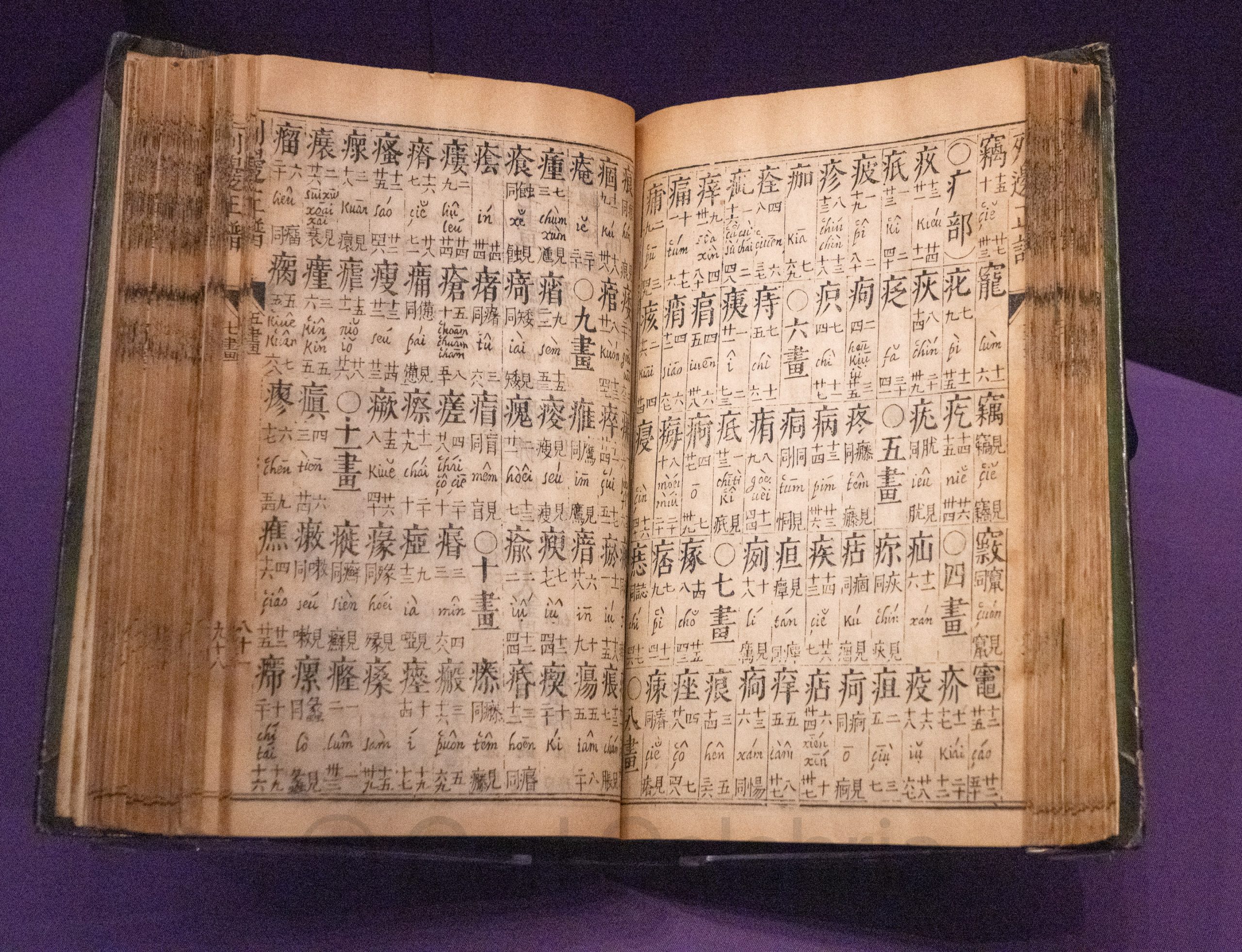
The Chester Beatty, also known as the Chester Beatty Library, is Ireland’s leading museum of world cultures located within the grounds of Dublin Castle. It was established in 1953 to house the collections of Sir Alfred Chester Beatty, an American mining magnate and collector. The museum holds an extraordinary collection of approximately 25,000 manuscripts, rare books, miniature paintings, and decorative objects from Europe, the Middle East, Asia, and North Africa, covering a range of world cultures and religions. The Chester Beatty is acclaimed for its diverse exhibitions, including significant religious manuscripts such as early Bible copies, Qur’an, Buddhist scriptures, and the Gospel of Mani.
It was our primary destination today and lived up to its reputation as one of Europe’s best museums. I learned more about the religions of the world in one day than I have during my lifetime.
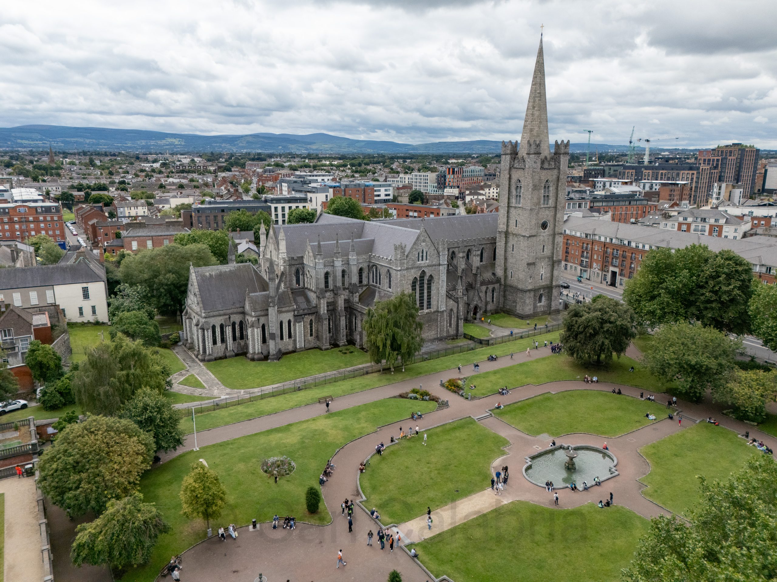
Afterwards, and in between ice cream breaks, we visited the nearby St. Patrick’s Cathedral, the largest church in Ireland and a prime example of Gothic architecture. Its history stretches back over 800 years, built primarily between 1220 and 1260 under Archbishop John Comyn, on a site believed to be where St. Patrick himself baptized converts in the 5th century. The cathedral was constructed in a cruciform (cross-shaped) layout typical of Gothic design, featuring pointed arches, ribbed vaults, flying buttresses, and an elaborate 140-foot tall bell tower.
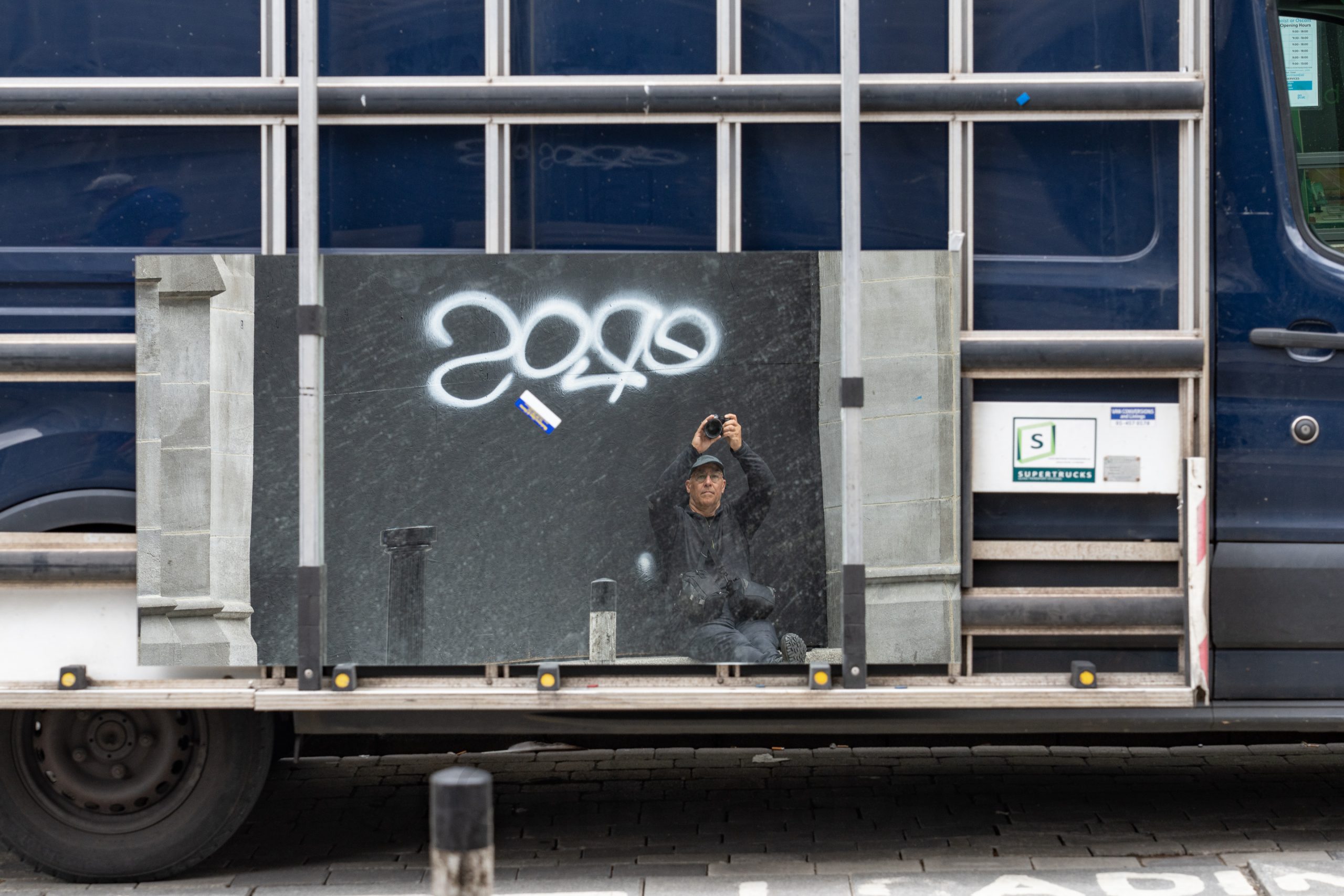
Pictured below is a random self-portrait I made. Jeanine studied this photo for several minutes and could not figure out what exactly she was looking at. See if you can figure it out.
UPDATE: In response to many inquiries about this photo, I am adding the explanation. I was seated on some stone steps in front of a boarded-up entry to an old stone-faced building. I photographed my reflection in a mirror being transported on a panel truck. The graffiti is on the plywood I am leaning against. The rectangular sticker below the graffiti is on the mirror. I am holding the camera above my head to get an angle that makes it look like I am sitting at the bottom of the mirror.
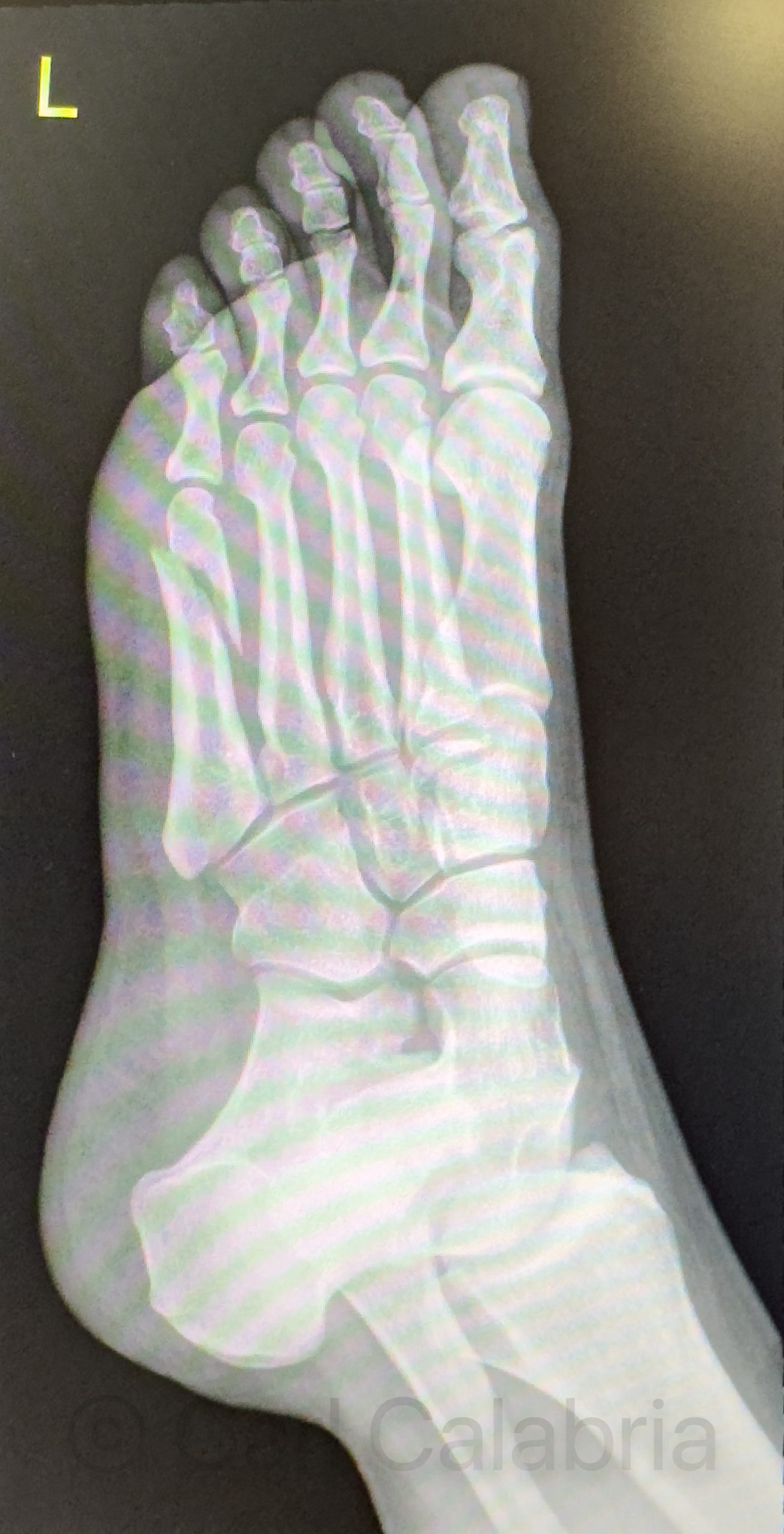
Shortly after we left the wedding reception last night, Maya broke the fifth metatarsal in her left foot while dancing. She was attempting a split leap when one of her feet got caught on her dress, causing her to land on the side of her foot with all her weight. She contacted us this morning to say that she was in a lot of pain and that she thought she might have broken a bone. Her siblings were quick to her aid while Jeanine and I drove over to their apartment from our hotel. Kyle scheduled an appointment at a local outpatient clinic to get her a referral for an x-ray. Nico found a medical supply house where we obtained a pair of forearm crutches. An x-ray at the hospital confirmed that she had a full fracture of her fifth metatarsal. The doctor said the bone will fully heal in 18 months. For now she will have to wear a boot for several months and avoid bearing her full weight on the foot. Regrettably, Maya was planning to spend the remainder of her vacation hiking in Norway with friends.
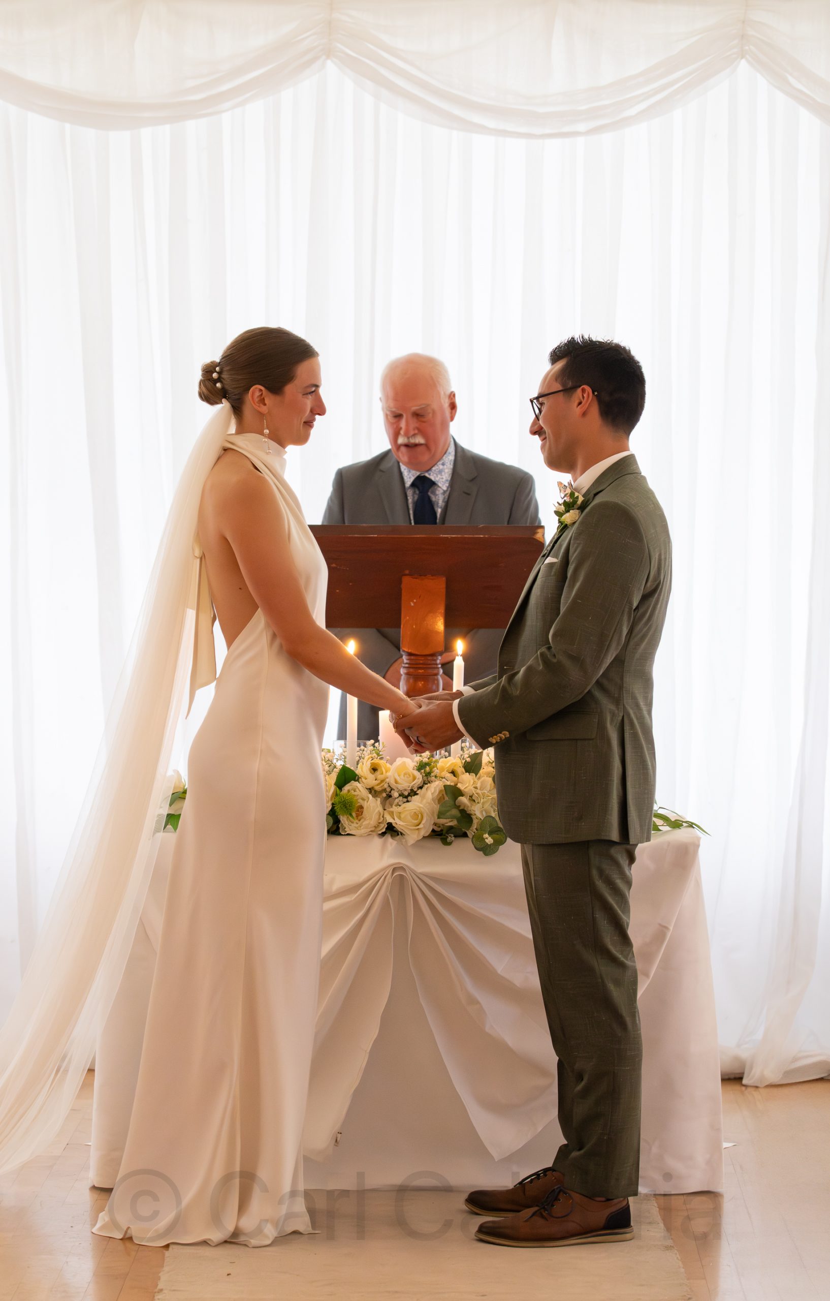
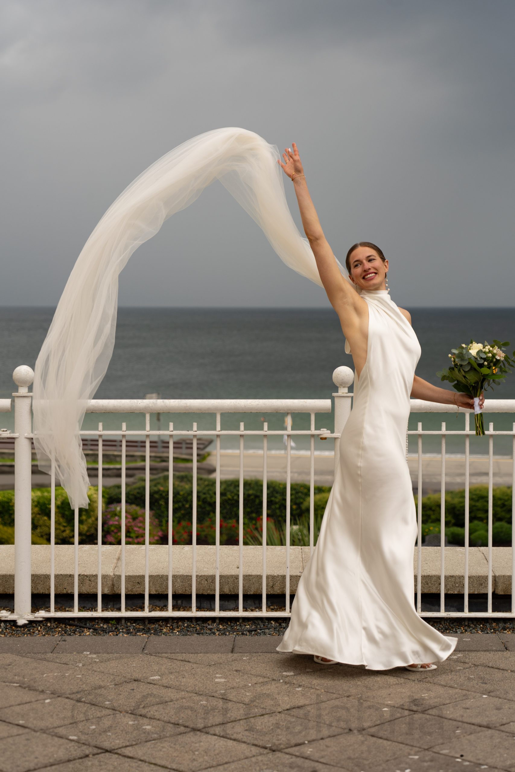
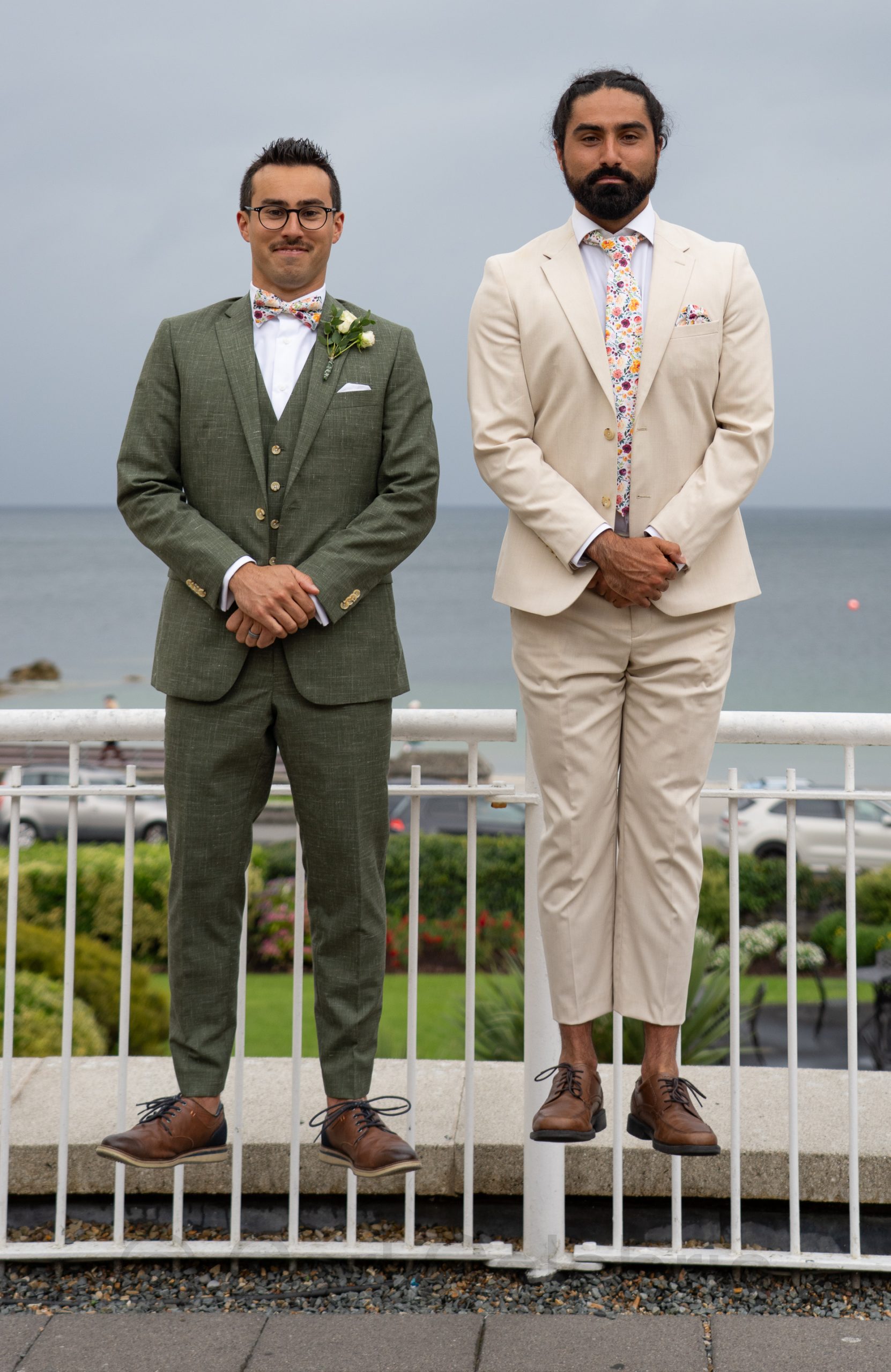
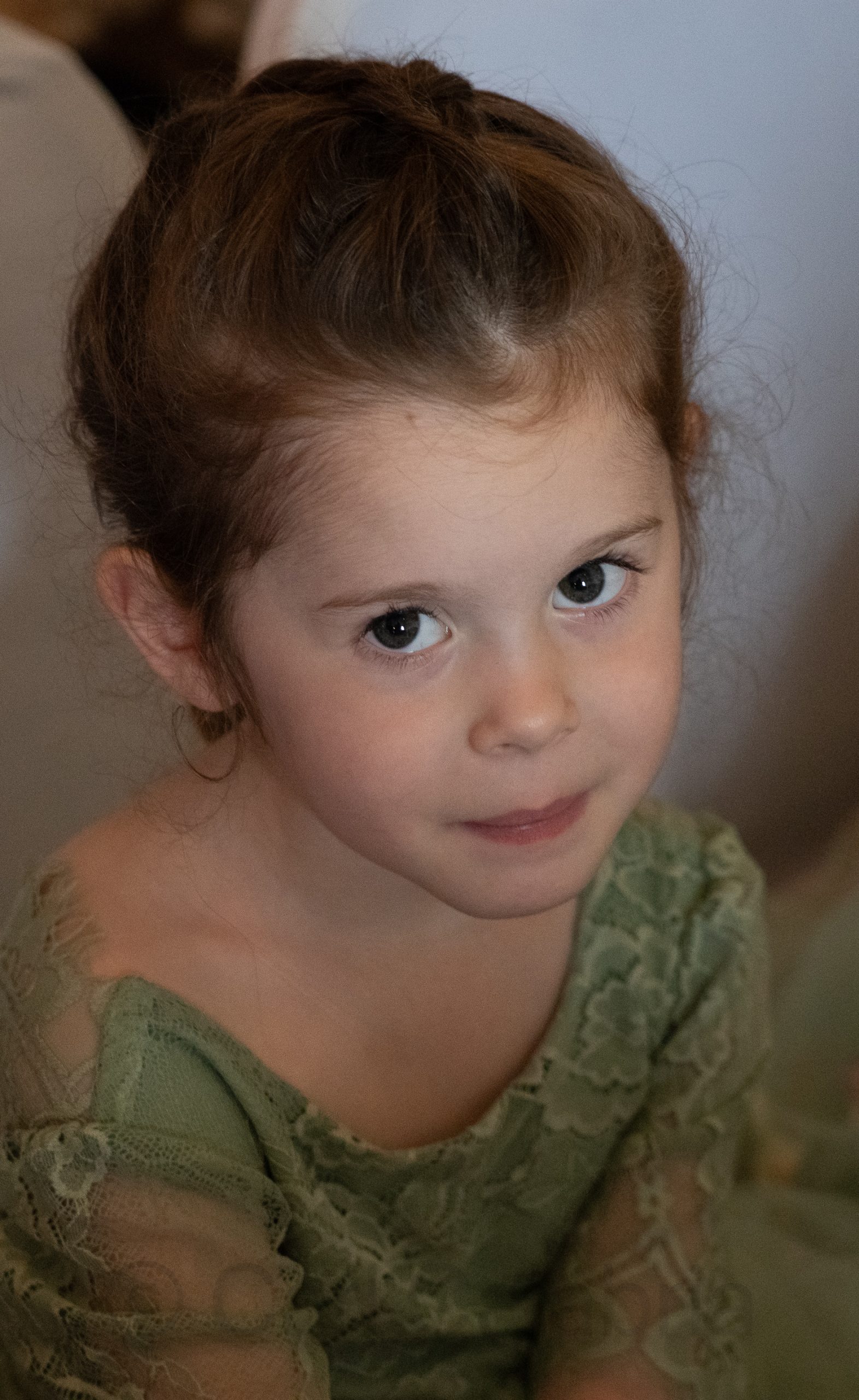
My nephew Mario and Brooke celebrated their marriage with family and friends this afternoon. Brooke’s father officiated the ceremony, and Mario’s brother, Rory, served as the Master of Ceremonies. The event was as playful as it was poignant, a perfect reflection of the couple. Our family was honored to share in the celebration. I took many photos but made sure not to interfere with the professional hired for the occasion. Knowing she would cover all the “standard” shots, I focused on the guests, especially the smaller ones, and some unique takes on the couple.
The full set of photos I have taken during the wedding weekend can be found here.
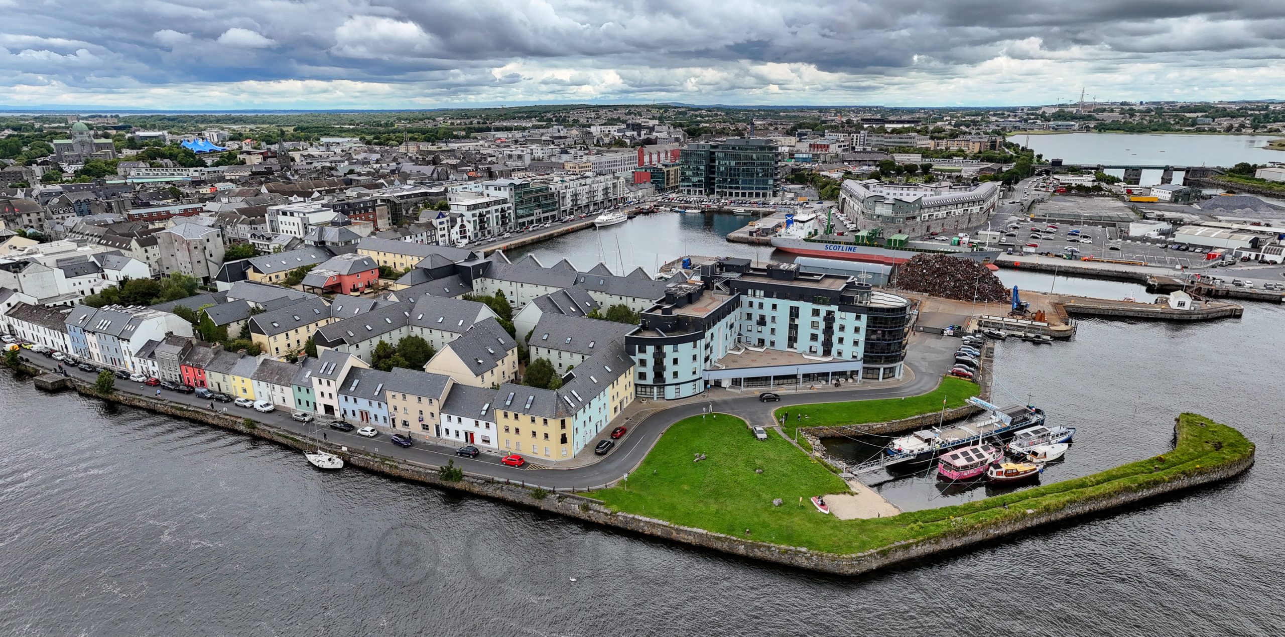
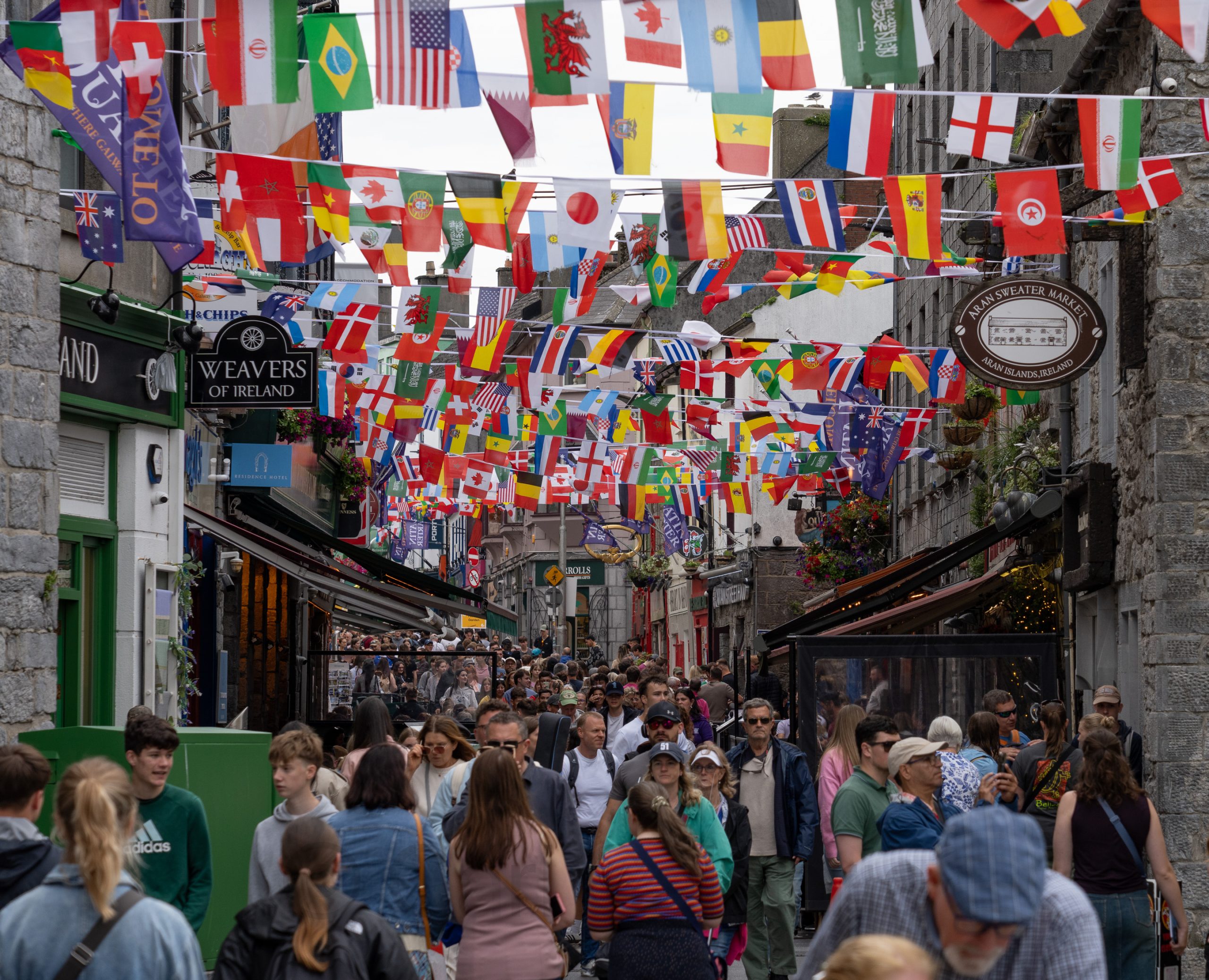
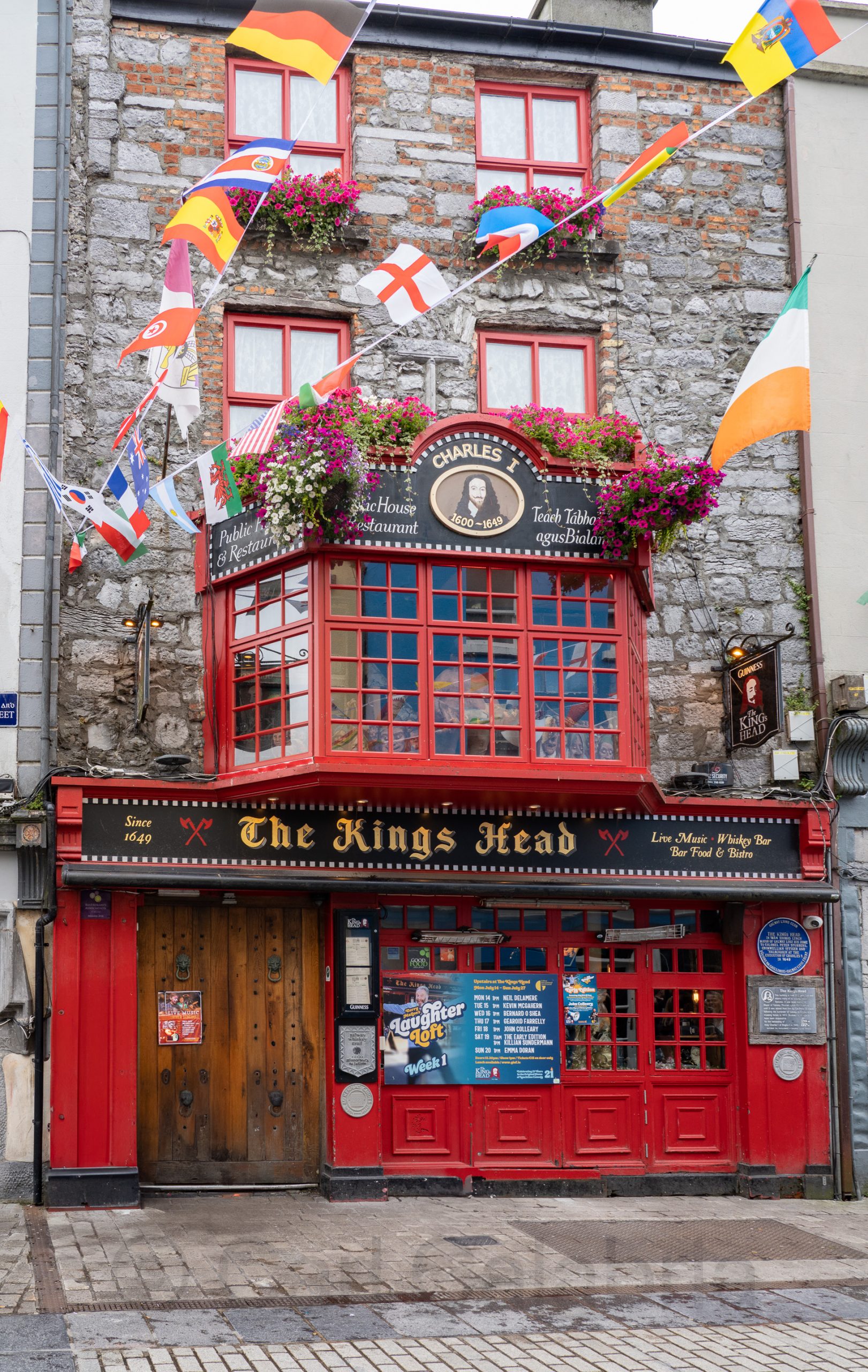
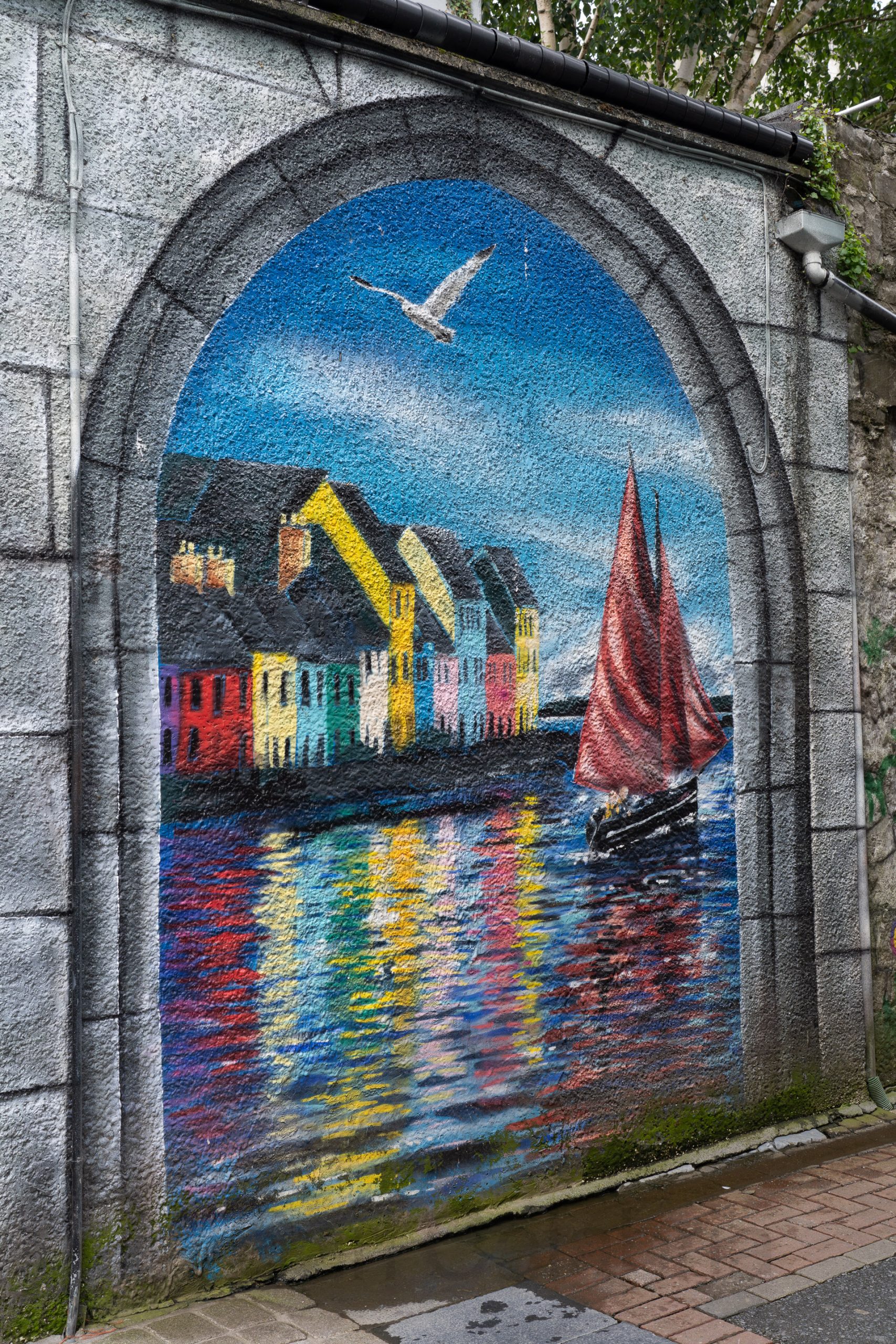
Galway is a vibrant, bohemian city on Ireland’s west coast, known for its lively arts scene, traditional music, and colorful, cobblestone streets along Galway Bay. The wedding was timed to coincide with the Galway Arts Festival which only served to amplify the cities bustling café and pub culture.
Jeanine enjoys catching up with Mario while Brooke greets her nieces.
Mario’s brother, Rory, is seen behind bars with one of his friends. Some might argue that this is a good way to protect Rory from the throngs of women who tend to follow him around.
Meanwhile, the kids have coerced me into the ridiculous pose below, designed to make fun of my sun hat; brim tipped up, ears tucked in.
I have started a wedding album for Mario and Brooke. It can be found here.
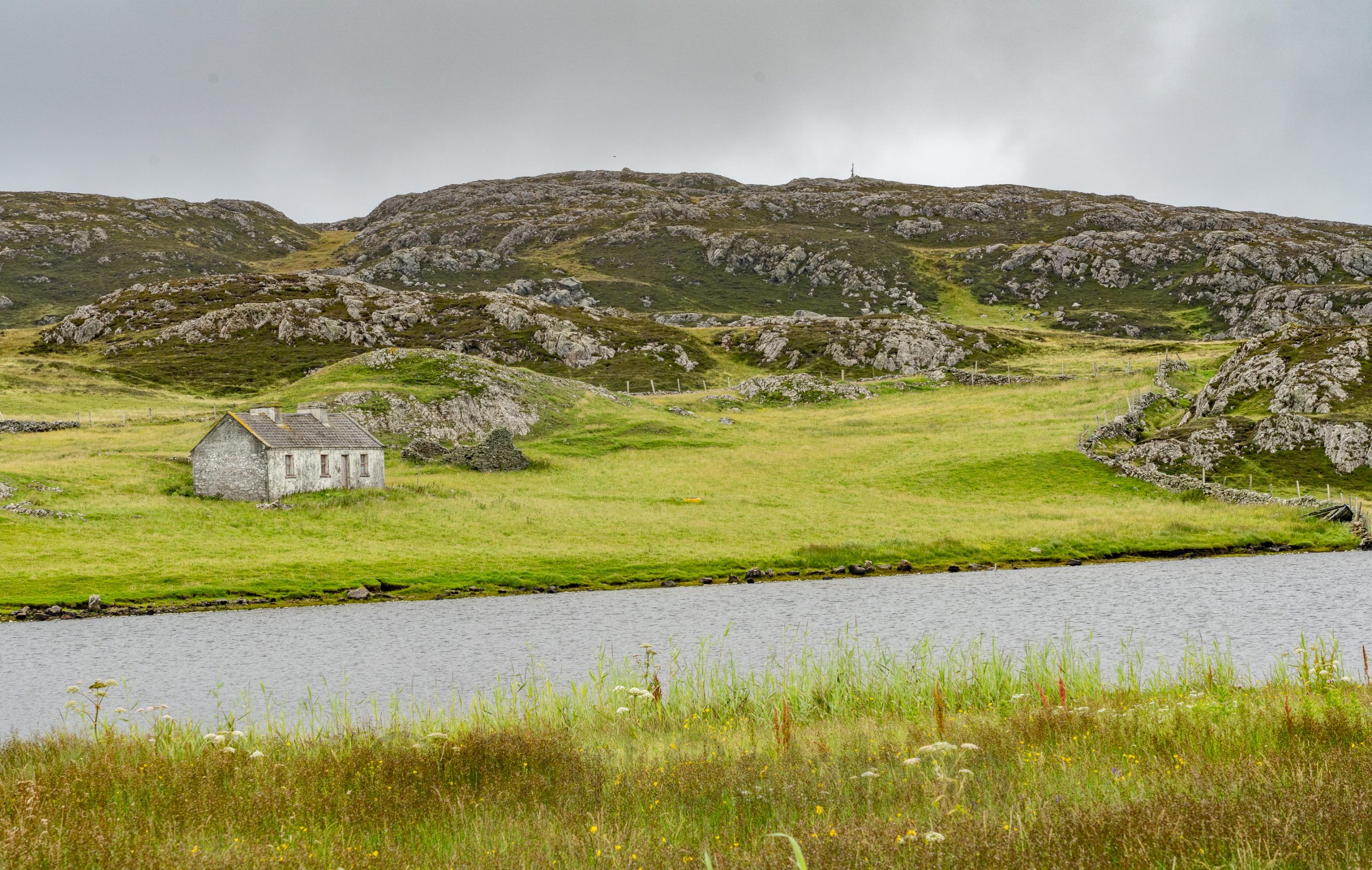
The reason for our visit to Ireland is to attend the wedding celebration of my nephew, Mario, to Brooke. Most of the guests have now arrived in Galway and will be touring the Aran Island of Inishmore today. Having previously visited there and also in need of some me time, I opted to drive up the Connemara coastline and take the ferry to Inishbofin, an even more remote island off the western coast.
If not for my 11:30 ferry time, I would have spent the entire day in Connemara where there seemed to be something worth photographing at every turn, and there were a lot of turns.
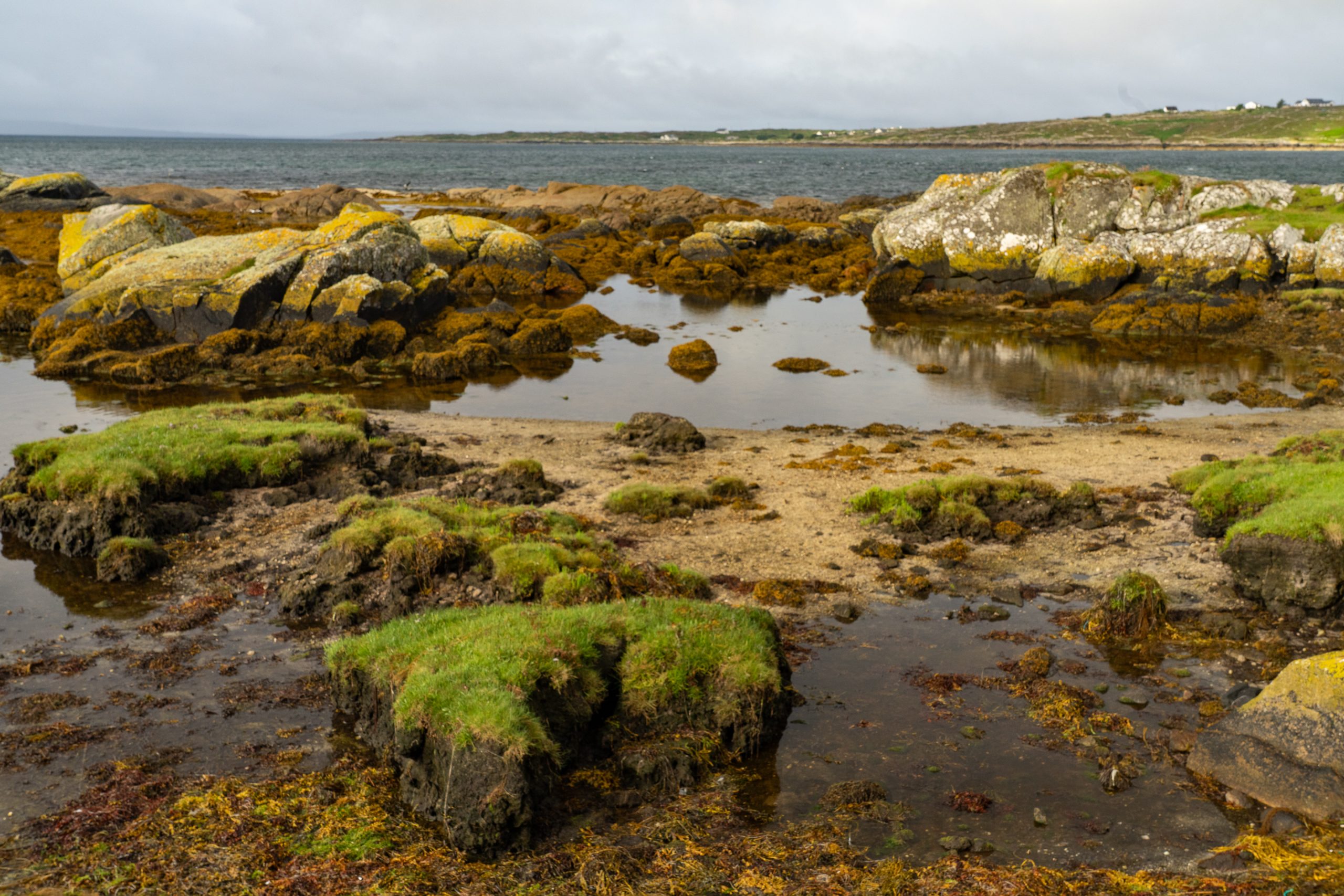
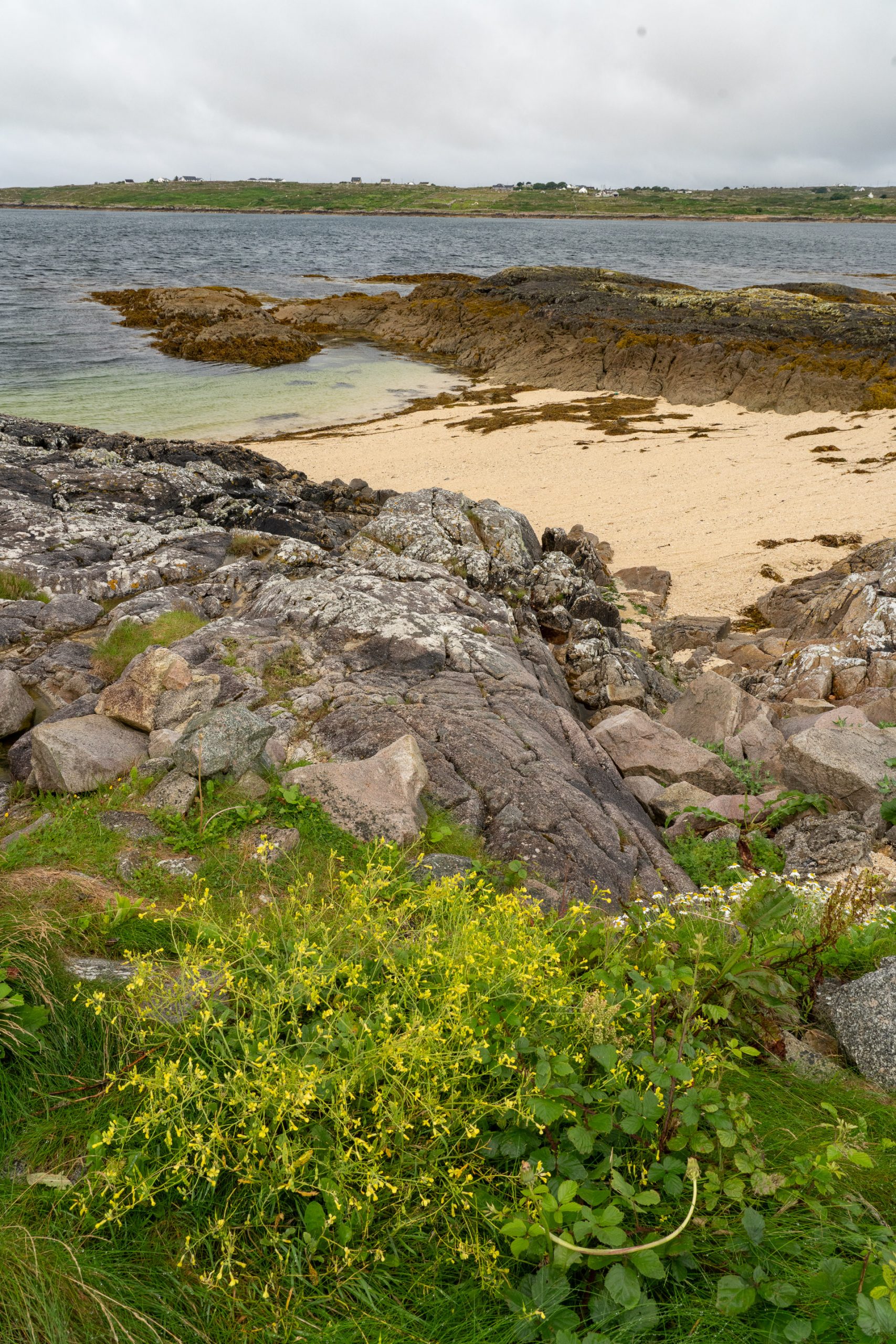
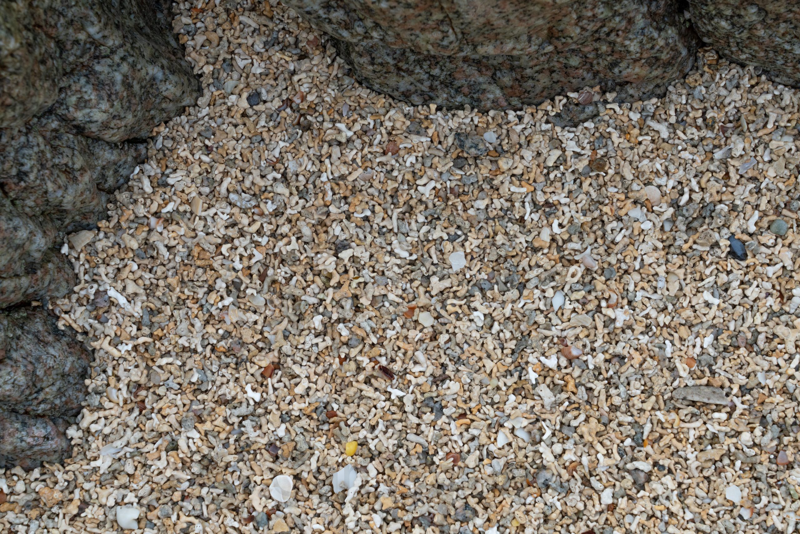
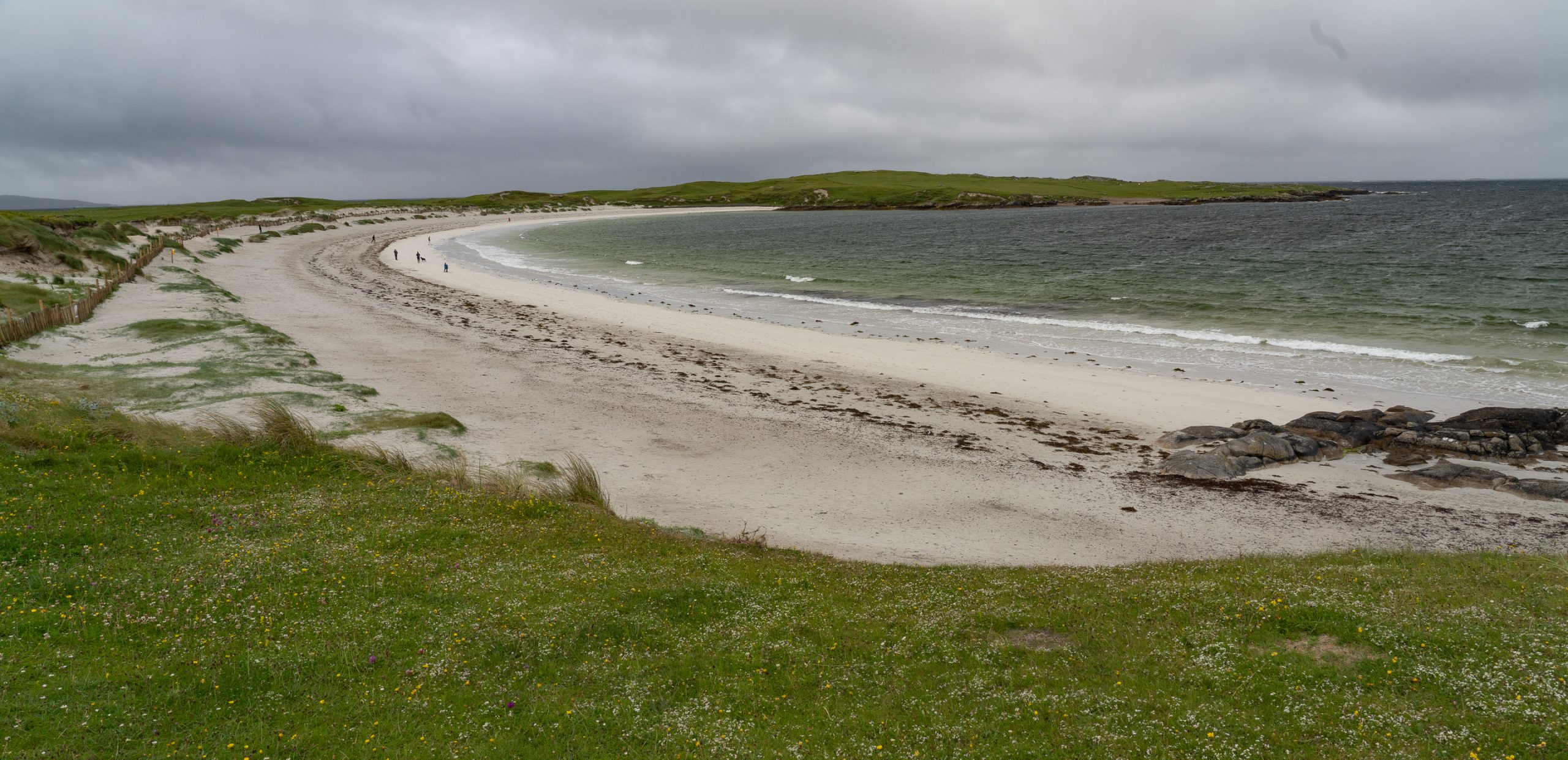
My first real stop was at the Coral Strand, known for its crystal-clear waters and unique sand composed of crushed coraline algae, giving it a distinctive coral-like appearance despite not being true coral. Click on the second photo below for a close-up of the “sand.”
After pausing for breakfast in Roundstone, it was on to Dog’s Bay, a beautiful horseshoe-shaped beach. I had hoped to get an aerial photo similar to the one below (not taken by me), but had to settle for a quick shot from the ground as I was running seriously behind schedule.
I will spare the details of my harrowing drive to catch the ferry to Inishbofin. Suffice it to say that I was the last passenger to board, and the gangway was stowed 30 seconds after I crossed it. For my own future benefit, the Cleggan Ferry does not depart from the Cleggan Cliffs, and it is best not to leave your phone in the car when your ferry tickets are stored on it.
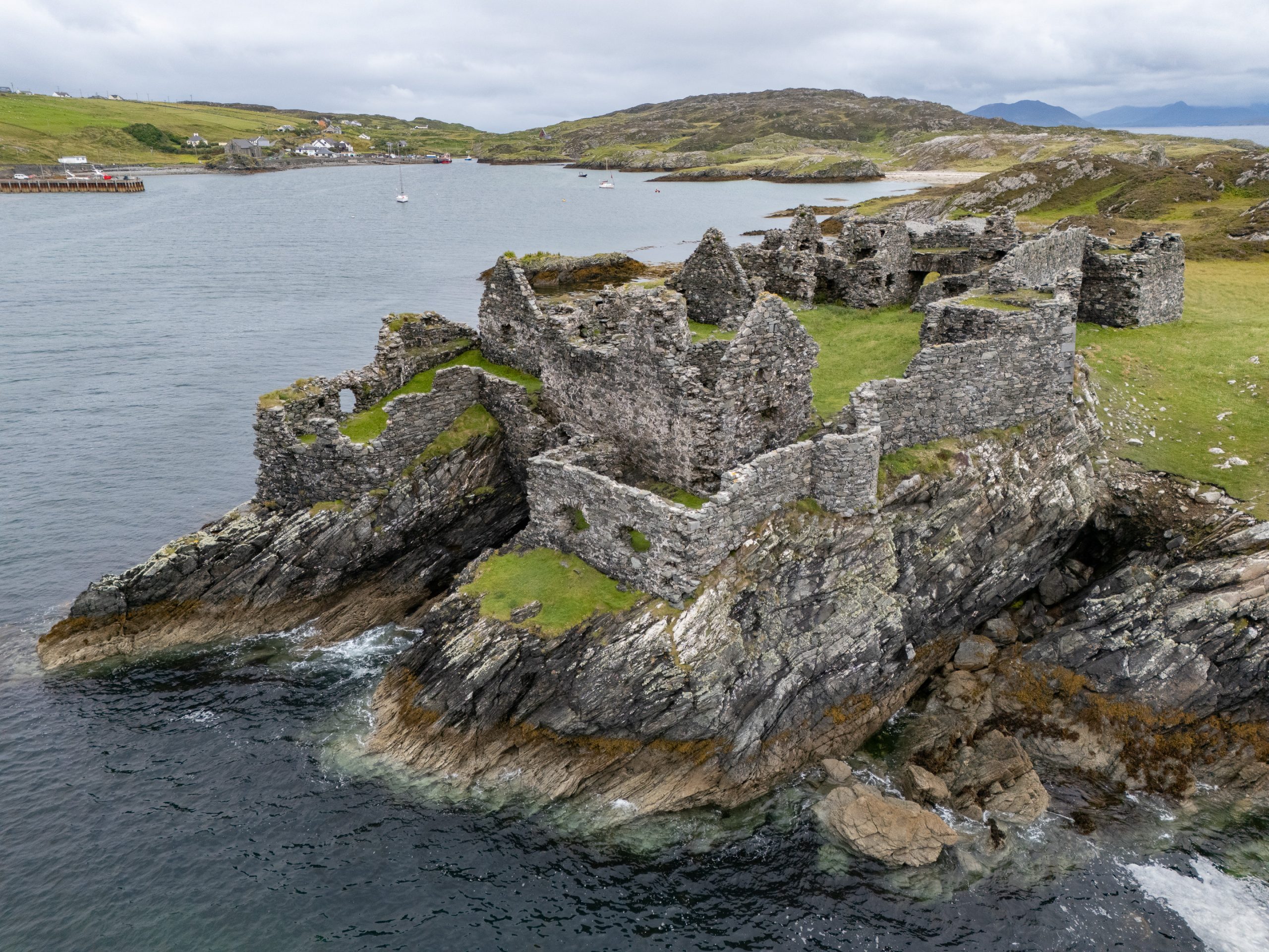
During the Cromwellian conquest of Ireland in the mid-17th century, Inishbofin was the last stronghold of Irish royalist forces. In 1652, it was captured by Cromwell’s troops, who decided to build a new, more formidable fortification to control the harbour and suppress opposition. The result was the star-shaped stone fort—now locally called Cromwell’s Barracks—which still dominates the tidal island today.
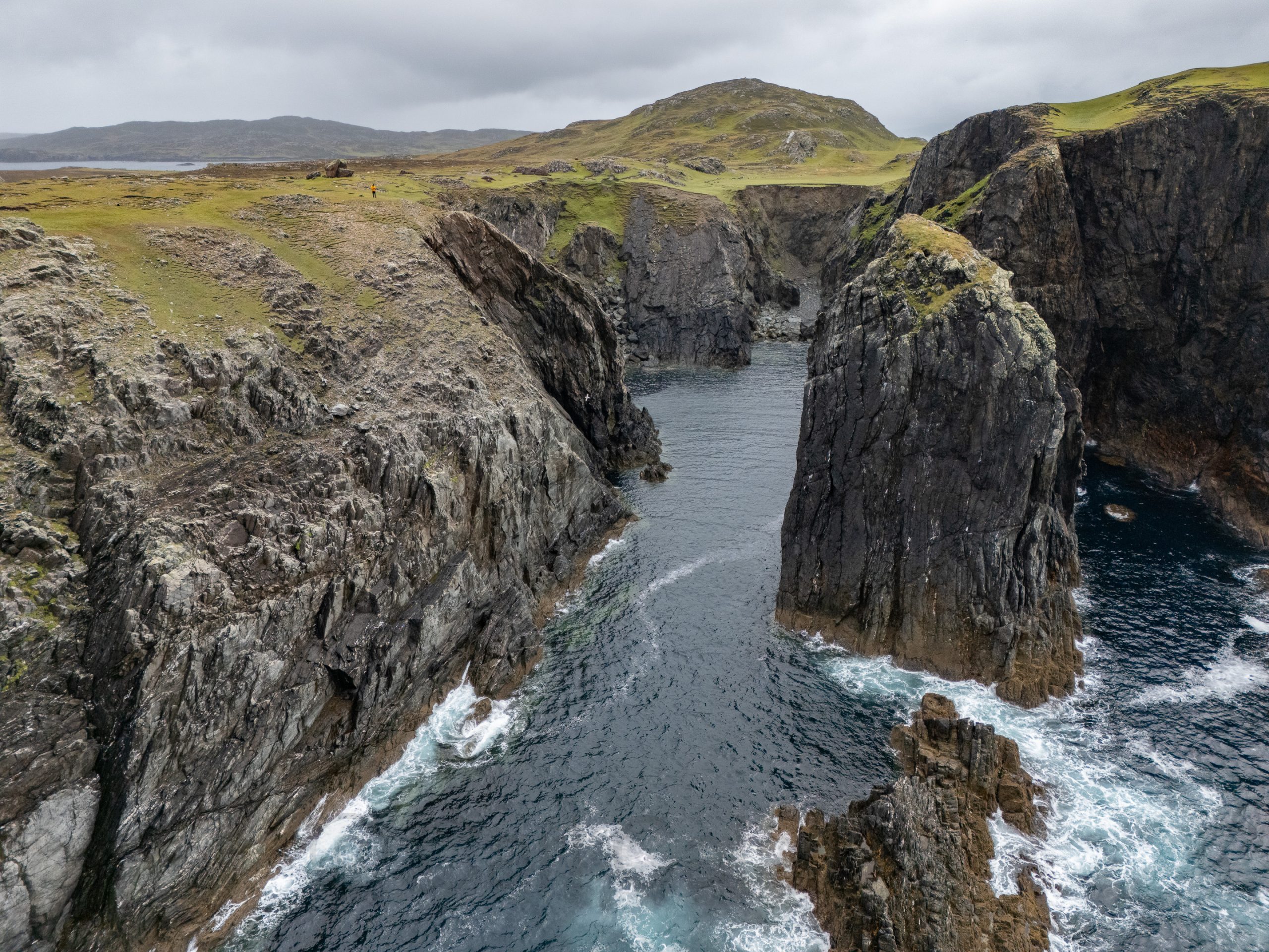
Once on the island, I decided to hike the 5-mile West Quarter Loop. Determined not to miss the last ferry back to the mainland, I set off during torrential rain, hoping it would abate as is often the case in Ireland. Mercifully, the rain stopped an hour into my hike just as the most interesting views appeared. Click on the aerial photo below and see if you can find Waldo. I saw more people in the bathroom at the Cliffs of Moher visitor center than I did on my entire hike on Inishbofin.
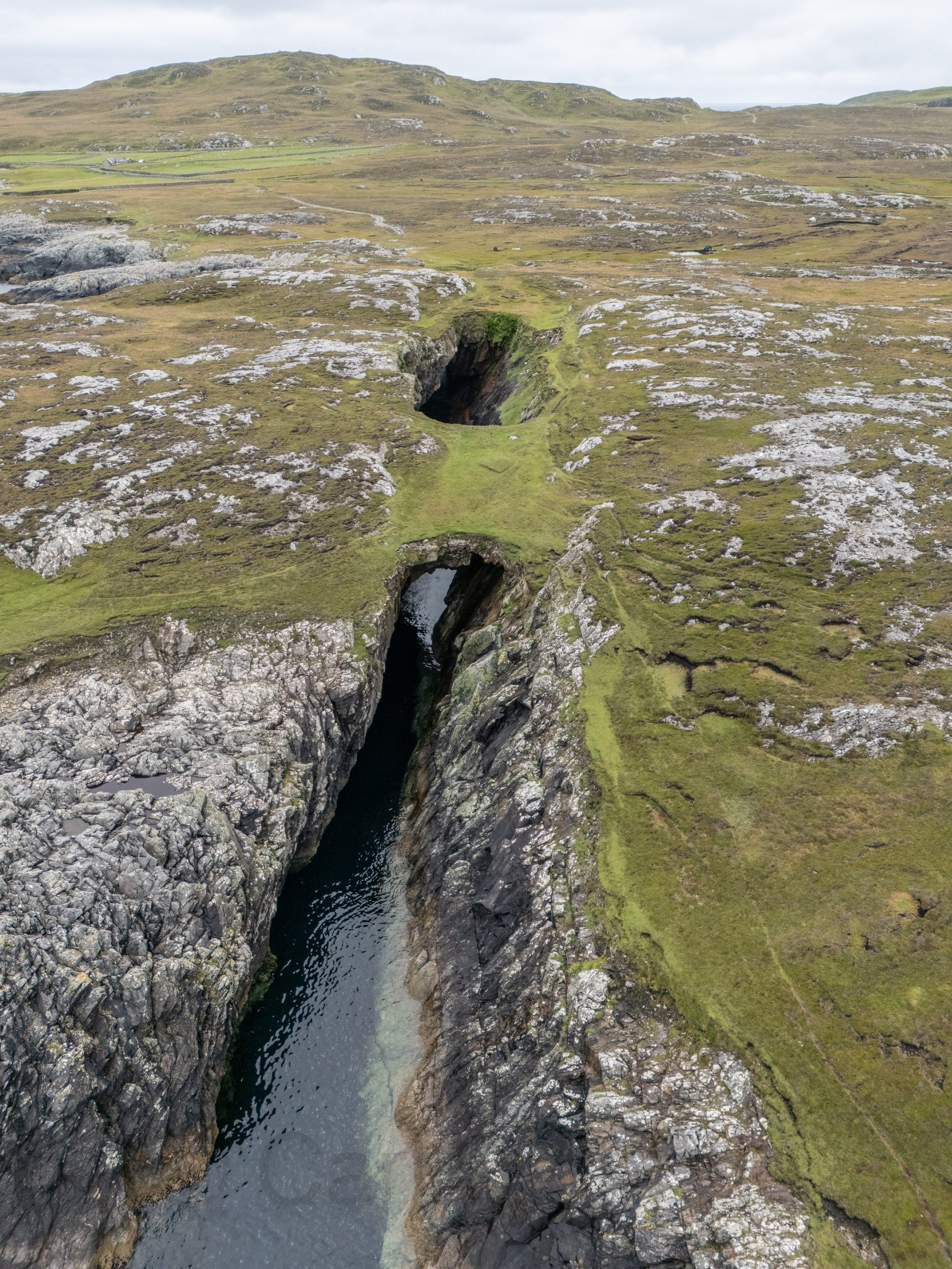
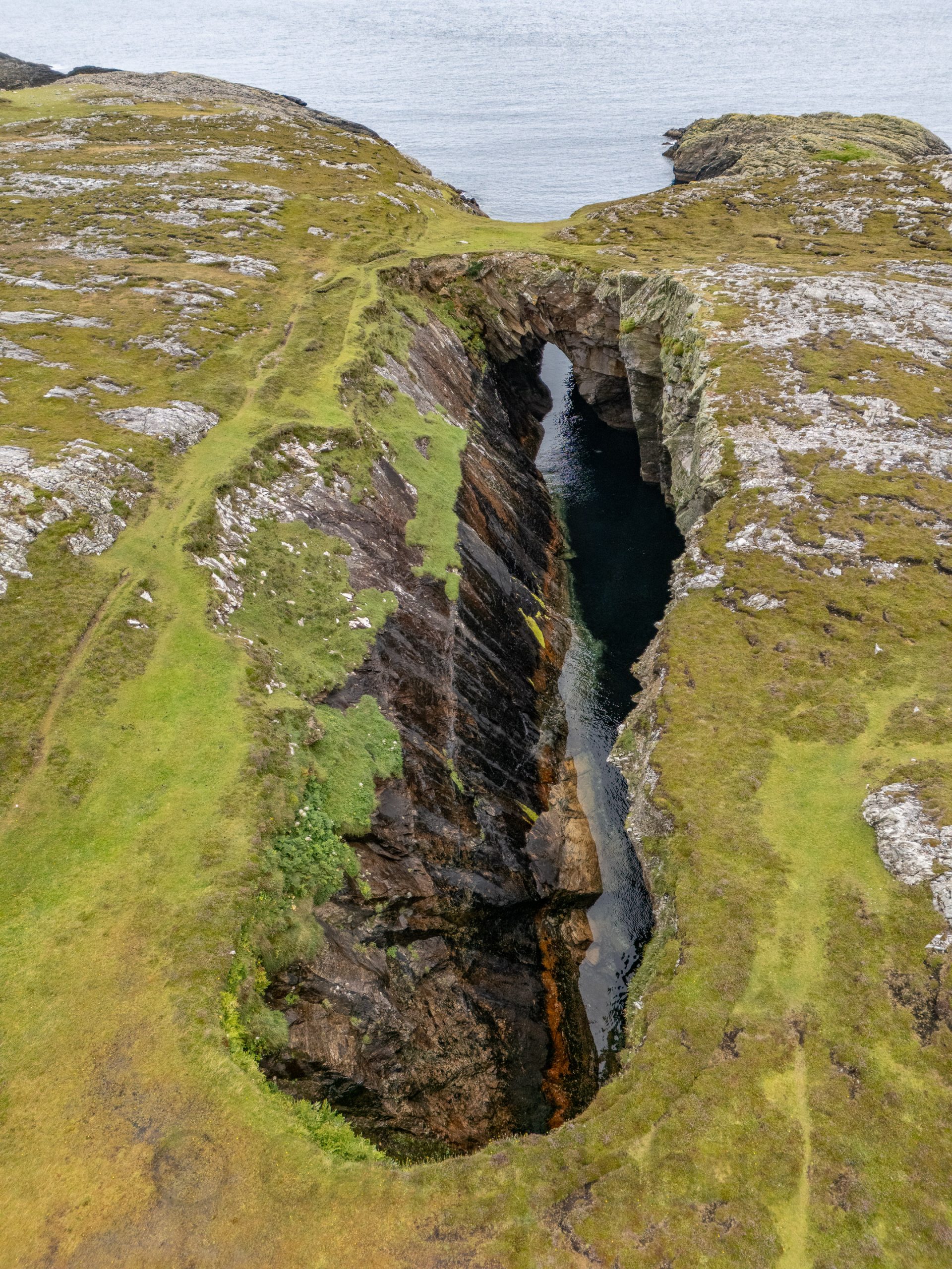
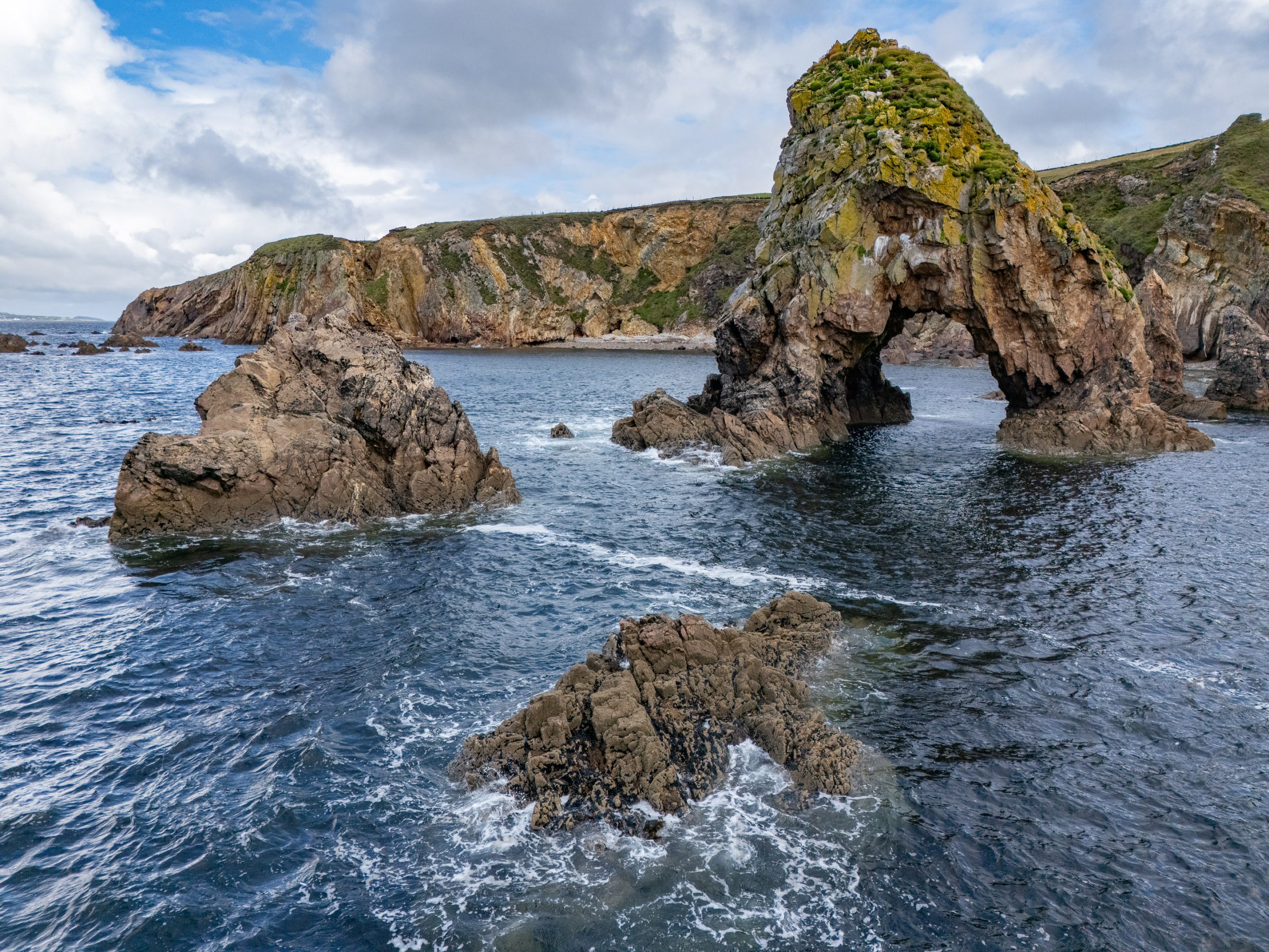
The blow hole on Inishbofin was formed when sea caves eroded landwards and upwards into vertical shafts that opened at the surface, allowing seawater to shoot dramatically into the air during certain tidal conditions. I knew the chances of catching the blow hole in action were minimal and was happy to capture the unique geological formation in a progressive series of drone photos, the last of which is a reverse angle.
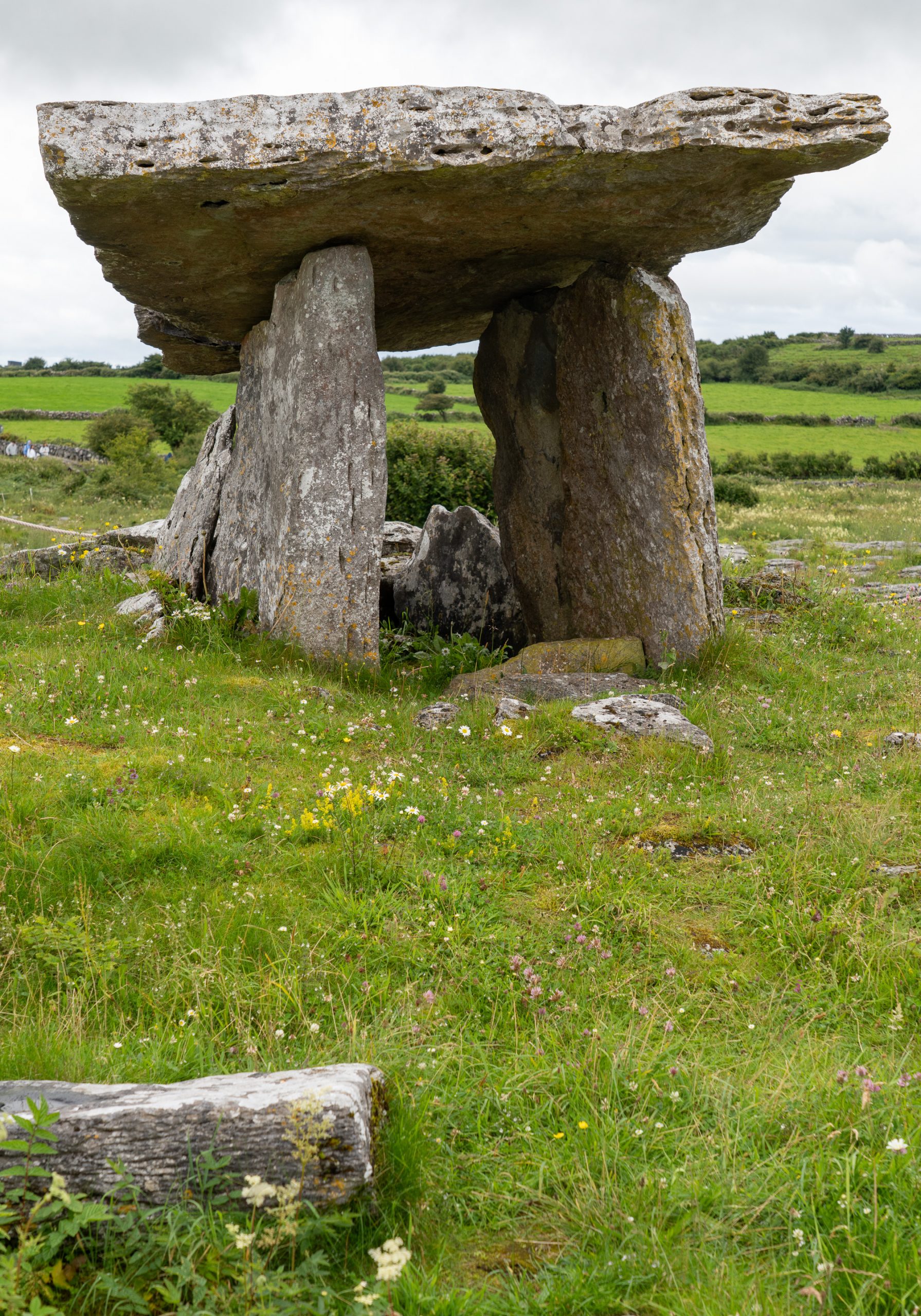
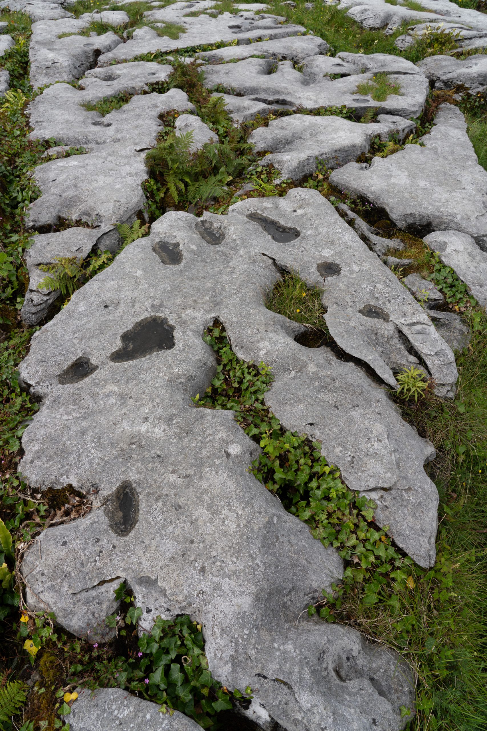
Situated on the high Burren limestone plateau, Poulnabrone Dolmen is one of the country’s most iconic archaeological monuments and the oldest dated megalithic monument in Ireland. It is classified as a portal tomb, featuring two large portal stones standing on either side of an entrance, capped with a massive sloping capstone. Excavations by archaeologists revealed the remains of 33 people at the site and radiocarbon dating of their bones indicates that the tomb was in continual use for a period of 600 years between 5,200 and 5,800 years ago.
Glacio-karst landscape features, which are the combined result of glacial activity and rainwater dissolution features, are abundant around Poulnabrone Dolmen. The limestone pavement has been scraped clean by moving ice sheets and the blocks of limestone known as clints are separated by fissures known as grikes. The grikes are formed by rainwater dissolving thin calcite veins that permeate the limestone. While the last ice sheets melted here almost 16,000 years ago and the karst process has been active since then, there is evidence that karst processes were operating in warmer interglacial periods before the last ice age.
After visiting the Burren National Park Visitors Center, we drove to the seldom-visited Cahercommaun situated on the edge of a valley. Cathair is the Irish for ‘stone fort’, and this fort contains 3 walls ranging in height from approximately 5-1/2 to 13 feet. It is not certain when Cahercommaun was built, but an excavation in 1934 suggests that it dates back to the early 9th century. However, this date is highly contested, as a number of artifacts that were found within the site pre-date this.
Earlier in the day, we visited the Cahermore ringfort, featuring massive drystone walls up to 9 feet high and thick, with well-fitted limestone blocks and an impressive entrance featuring a complex gateway that could be used to trap would-be invaders.
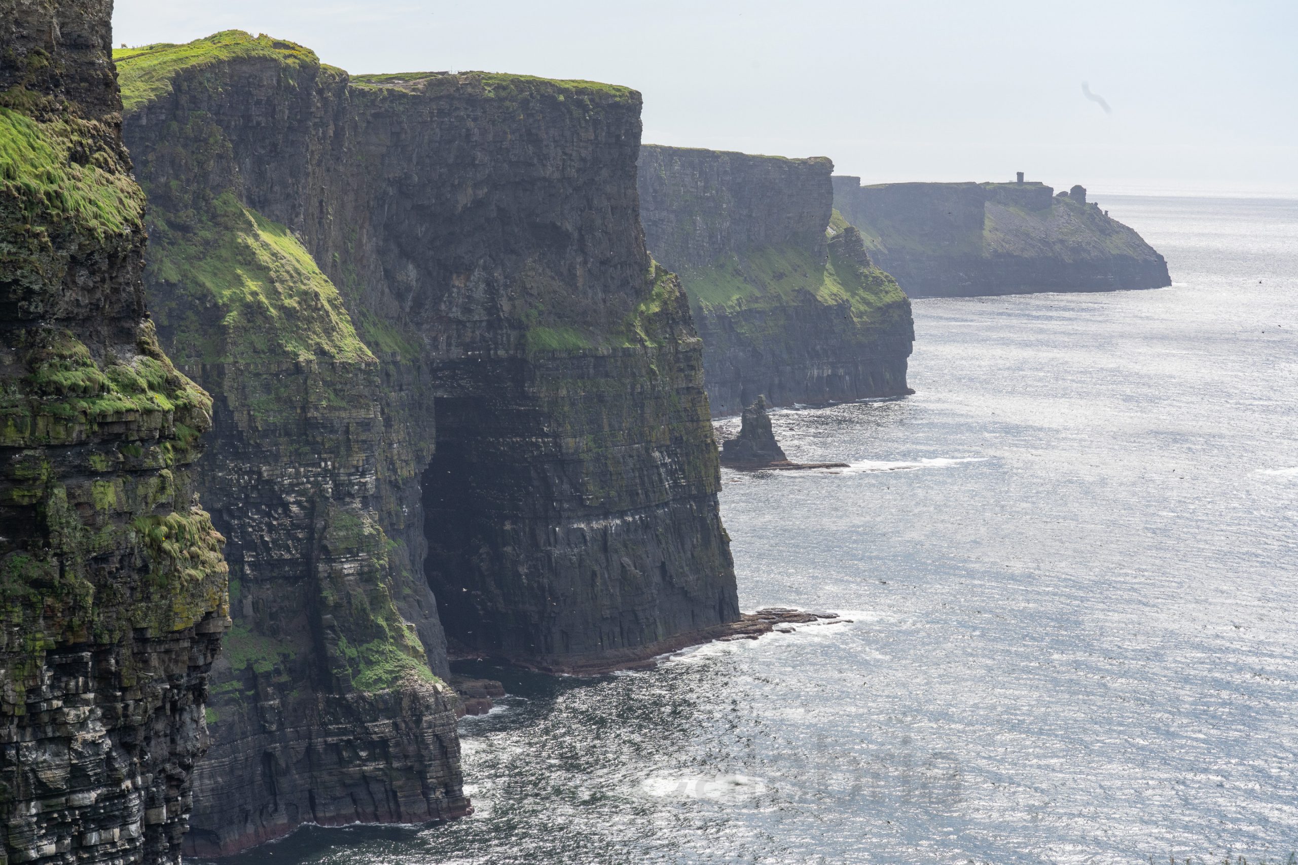
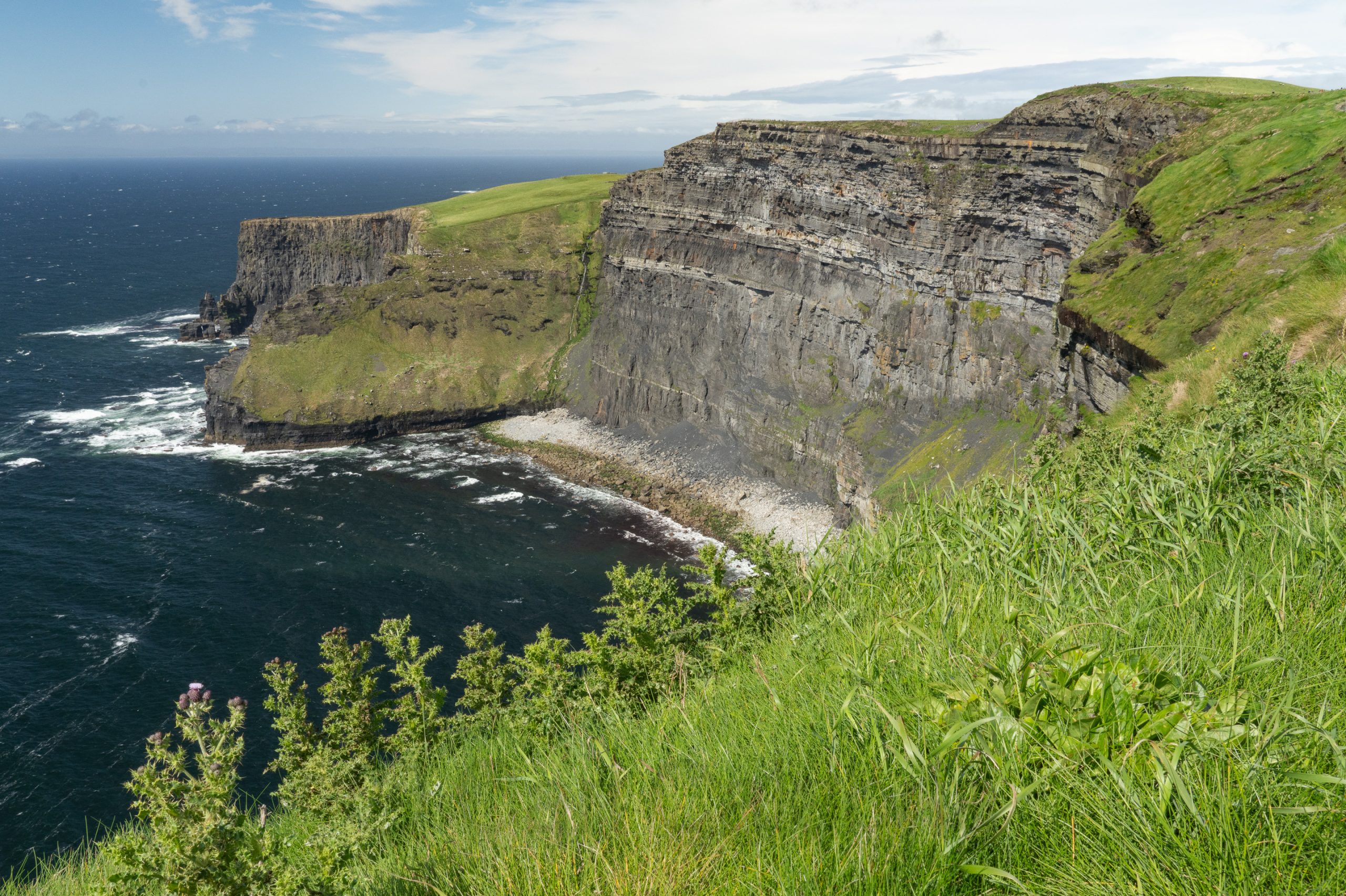
Our final destination for the day were the Cliffs of Moher, which proved to be somewhat of a disappointment for me. Since our last visit, 34 years ago, the site has been dramatically developed to include a $32M visitor center and flagstone barriers installed to physically discourage and prevent visitors from getting closer to the edge. It felt like the difference between seeing a declawed tiger in a zoo compared to one roaming in the wild. The sun angle did not favor the traditional view of the cliffs so I focused my photographic attention on a less dramatic but better illuminated section of the coastline.
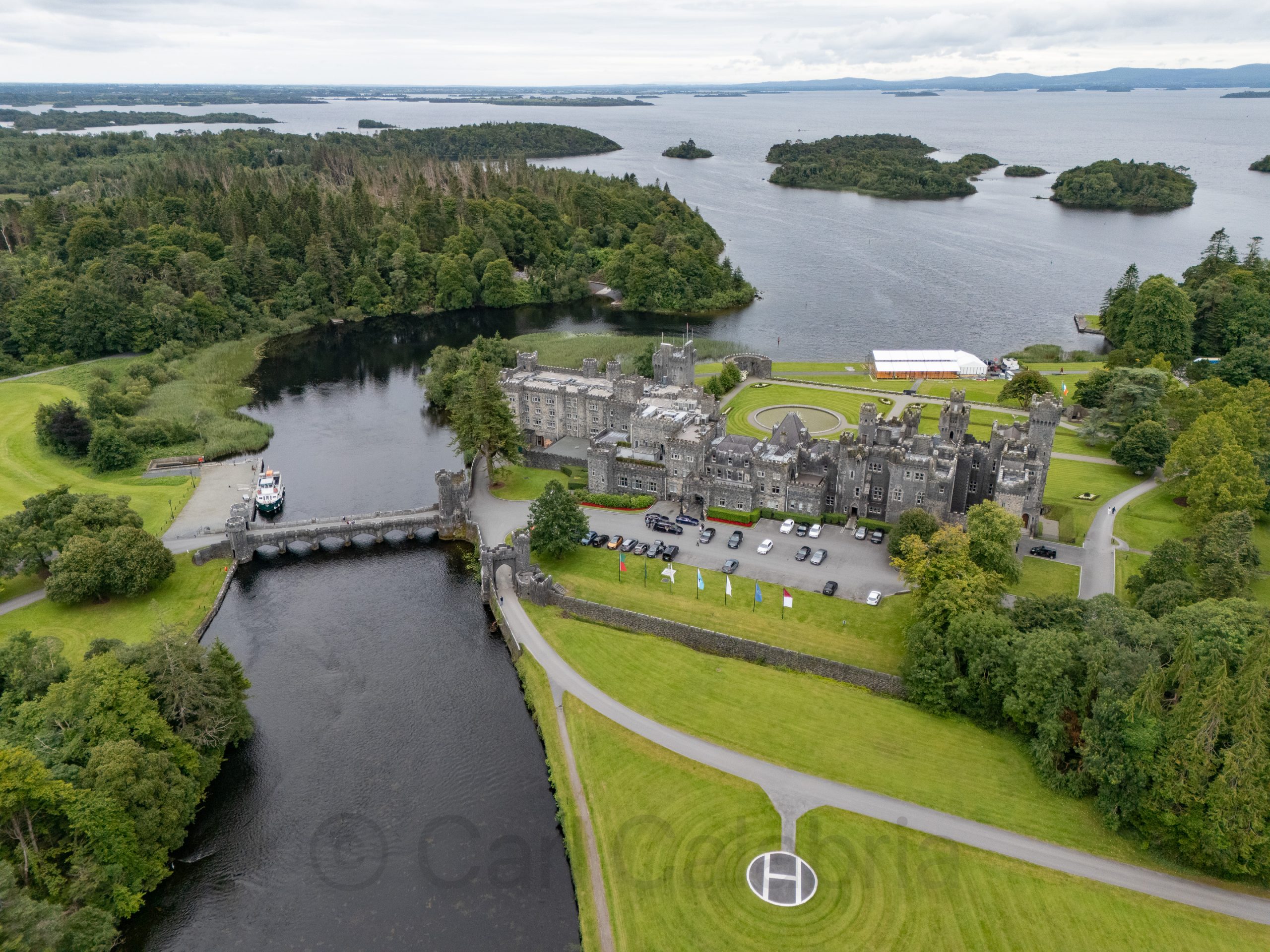
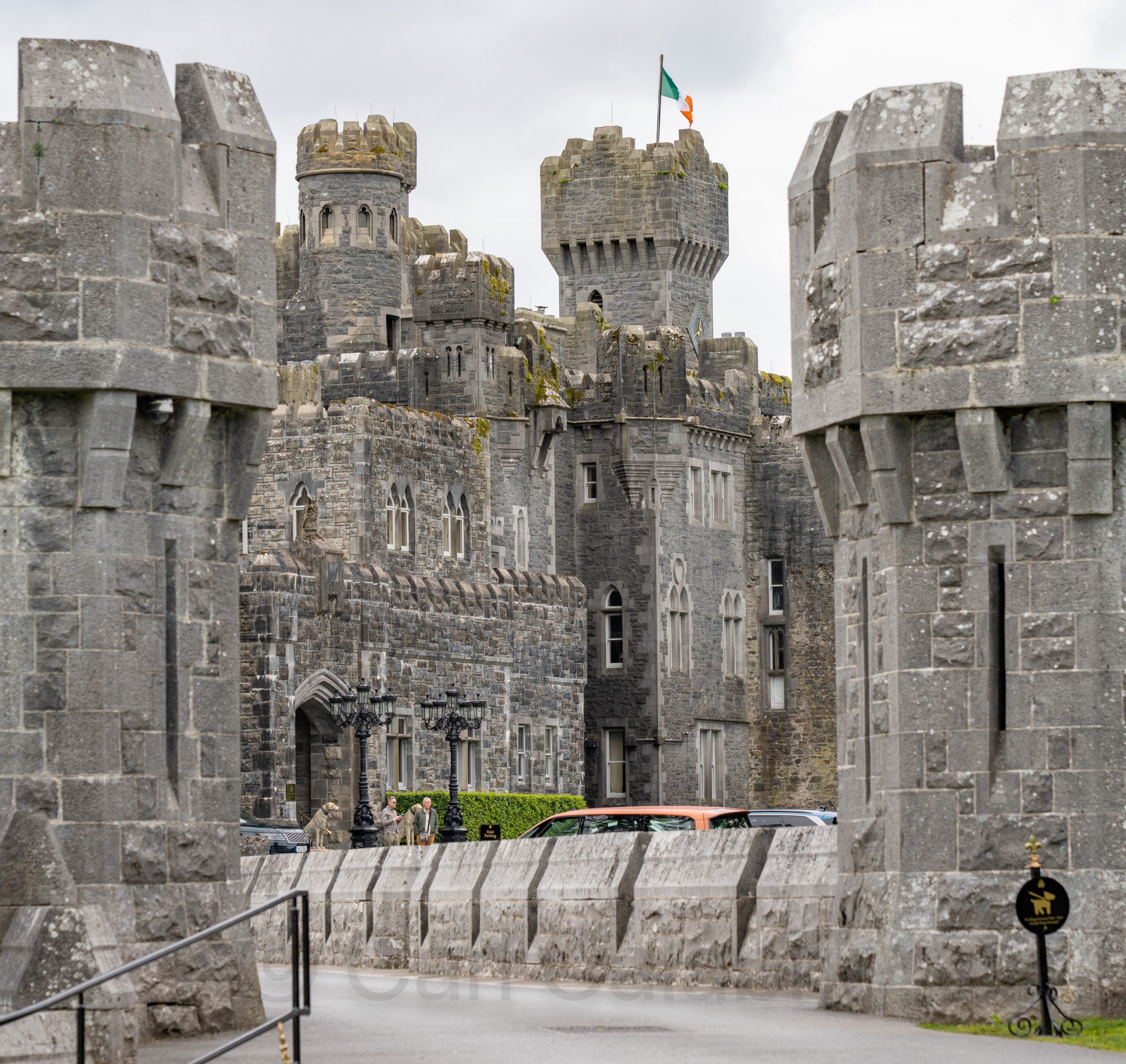
Ashford Castle is a historic 13th-century fortress in the quaint town of Cong. It has been transformed into one of Europe’s most prestigious and luxurious five-star hotels, renowned for its grand architecture, lavish interiors, and storied heritage. The castle has hosted royalty and celebrities over the centuries and sits amid a spectacular 350-acre estate by Lough Corrib. It was our first destination for the morning as we made our way south to Galway.
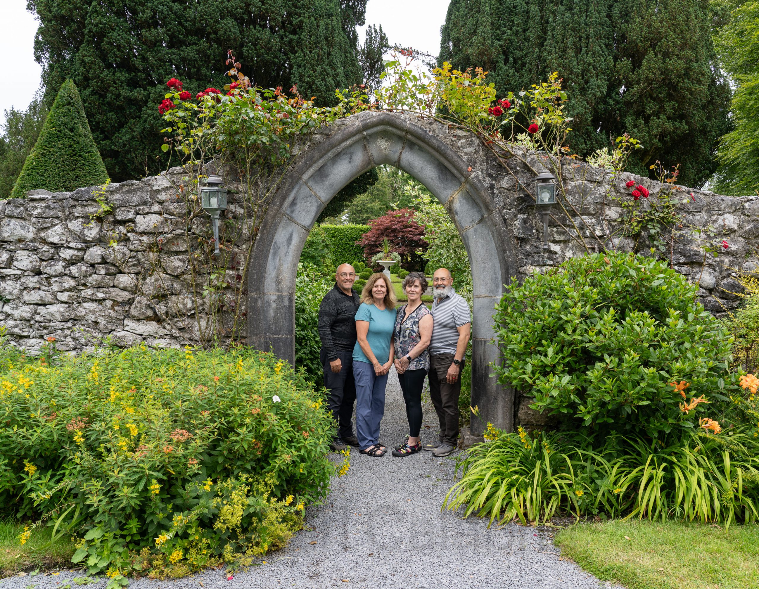
Somewhat more diminutive but every bit as elegant, Ross Castle was our next stop. Thirty-four years ago, Mark and Marie posed in this very arch for their wedding photos. It was the first time they had returned since, and it was fun to watch them relive cherished memories.
The Old Church of Dunlewey, built in 1853 from white marble and blue quartzite at the foot of Mount Errigal in County Donegal, is a striking and now roofless Gothic-style landmark erected as a memorial by Jane Russell for her husband James, overlooking Dunlewey Lough and renowned for its haunting beauty and rich history. It was our first stop on the way to the dramatic Crohy Head Sea Arch.
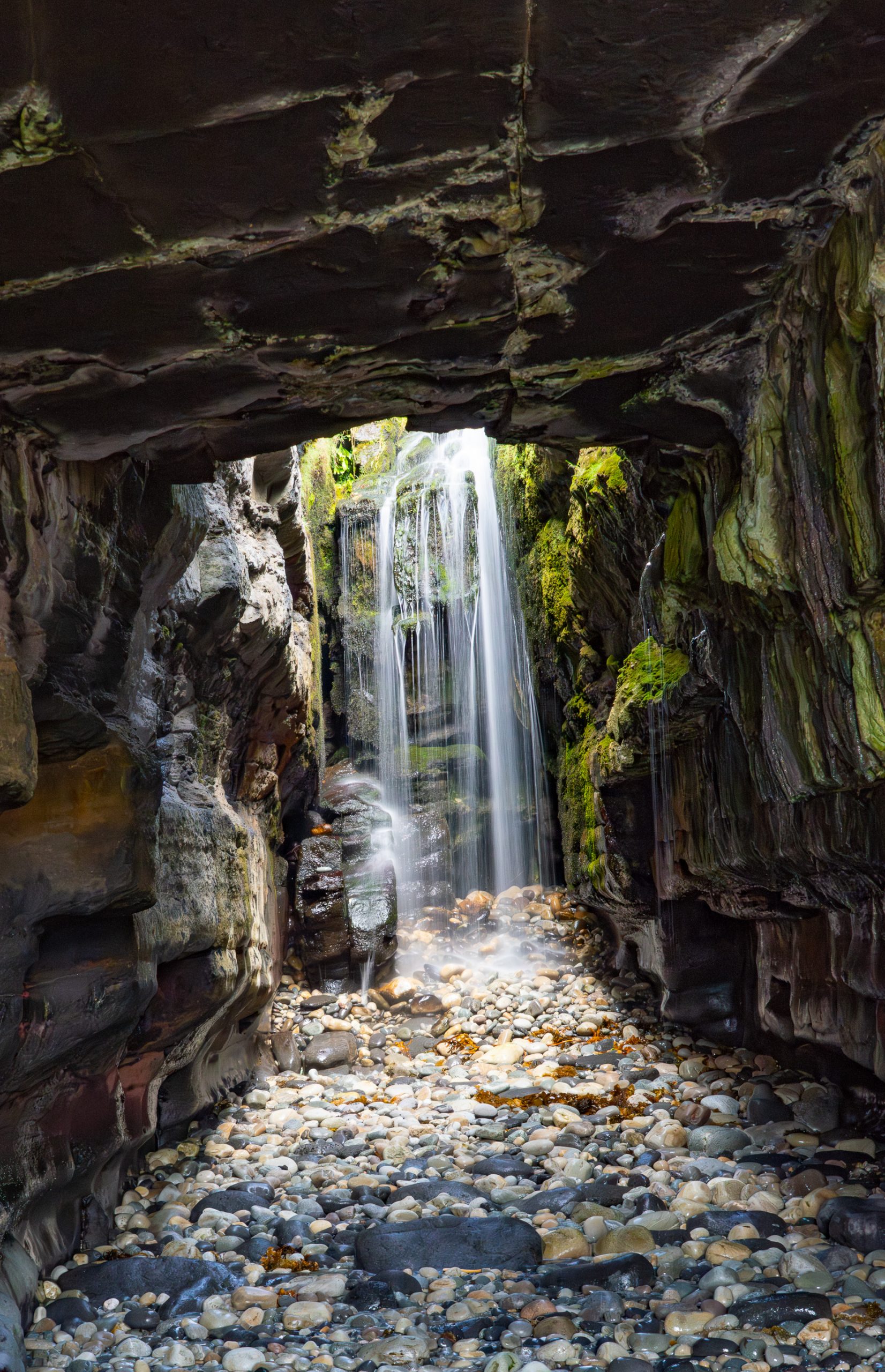
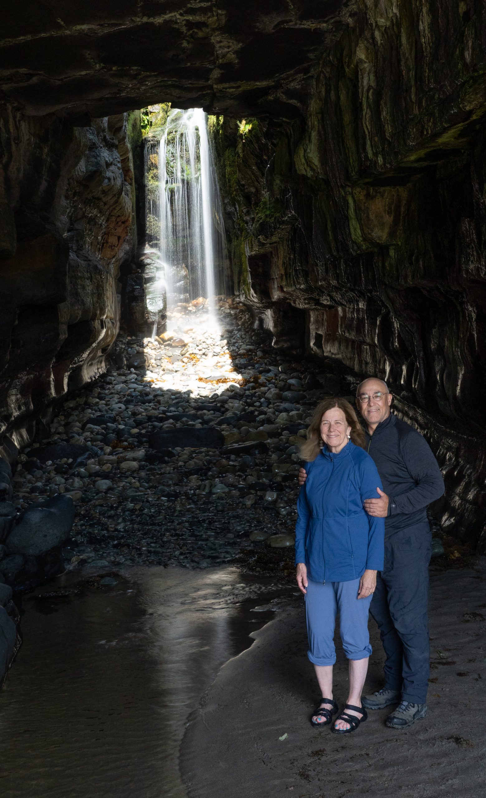
A secret waterfall in a blowhole viewed through a sea cave only accessible at low tide. It doesn’t get better than this.
Killybegs is a town on the south coast of County Donegal, renowned as the largest fishing port in the country and serving as a lively maritime hub with a rich history and vibrant local culture. We stopped here for a little snack.
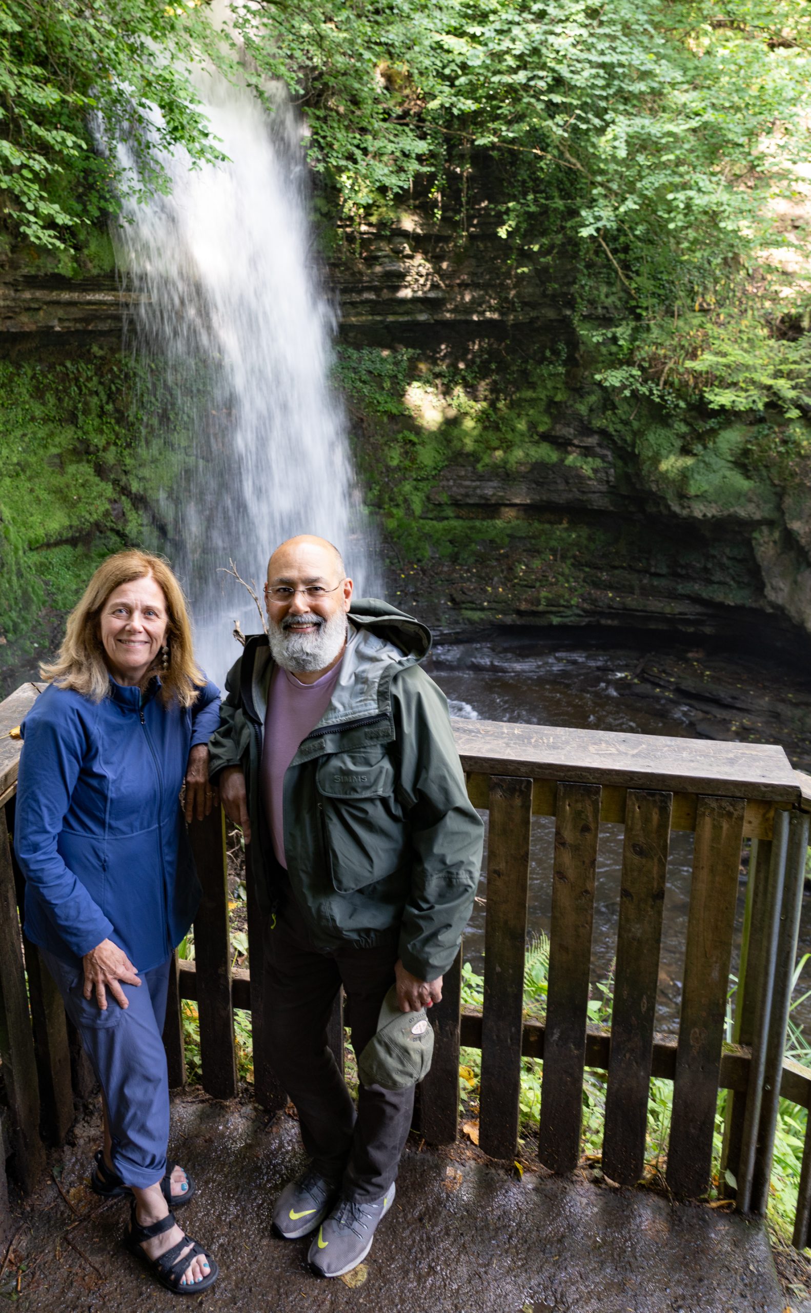
Jeanine found this delightful waterfall along our drive where we paused while Marie took a work phone call.
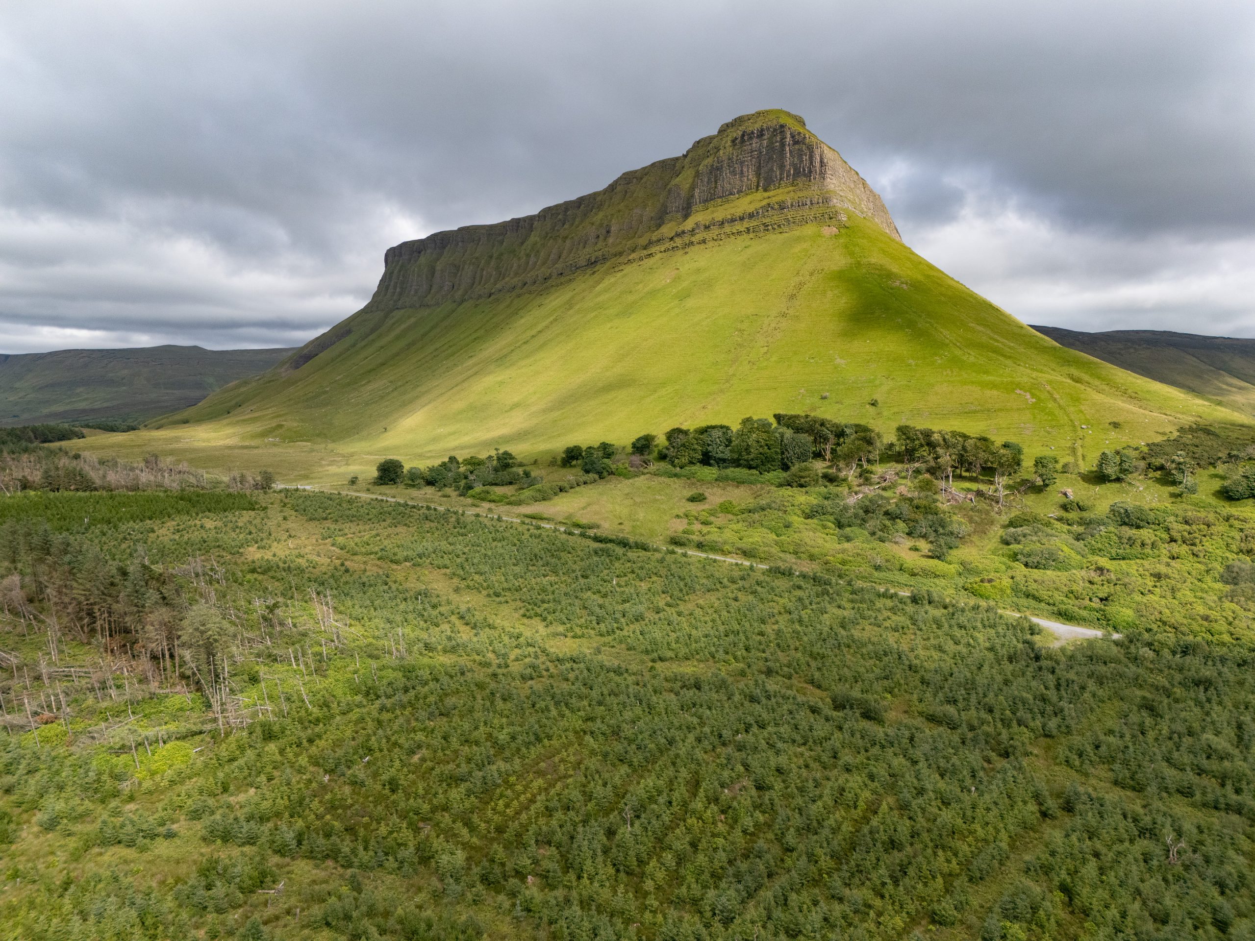
Benbulbin is a dramatic, flat-topped limestone mountain rising 1725 feet, formed by glaciers during the Ice Age and renowned for its unique shape and significance in Irish geology and mythology.
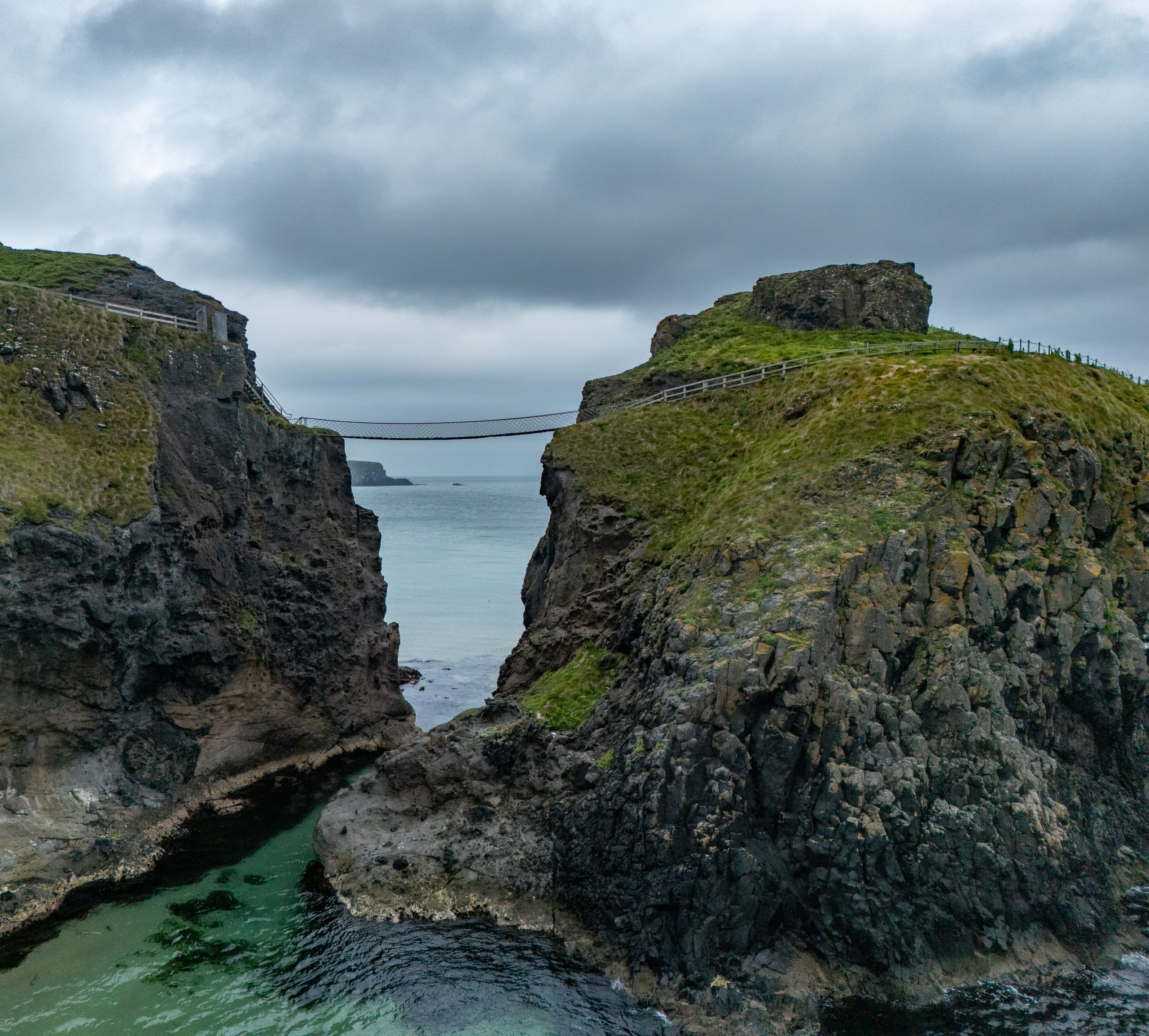
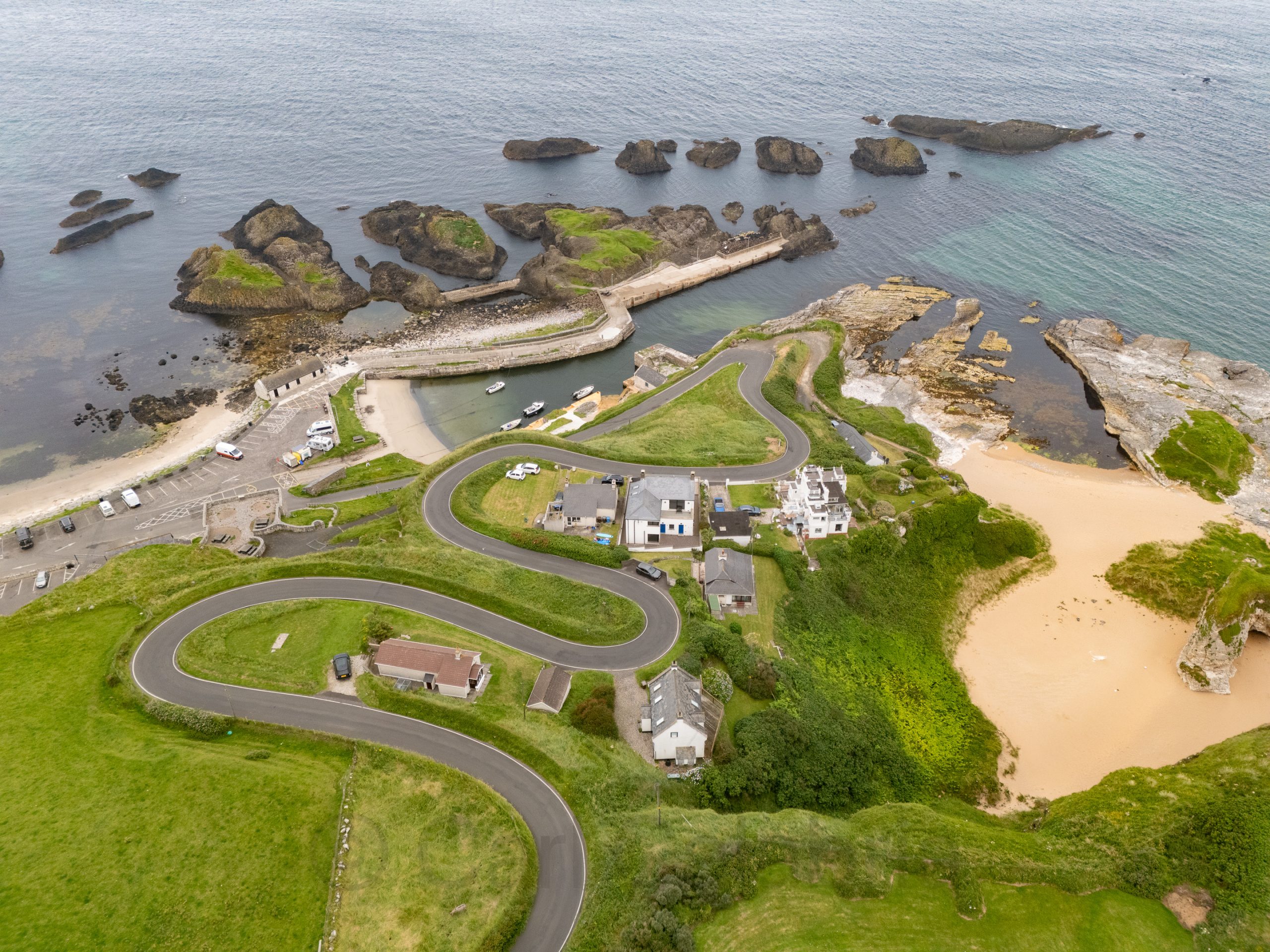
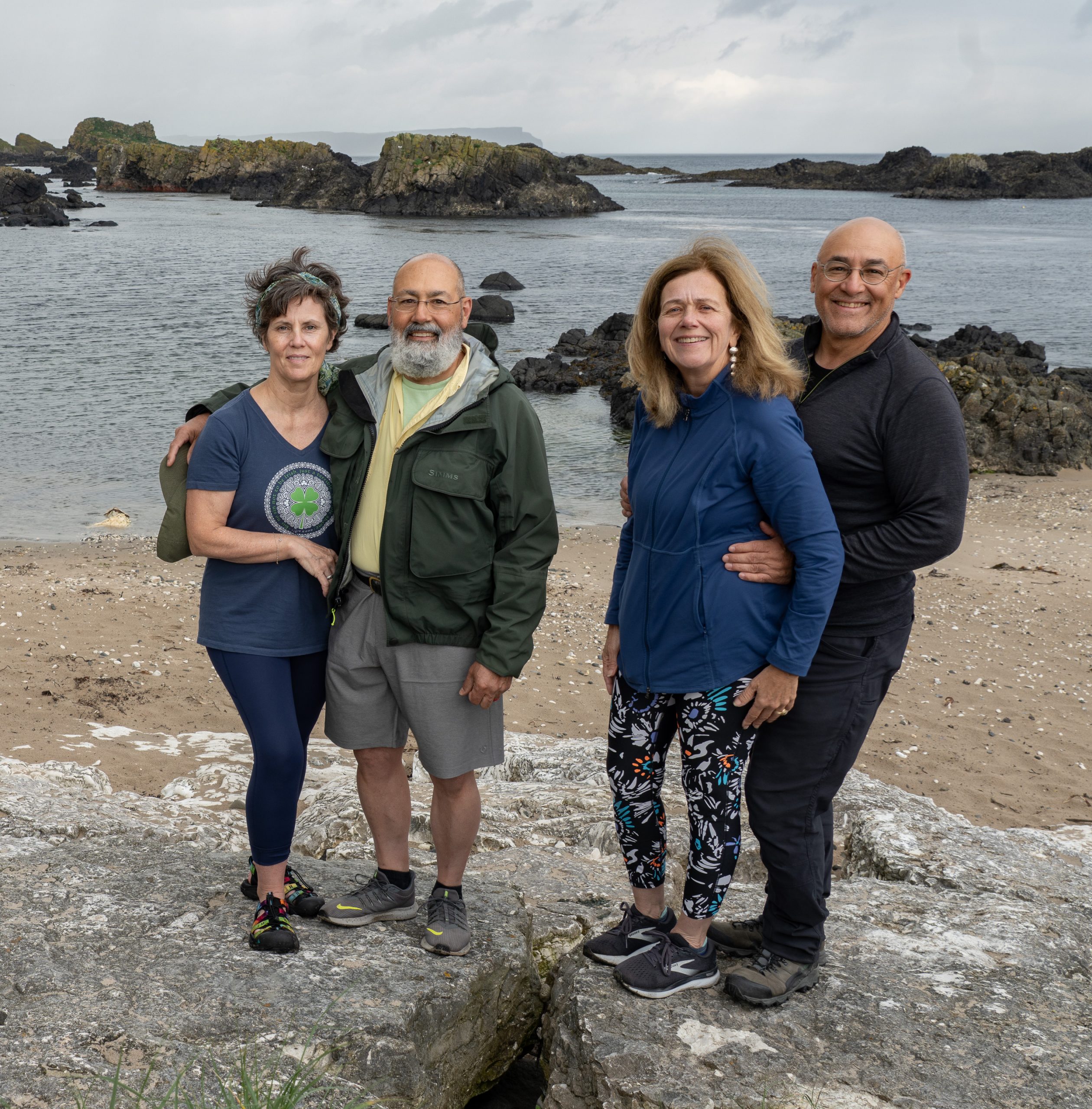
Today, the crew covered a lot of ground, stopping frequently to take in the sights of Ireland’s northern coast. Pictured above is Carrick-a-Rede, originally constructed to provide salmon fishermen with safer and easier access to Carrickarede Island for netting Atlantic salmon, reducing their reliance on boats to reach the best fishing spots. Below, is an aerial view of Ballintoy Harbour where we paused to stretch our legs and take a group photo.
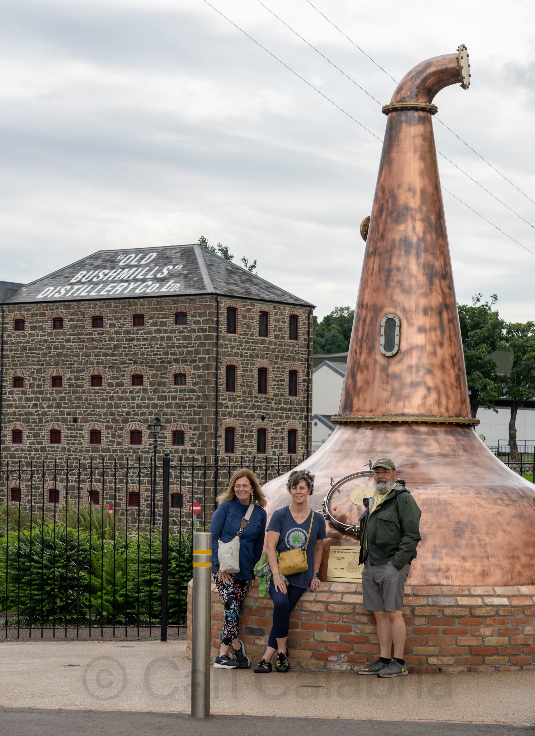
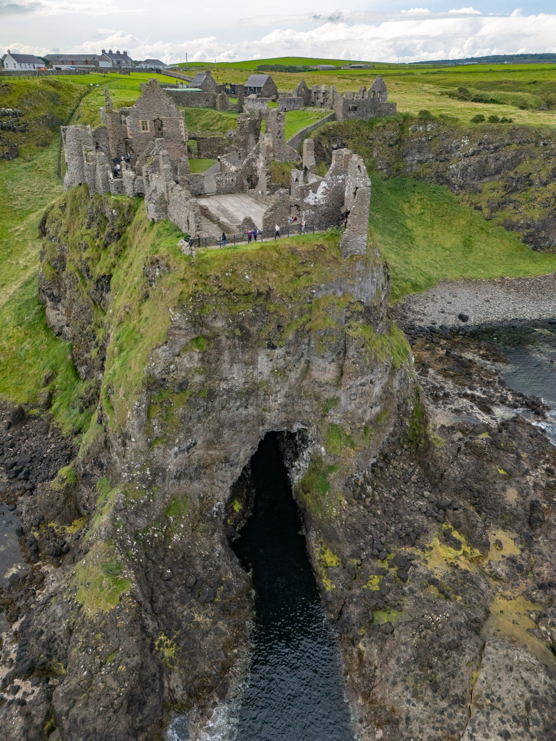
Liquid fortification for the rest of the journey was sampled at the Bushmills Distillery before a brief stop at the ruins of Dunluce Castle, a dramatic, ruined medieval castle dating mainly from the 16th and 17th centuries. It once served as the seat of the powerful MacDonnell clan and the Earls of Antrim.
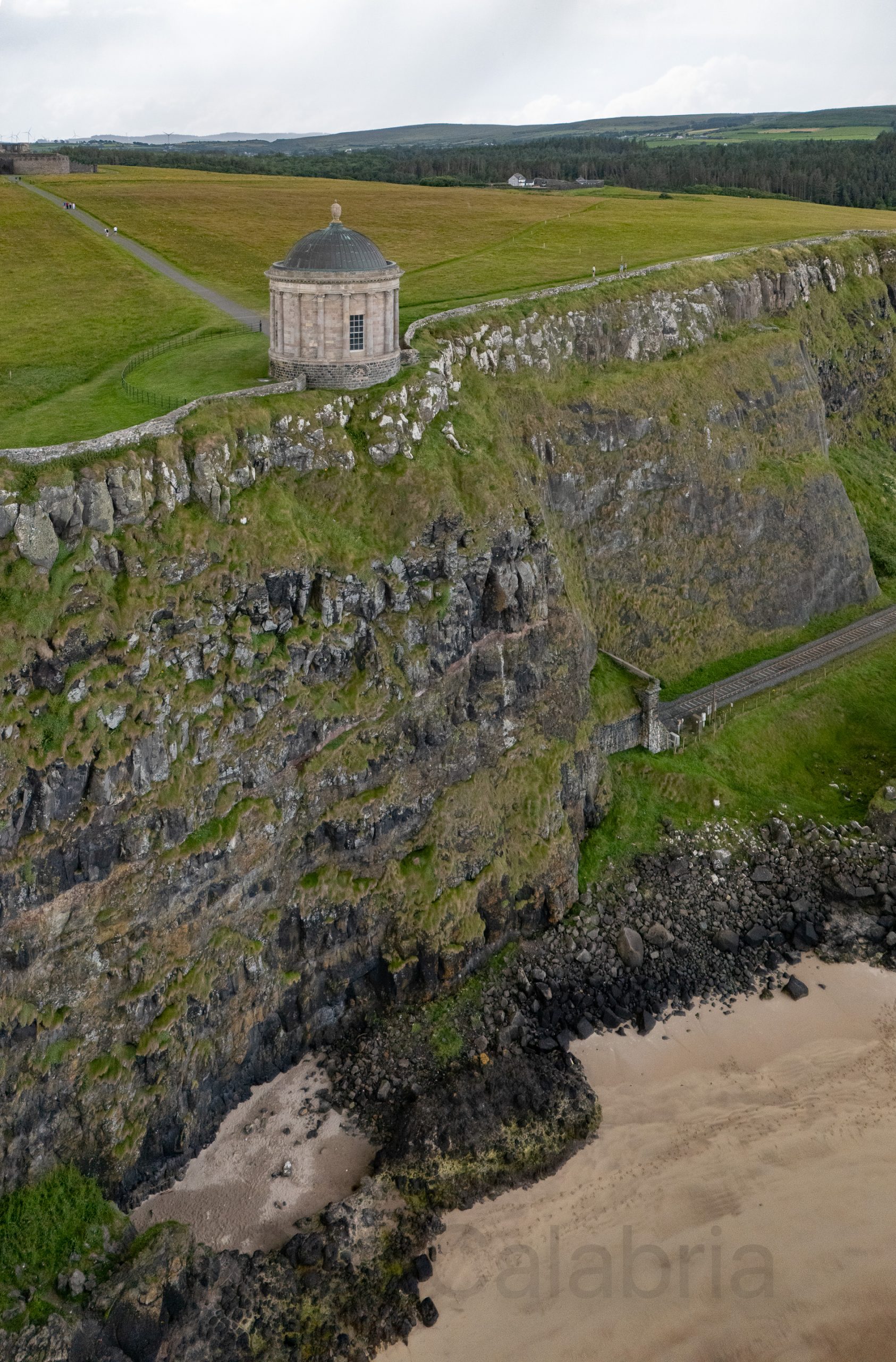
Mussenden Temple is a striking circular building perched on a dramatic cliff edge near Castlerock in County Londonderry, built in 1785 as a library for Frederick Hervey, Earl of Bristol and Bishop of Derry, and dedicated to his cousin Frideswide Mussenden. Inspired by Rome’s Temple of Vesta and renowned for panoramic views over Downhill Strand, it is now one of Ireland’s most photographed landmarks.
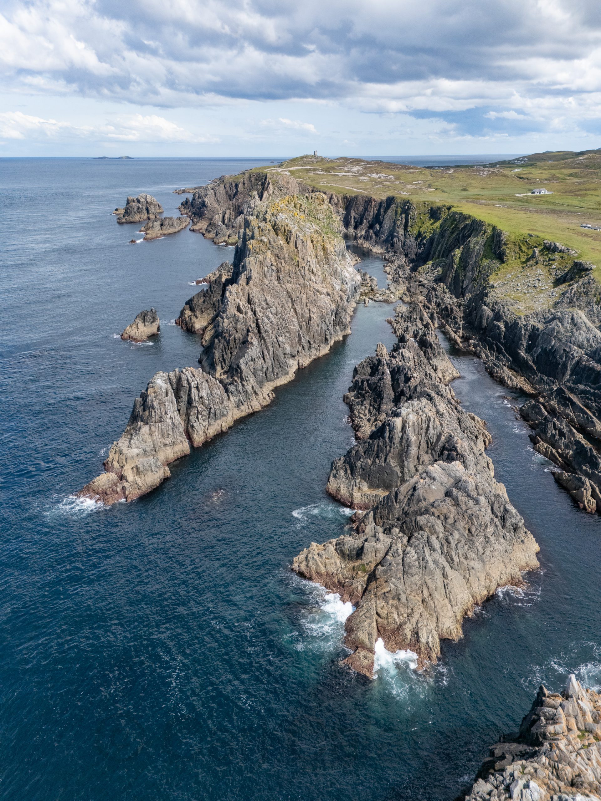
Malin Head is Ireland’s most northerly point, renowned for its wild coastal scenery, geological significance, and diverse marine life. We hiked up to an optimal viewing point where we enjoyed the breathtaking views.
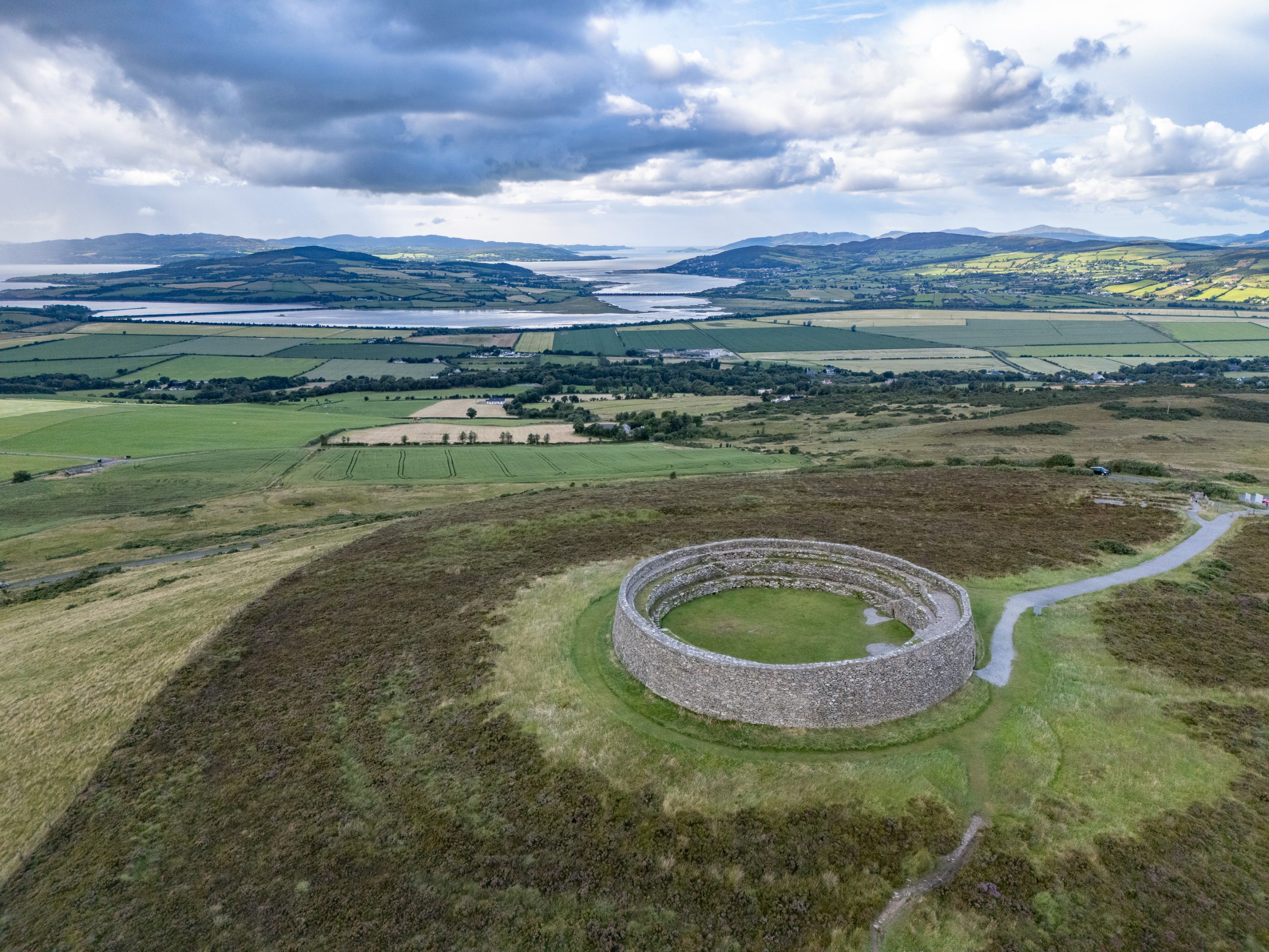
Our final destination for the day was Grianan of Aileach, a large stone ringfort atop Greenan Mountain in County Donegal, dating mainly from the early medieval period, which served as the royal seat of the Northern Uí Néill and is associated with both ancient mythology and early Irish kingship. The impressive drystone structure, originally constructed without mortar and partly reconstructed in the 19th century, offers panoramic views of the surrounding landscape and has stood witness to over 4,000 years of history, myth, and power struggles in the region.
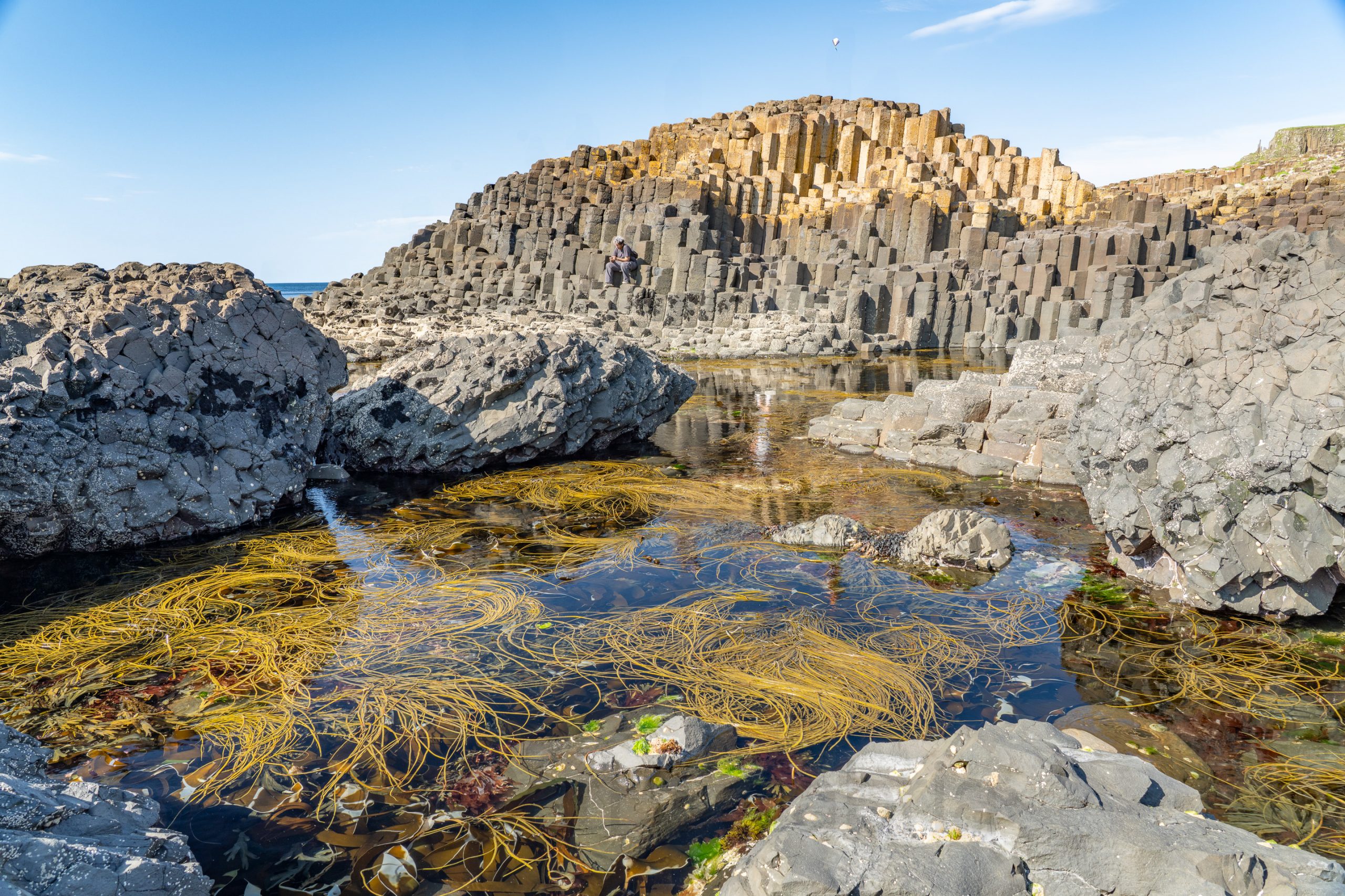
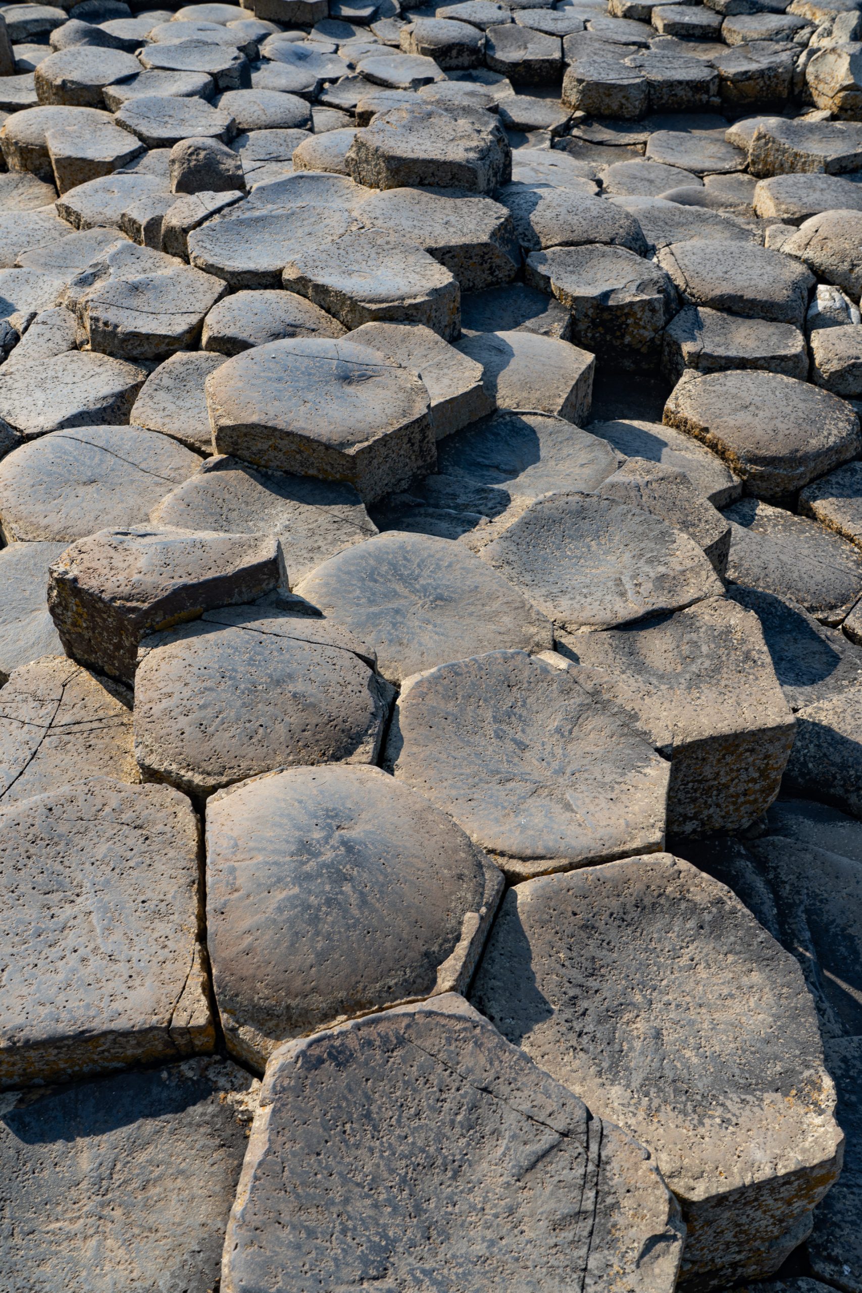
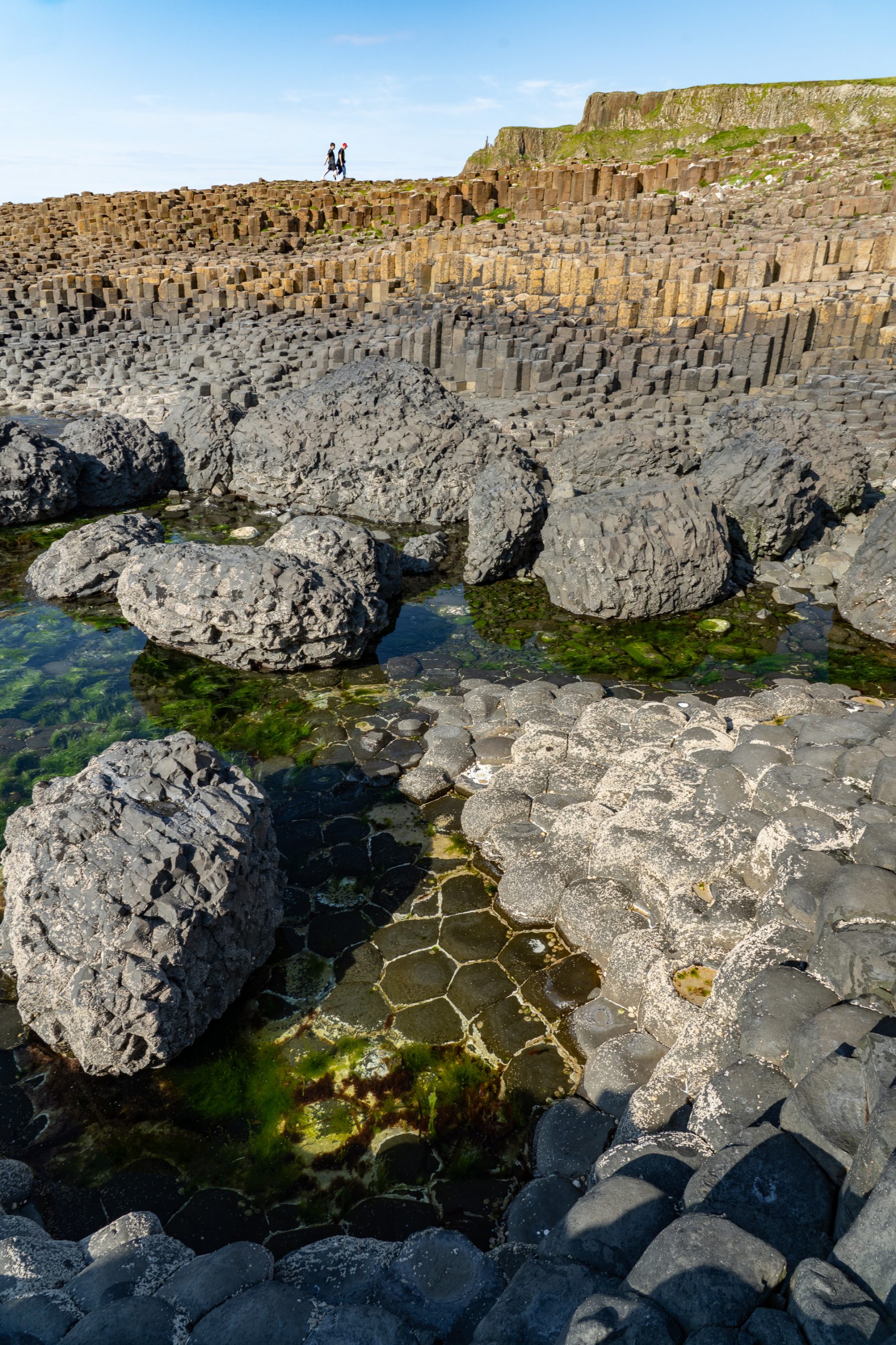
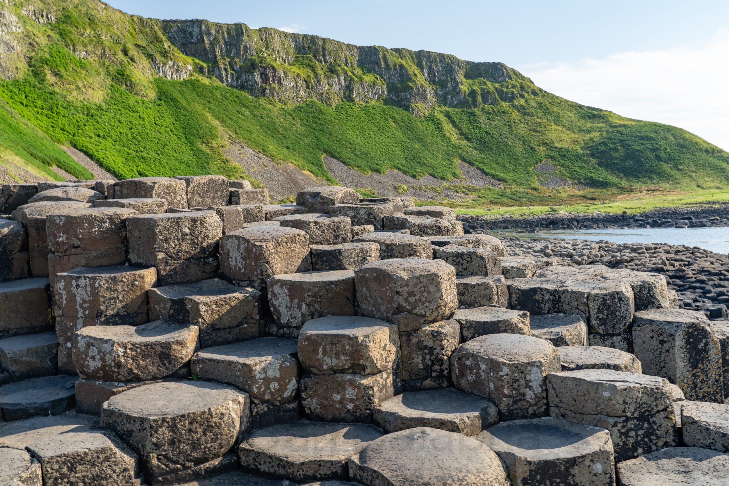
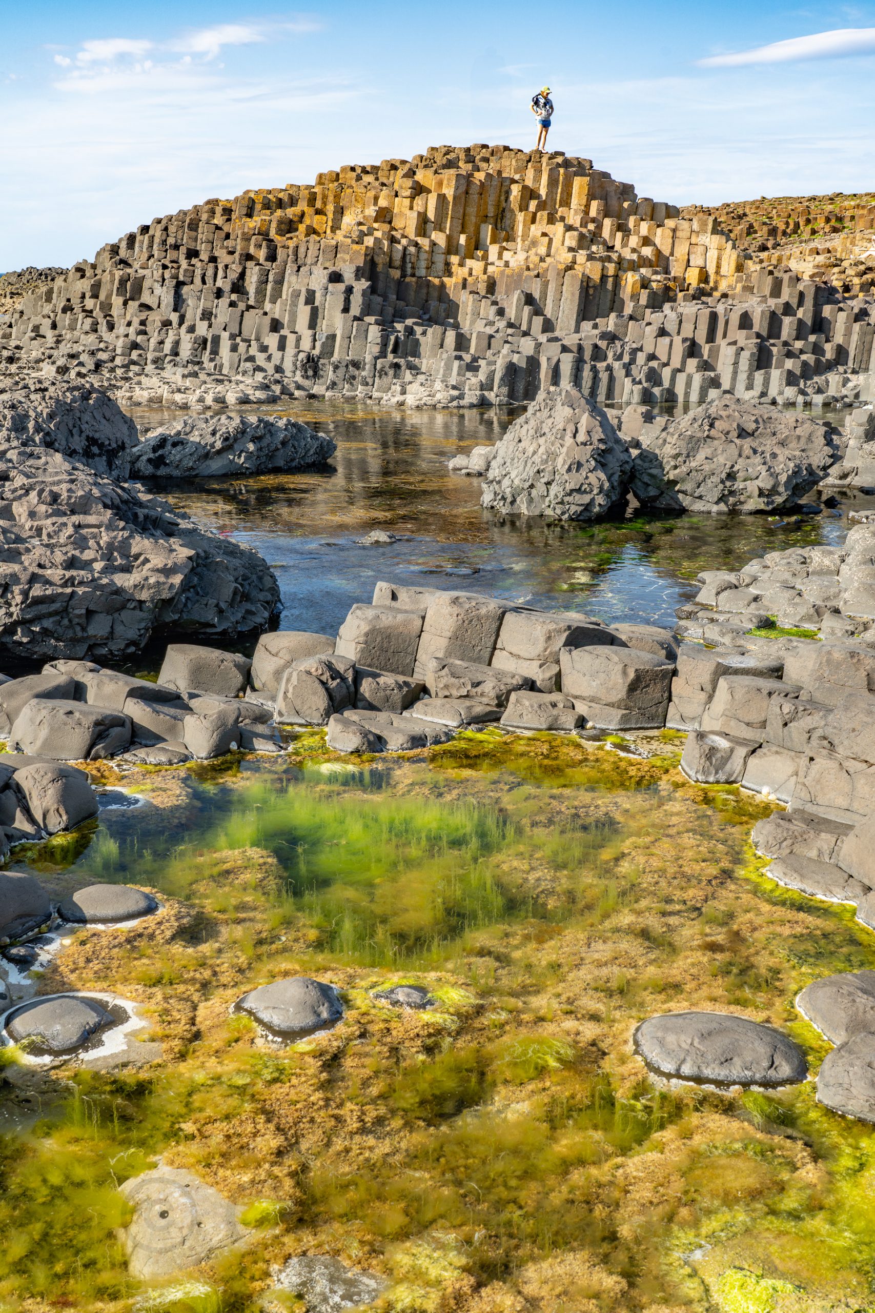
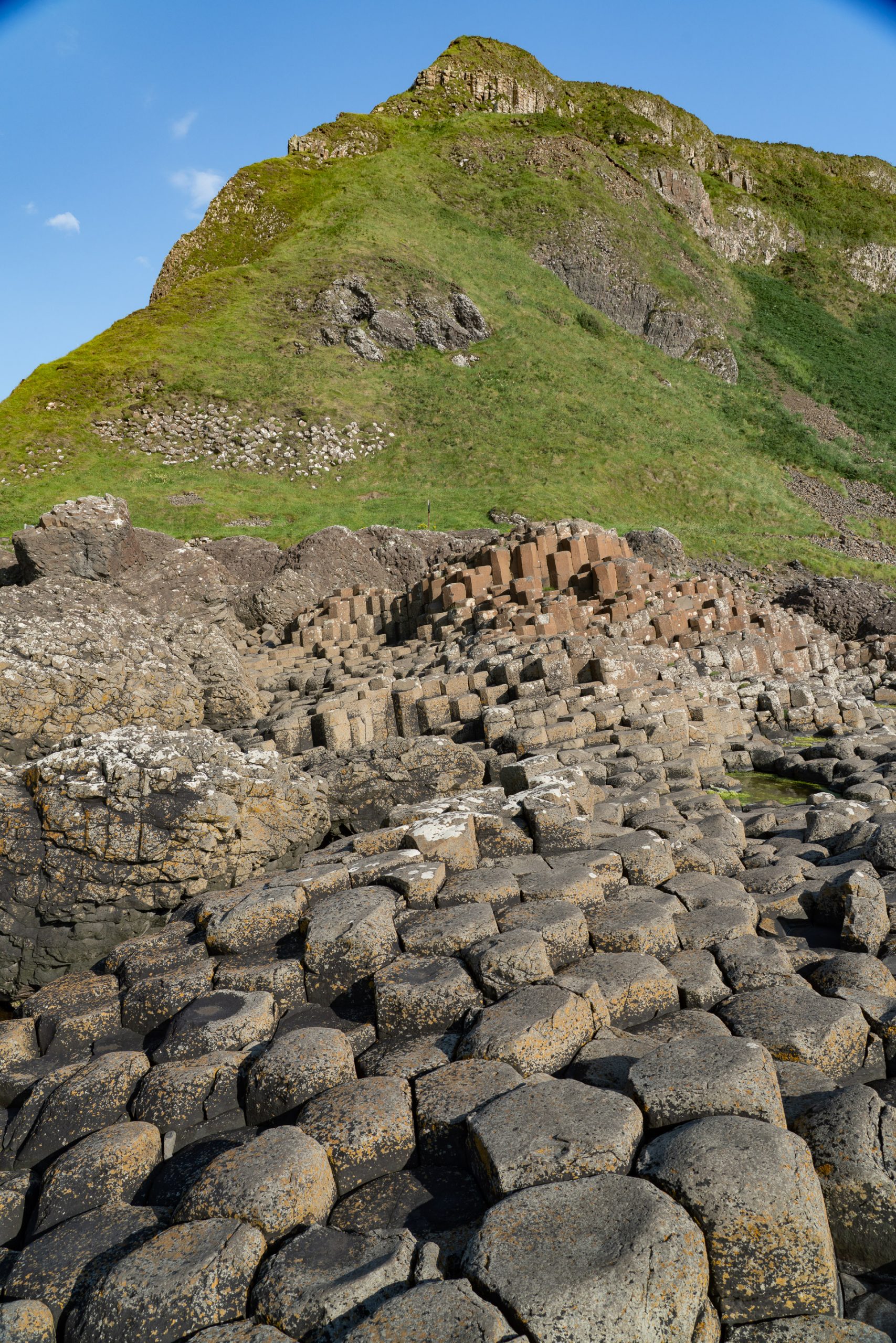
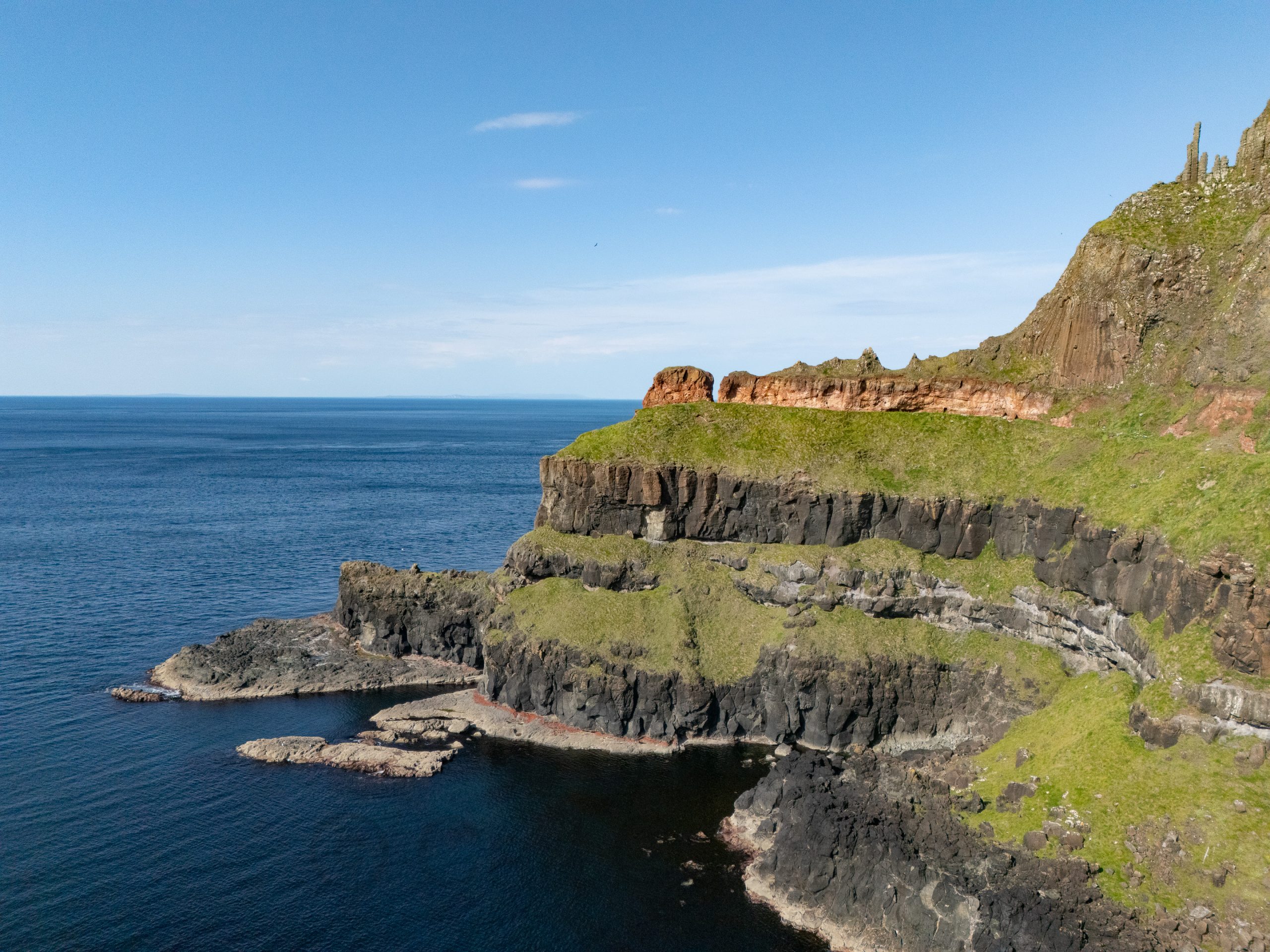
This morning, our crew (Mark, Marie, Jeanine, and I) joined a guided walking tour of Belfast focused on “The Troubles.” It was highly educational but not exactly visually stimulating. The opposite can be said of the Giant’s Causeway, which is a photographer’s dream. I separated from the group that joined a tour, so I could explore on my own. I racked up 7 miles and hundreds of photos. The Giant’s Causeway was formed about 50 to 60 million yearsago when intense volcanic activity caused molten basalt to pour through fissures in the Earth’s surface. As the lava pools cooled slowly and evenly, they contracted, leading to extensive cracking that produced around 40,000 polygonal basalt columns—most famously hexagonal in shape. The distinctive appearance of the columns is the result of this regular fracturing during the cooling process.
This website is dedicated to sharing, with family and friends, the day-to-day adventures of the Calabria family.